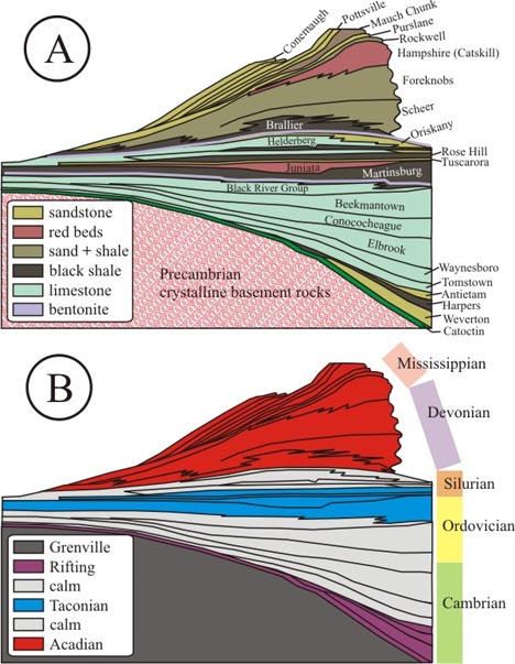
We just looked at the Chilhowee Group, a package of sediments that records the transition for the North American mid-Atlantic from Iapetan rifting through to passive margin sedimentation associated with the Sauk Sea transgression. Well, if we journey a bit further west, we see the sedimentary stack isn’t done telling its story. The saga continues through another two pulses of mountain building. Consider this “unfolded, unfaulted” east-west cross-section cartoon:
Part A of the image above shows the overall stratigraphic sequence for the Blue Ridge and the Valley & Ridge provinces in Virginia and West Virginia. You’ll notice that the small, detailed stratigraphic column I used to start the last two posts covers just the bottom 6 layers in this stack. Zoomed out to the bigger picture, we see ~40 layers overall. Lynn Fichter of James Madison University, one of the leaders of the Transect Trip, has published an excellent information-dense guide to the mid-Atlantic column. It’s a terrific reference for anyone looking to learn more about these rocks and the story they tell.
Part B of the image above shows the tectonic interpretation of these different packages of rock — some represent rifting, some represent passive margin sedimentation, some represent clastic influence from various orogenies occurring to the east (Taconian and Acadian).
The cartoon cross-section below, modified from an original by Steve Marshak in his excellent introductory textbook Earth: Portrait of a Planet, shows the tectonic evolution of the east coast over the past ~1 billion years of geologic time. It is reprinted here with Steve’s permission.
The story begins with the Grenville Orogeny, an episode of mountain building that completes the assembly of the Rodinian supercontinent. This is followed by Iapetan rifting, followed by three pulses of Appalachian mountain-building: the Taconian (“Taconic“) Orogeny, the Acadian Orogeny, and the culminating event of Pangean supercontinental assembly, the Alleghanian (“Alleghenian”) Orogeny. Finally, Pangea breaks up in the Mesozoic, an event also known as Atlantic rifting. Two complete Wilson Cycles are preserved by the Appalachian mountain belt!
The Valley & Ridge province received sediment courtesy of the Taconian and Acadian Orogenies, but wasn’t directly involved with the tectonic collision in any deformational way. Notice how west of both those orogenies in the Marshak diagram you see a fresh layer of sediment being deposited atop the North American craton.
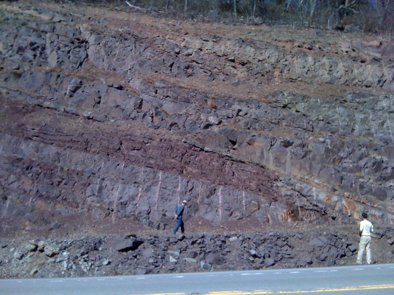
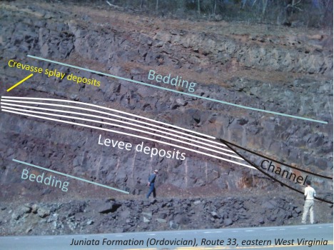
During the field trip, I posted some iPhone photos of the sedimentary strata that accumulated in the Valley & Ridge during the mid-Paleozoic, shed off from the orogenic activity to the east. For example, the Brallier Formation’s turbidites record a time when sea was west and mountains were east. Or the Juniata Formation’s red beds speak of a time in the late Ordovician when an advancing clastic wedge had piled sediment up above sea level. This shot of some of those red beds preserves some beautiful depositional relationships from ~440 million year old river systems.
Let’s annotate that, shall we?
Even in the Ordovician, rivers did what they do today, spilling over their bansk and building up natural levees. Same as it ever was, people.
That “sediment only; no deformation” regime for the Valley & Ridge changed with the Alleghanian Orogeny. That’s when deformation propagated to the west, encompassing the flat-lying Valley & Ridge strata into a proper fold-&-thrust belt. Later, differential erosion of these folded and faulted layers would etch the landscape into a series of valleys and ridges… hence the province name. More on that deformation in the next post.


