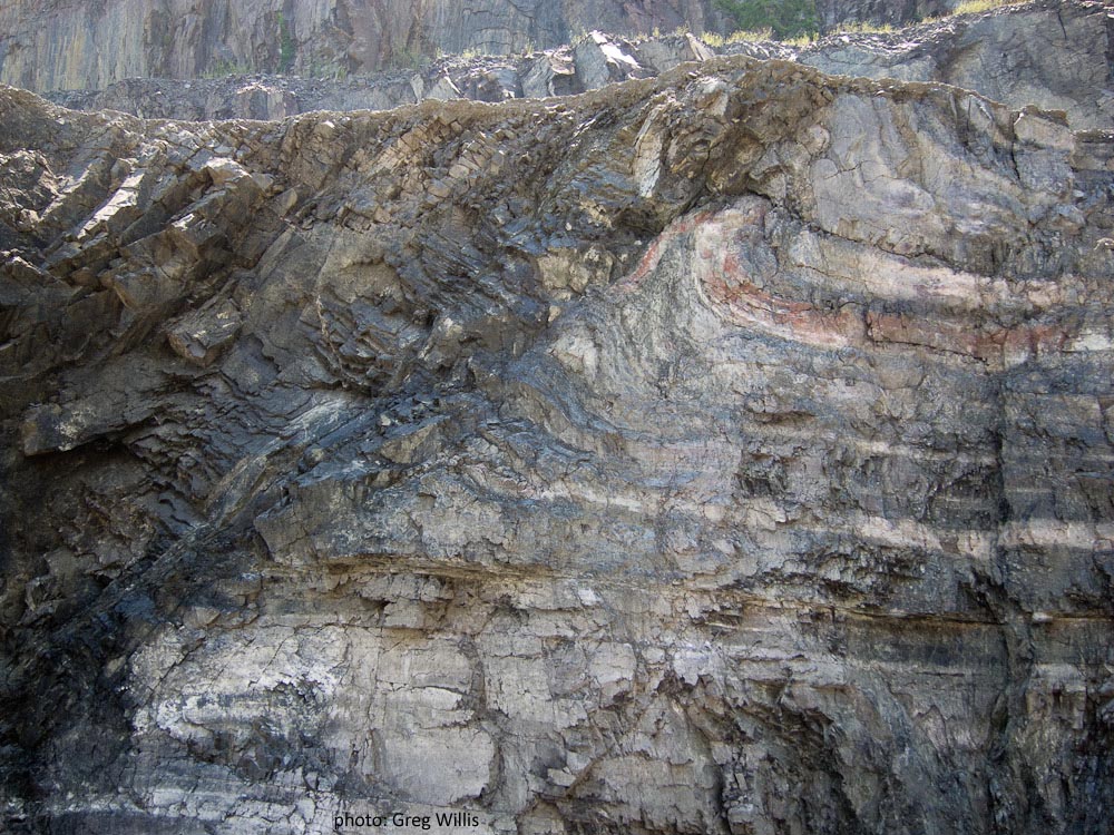
Mountain Beltway reader Greg Willis attended my colleague Ken Rasmussen’s Triassic Rift Valley field course last weekend, and sent me this photo of the view inside the Luck Stone diabase quarry in Centreville, Virginia:
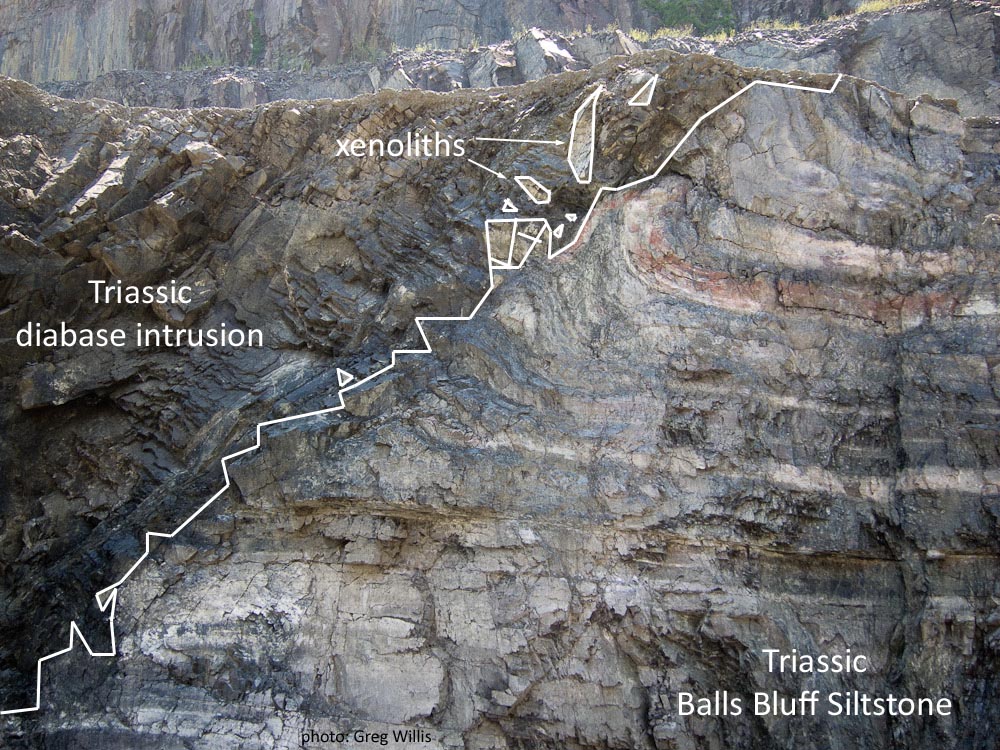
Here’s an annotated version:
Both photos are enlargeable by clicking on them (twice).
This quarry chews into rock right along the contact between a mafic igneous intrusion and lake sediments that formed when water pooled in a low-lying continental basin that formed during the breakup of Pangea. This rift valley, the Culpeper Basin, is just one prominent basin in a whole series of Triassic grabens and half-grabens that run through the Piedmont north and south of here, including all the way to the Bay of Fundy.
A similar environment can be seen today in east Africa, where a modern rift valley hosts similar lake deposits and mafic igneous rocks:

If you were to drop maybe half a kilometer below the surface of the Afar region, you’d see a similar situation to the one that produced Greg’s quarry photo ~200 million years ago.
Visiting the Centreville quarry is by permission of the Luck Stone corporation only; the best way to see it is by signing up for Ken’s course the next time it rolls around!


