
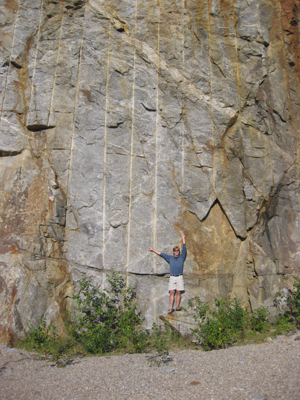
I’d like to start a series on the geology I encountered last summer at Mount Washington, in New Hampshire. It’s not only the site of the “World’s Worst Weather,” but it’s got some cool rocks and some cool geomorphology too. I hiked it last August with my fiancee Lily, and my cousin Brad. Lily and I got to the mountain first, and to kill some time while we waited for Brad to drive up, we checked out a prominent outcrop on the west side (east facing, hence the fine morning lighting) of the road up to Pinkham Notch.
According to the superb map accompanying Dykstra Eusden’s book The Presidential Range: Its Geologic History and Plate Tectonics, the outcrop we were checking out is the Crawford Member of the Rangely Formation, a gray migmatitic orthogneiss.
A quick taste of what we saw there:
Here’s a pegmatite dike dipping at (apparently) 45° to the north (right) and a big, gray, angular inclusion:
A closer look at a similar exposure, a bit further down the outcrop:
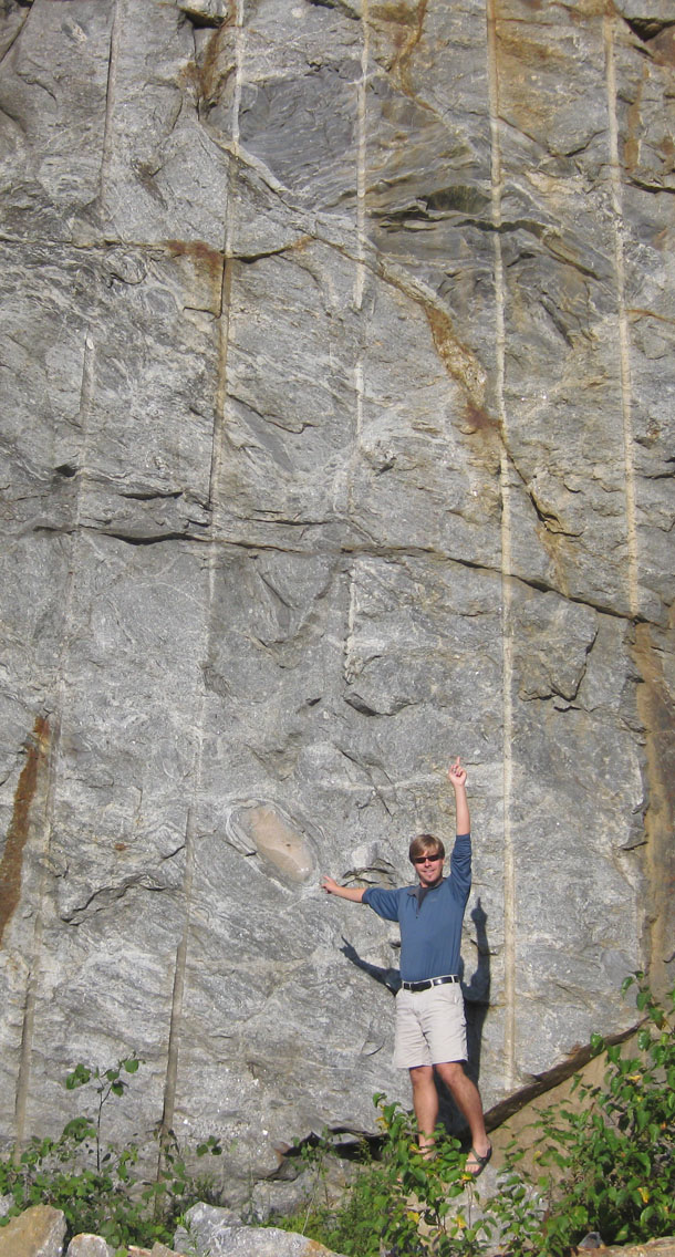
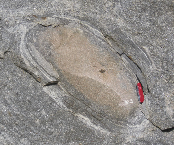
Again, you can see a big angular gray inclusion (this time above me), and also an elliptical inclusion (“concentrically mineralogically zoned calc-silicate granofels”) that’s tan in color. Let’s zoom in on that second one:
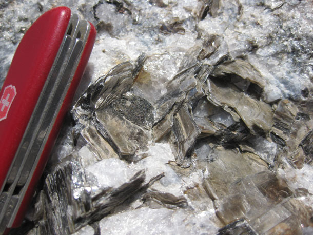
Nearby were some ground-level exposures of the pegmatite. For instance, consider this veritable “library” of muscovite books:
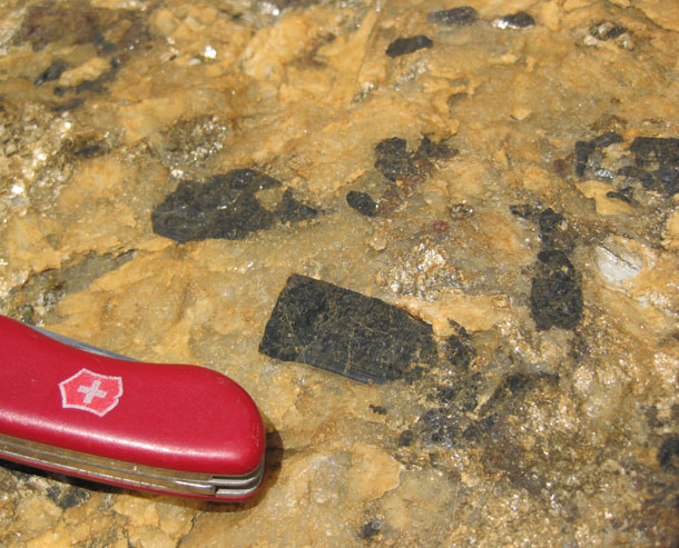
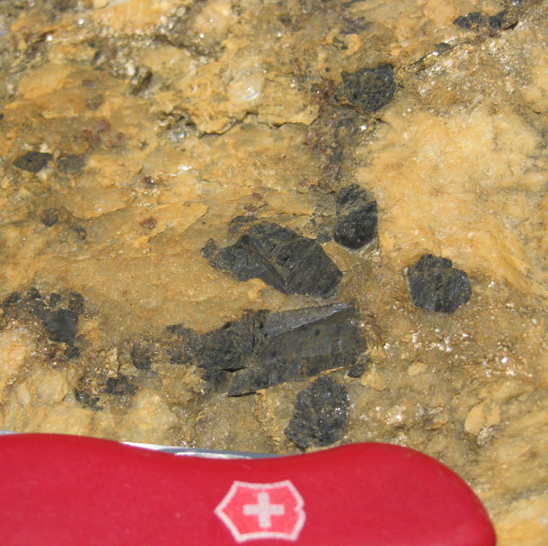
And here we go with a rust-stained exposure of pegmatite, bearing large black crystals of tourmaline (?):
More later, from the trail…
And some lovely anthropogenic striations!
The calc-silicate pods are the big indicator that you are standing next to the Rangely Fm. I can’t staunch my curiosity about the pegmatite dike and gray angular inclusion. Trying to wrap my head around the inclusion, it could be a number of things. Someone with really sticky hands should climb up and grab a sample of it! The first potential that comes to mind which would also tie in the dike is as such: the partial melting causing local migmatization created some amount of fluid which migrated along a sketchy plane of weakness, forming the dike as it cooled slowly in the rather warm metamorphic rock. Obviously, the first things to enter the melt were comparatively low-temperature melting point minerals like orthoclase and incompatible elements. Necessarily, when these are melted out, the remainder of the solid becomes more mafic with higher temperature and compatible element bearing minerals left behind. That’s the darker ‘inclusion.’
Of course, that’s shooting from the hip. As far as I can tell, the inclusion’s nowhere near the dike. If such a process happened, one would imagine that a more mafic area in the rock would remain only at the points at which melt contributed to the dike. There are other explanations I’m sure, like a different protolithic material (in other places the Rangeley protolith is basaltic, for instance), but angularity ought to be reduced during metamorphism. This occurrence is so small there should be an outcrop-scale explanation, but I can’t think of one that would make it some foreign inclusion. Any thoughts?
All the way down here, it seems that the joints are spaced far apart. All I see on the big picture are three instances of the sheeted set, and what look like one instance each of the NE-SW and E-W sets just to the right of you. There’s one great dike I sampled along Rt. 16, just south of the base of the Mt. Washington auto road. It’s a bit hard to spot unless you know where to look, but it bears excellent banding textures at the contacts which imply multiple injections. We see this in all three of the dikes in my study area as well. Enough spoilers though, you’ll just have to see my poster and Dyk’s talk in Pittsburgh.
Did you get to hike the Gulfside Trail at all? Such a beautiful area, and so much geology to explore!