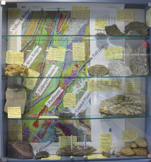
A quick glimpse of what I spent a few hours working on last Thursday: a new hallway display in my building at NOVA, focused on the different geologic provinces of northern Virginia (and adjacent Maryland, West Virginia, and Washington, D.C.):
I think I’ll gigapan it for you next week, so you can explore the details. In the meantime, feel free to click through for a bigger version of this photo.


sweet!
Do you have any idea where I can find some detailed geologic maps of Fairfax county and Prince William Co? Specifically what underlies the Potomac formation east of the Fall Line for those counties?
Thanks.