Nelson Horatio Darton (1865-1948) was a USGS geologist who did a lot of foundational exploration in Wyoming and other Rocky Mountain states. He also spent a lot of time in Washington, DC, and published several items on its geology. Darton was a founding member of the Geological Society of Washington, an august and learned society of which I am a member. He was GSW President in 1926. It was Darton who preserved the fault on Adams Mill Road and Clydesdale Place in Lanier Heights, DC, that first piqued my interest in DC geology. This is what he looked like:
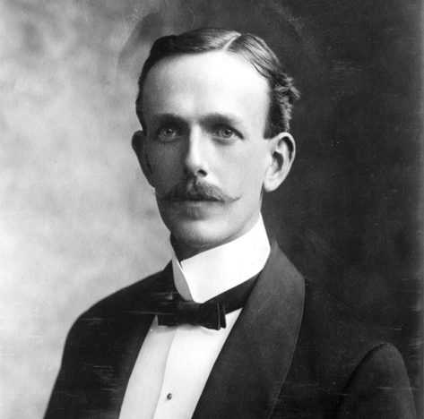 source: Wikimedia Commons
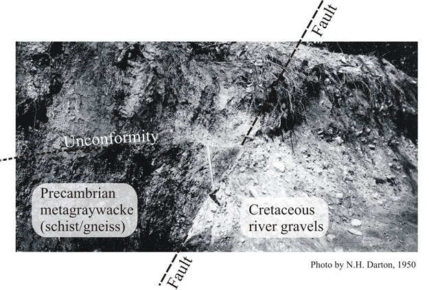
Here’s the fault that Darton preserved, a trigger for my own interest in the geology beneath the capitol city:
And so it transpires that this week I found myself in Wyoming, with a wife who loves backpacking and a few days free from our energy resources workshop at Sheridan College. We decided to pack up and head into the Cloud Peak Wilderness, and as we were browsing the map of the wilderness, we made an intriguing discovery. It turns out that one of the peaks that was within striking distance was 12, 275′ (3,741 m) Darton Peak. Could it be the same? Sure enough, Darton Peak is named for Nelson Horatio Darton.
I had to climb that mountain!
We loaded up the packs, bought groceries and a new pair of boots for me, and headed in.
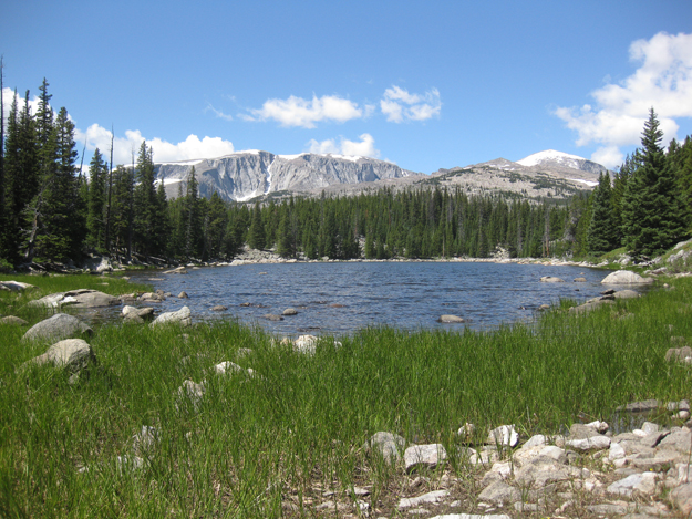
Here’s our lunch spot, at Rainy Lake. Darton Peak is the snowy one in the distance, on the right side:
By the time we got to Willow Lake, about three miles in, Lily was feeling uncharacteristically tired, so we set up camp and she agreed to hold down the fort while I went for the summit. I took two liters of water, a Clif bar, and some trail mix, as well as rain gear, first aid kit, bear spray, and camera. I climbed the talus-covered slopes of the valley containing Willow Lake (hereafter “our” valley, since we were camping in it), and saw this view to the northeast:
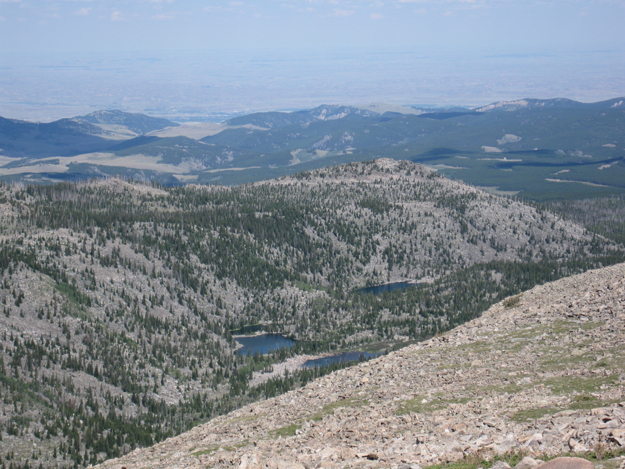
(Willow Lake is the rocky-shored one that’s half hidden behind the foreground ridge.)
Here’s the view to the northwest, over “our” valley:
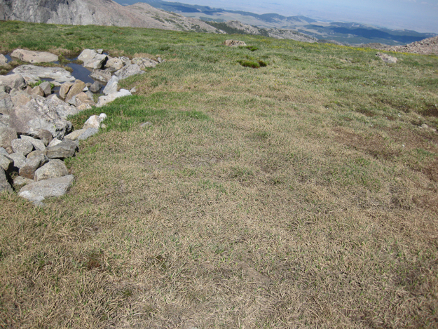
There was about 3000′ of elevation gain between Willow Lake and the summit of Darton peak. Most of the way up (I would estimate 95% of the route) was talus. The other 5% was split between meadows like this one (4%)…
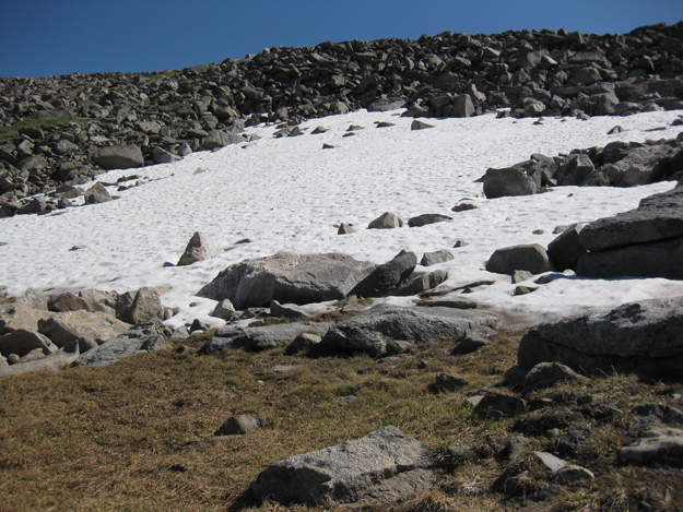
…and snowfields like this one (1%):
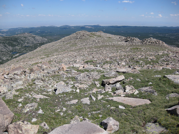
But most, so so so so so so so much, was boulders of many sizes. It made the going moderately treacherous, and thoroughly exhausting. I could not have made it without a trustworthy pair of Black Diamond trekking poles which gave me three points of contact at all time (very useful when boulders roll out from under you!). This shows this rocky, trail-less terrain well:
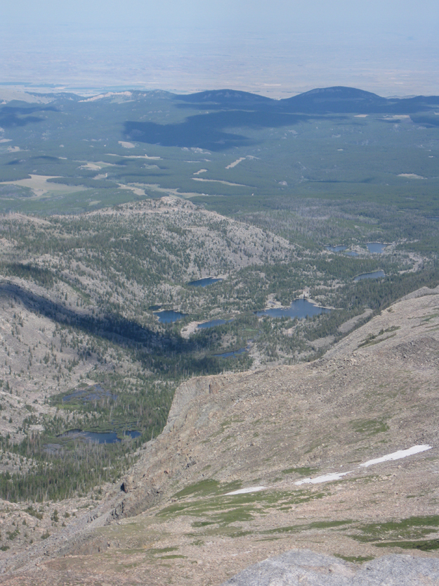
On I went, boulder-hopping up the ridgeline. A look back showed how far I had come:
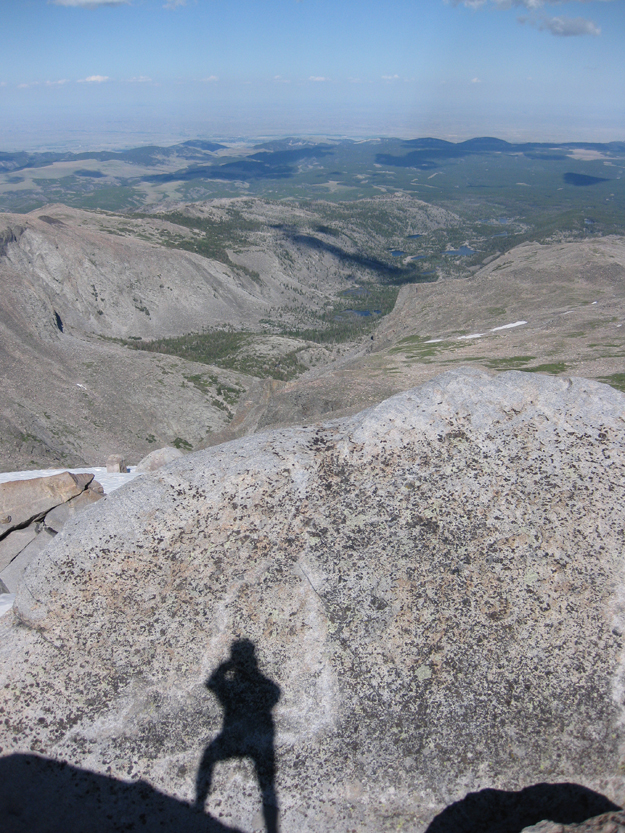
Zoomed in a bit, you can see more details of the lakes around Willow Lake (and camp, sweet camp):
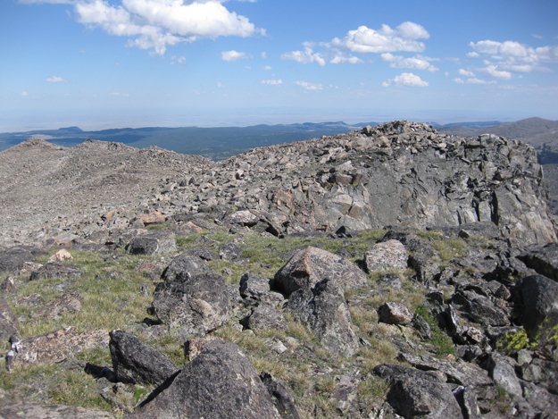
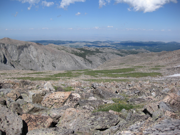
Some scenes from along the way:
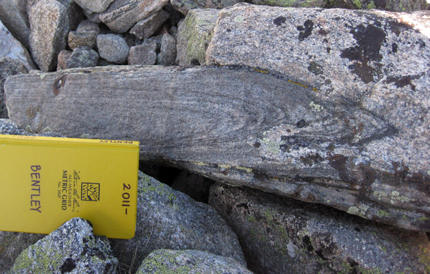
A sweet isoclinal fold reminds me to tell you that the rocks here are all Archean basement complex (mainly granite and granite gneiss, with a dash of mafic intrusives and their metamorphic equivalents thrown in for flavor):
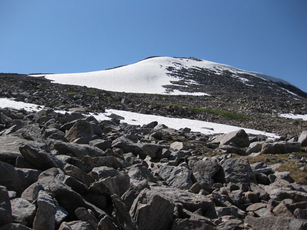
I left camp around 1pm, and got to the base of the summit snowfield at about 4:30 or 5 pm. I was getting tired, but I was close:
To my left was a view into the next valley to the south, where there is a pater noster ensemble of glacial lakes called (appropriately enough, as you can see below) the Chill Lakes:
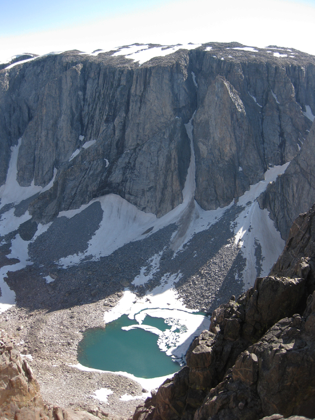
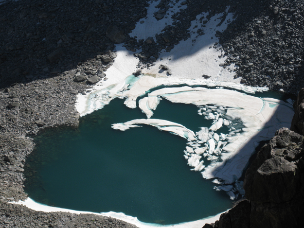
Yes, in spite of it being early August, that is ice floating on upper Chill Lake:
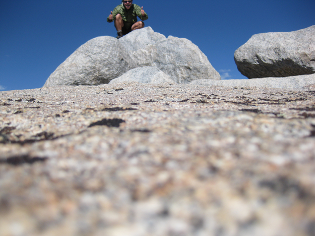
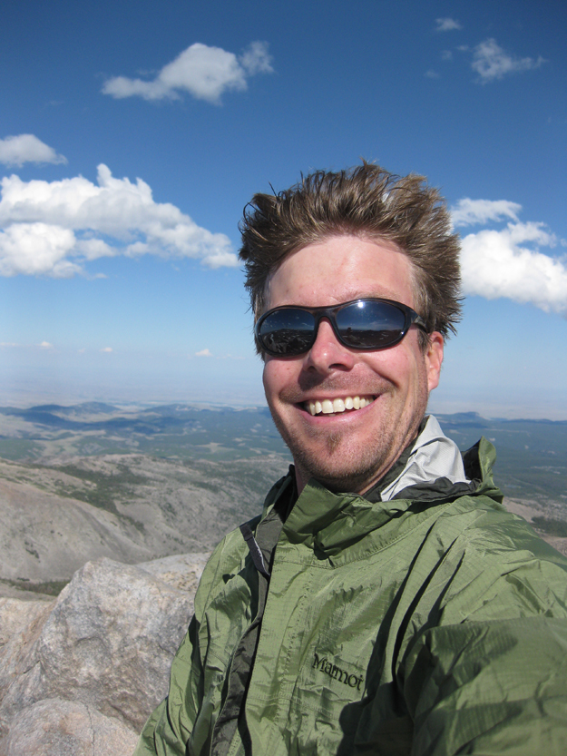
Another half an hour of hard climbing, and I attained the summit. Two “I made it!” self-portraits:
Here’s a ten-photo 360° panorama from the summit (click to make it bigger):
I hope you clicked through for the full version – almost like being there yourself…
…although it’s not quite like being there yourself. If you had been in my shoes as those photos were taken, you would have realized that you still had the three-mile boulder-scramble descent back to camp. I’ll spare you the details, but it was a longggggggggg trip back to camp, with numerous near-spills and an increasing sense of exhaustion. I was 100% knackered by the time I stumbled back into camp. I crashed into bed, and Lily got me water and made me a restorative dinner of pasta.
In the morning, I could walk again, and we hiked out, pausing on the drive back to Sheridan to gigapan a nice roadside outcrop. We showered and rested Sunday afternoon, and by dinner I felt good enough to rejoin society and have dinner with my fellow energy workshop participants.


Callan,
Darton’s bio says he passed away in 1948, yet the photo credit says “Photo by N.H. Darton, 1950” ????
Posthumous publication of “Bedrock Geology of Washington, DC,” I reckon. Not only that, but the photo was taken when the fault was uncovered in the 1930s, and then sat around for 15 years before finally being published.
Looks like an excellent hike! Sorry about your boot, but I had to chuckle: Kootenay Park is notorious for its ravenous porcupines. Years ago (late ’70s?) I backpacked the Kootenay Highline trail (Paintpots/Helmet Creek to Numa Creek) and at that time the park rangers warned us to keep our boots in our tents at night, with good reason. Anything along the trail that was touched by human hands (therefore slightly salty) or made of plywood (for the glue) had been gnawed: signposts, signs, picnic tables, outhouses, etc.
Nelson Horatio Darton was my great grandfather on my father’s side. There are a number of family stories about him. We really appreciated your photo story on Darton Peak. Thanks so much.
Thanks for letting me know. Your great grandfather is my hero!
Great photos from a great ascent! I have always wanted to climb Darton and descend Big Horn and do a shuttle out of the West Ten Sleep Trailhead. Great bit of history, it is always fun to find our who these peaks are named for.
Having lived and hiked in Wyoming my entire life I cant help but do a bit of scolding however, and point out that leaving to climb a mountain in the afternoon to early evening is extremely, extremely dangerous (in AUGUST no less). Many people have died when sudden storm have delivered snow, hail and lightning on them suddenly in every month of the year.
That aside im glad you were able to see such a beautiful part of a state!
Thanks again for the post,
Jordan
Thanks for the belated scolding, Jordan!