On Monday at about 10am, midway between Nellysford and Scottsville, I was groggily steering my car east across the Blue Ridge province. Then we drove past a shear zone in the Blue Ridge basement complex. My heavy eyelids rose at the gleam of morning light reflected off feldspars and foliation. To my wife, who was in the passenger seat at the time, I said, “Wow. Those looked like some really highly strained rocks.” My heart began to beat a bit faster.
Then I turned to her and put on my best puppy dog eyes: “Mind if I stop and take a look at them?” (works best if accompanied by a big grin)
She sighed, and acquiesced with a pleasant smile. It’s a typical routine for us: she knows how I get when I’m around deformed rocks. And she wants me to be happy. She replied, “Sure!”
I turned around, parked the Prius, and clambered up the embankment. There, to my wonderment, were an array of variably-strained granitoids. These rocks were originally emplaced in the crust around a billion to 1.1 billion years ago, during the ancient episode of mountain building called the Grenville (or Grenvillian) Orogeny. That orogeny closed an ancient ocean basin (nameless, as far as I know) and assembled the supercontinent Rodinia. The Grenvillian mountains rose along ancient continent-continent suture zone. The rocks there were baked and squeezed and metamorphosed and deformed.
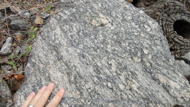
Later, Rodinia broke up, and the Iapetus Ocean basin opened. In time, the Iapetus closed, and continents converged again, this time to amalgamate into a new supercontinent, Pangea, and part of the ensuing deformation was that a series of ductile shear zones developed throughout the Blue Ridge basement rocks. Presumably this occurred when they were deeper and warmer, and thus perhaps preceding the wholesale detachment of the Blue Ridge from an original position lower in the crust and to the east. (After that “snap,” the Blue Ridge rode up along the Blue Ridge Thrust Fault, climbing up to the west on top of the much younger strata of the Valley & Ridge province.) So while these rocks themselves are Mesoproterozoic in age, the strain zone that overprints them is Paleozoic in age, probably late Paleozoic (during the Alleghanian Orogeny that spanned the Pennsylvanian and Permian periods of time).
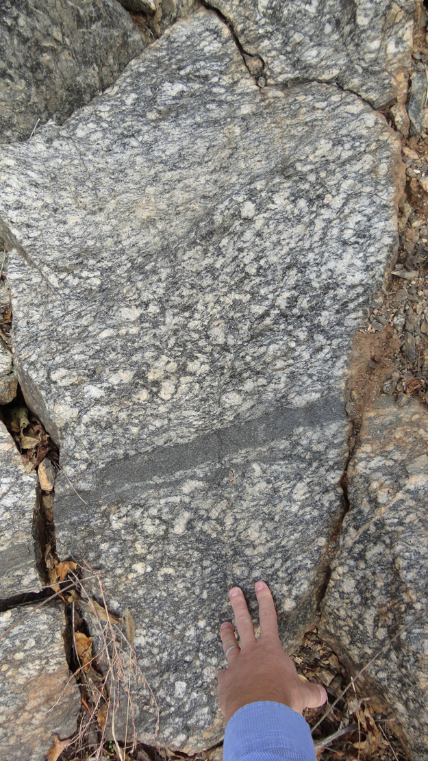
Along these shear zones, the rocks were ductilely deformed and “smeared out.” The resulting grain size reduction produces a structural fabric in the rocks: what we call a “mylonite.” Mylonites, strictly speaking, are defined by grain-size reduction, but they may also exhibit foliations in “S” and “C” orientations.
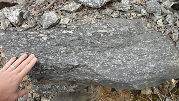
In the previous image (and the next one), you can make out an “S” foliation tipped over with the top to the left, and “C” surface shear bands which dip from upper right towards lower left. The overall “sense” of shear displayed here is sinistral:
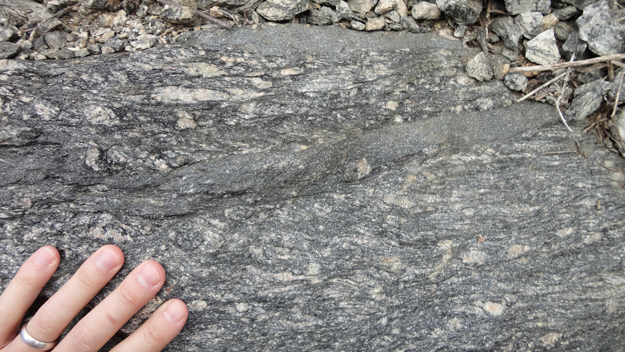
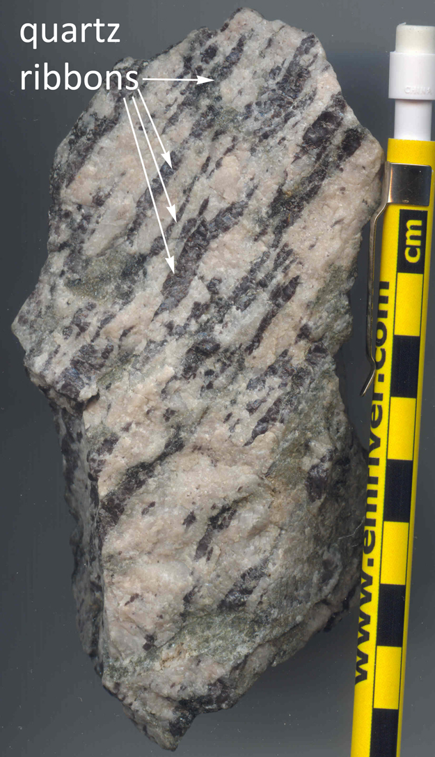
Here’s a chunk of sheared granite that I picked up at the outcrop. Note the elongated quartz “ribbons” which suggest this is deformation that occurred in the solid state (as opposed to a magmatic fabric):
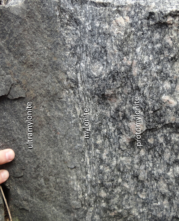
Here’s the best part of the whole outcrop:
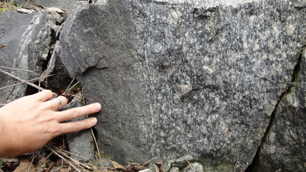
See that change in the middle? It’s pretty profound. If you zoom in, you can see what I’m all jacked up about:
Grain size reduction from right to left! You can see the gradation in “pulverized material” that marks increasing levels of strain in these rocks. The gradual increase in strain level is an indication of a shear zone – less deformed rock outside the shear zone, and progressively more deformed rock inside the zone. Technically, these should be called “high strain zones”. I think it’s awesome to see a single outcrop that captures 3/4 of this gradational series: you can make that image full-size by clicking on it.
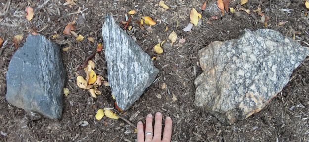
I collected three samples at the site, and brought them back to NOVA, where on Tuesday afternoon, I arranged them in our new campus rock garden in a similar sort of position: most strained on the left, least strained on the right:
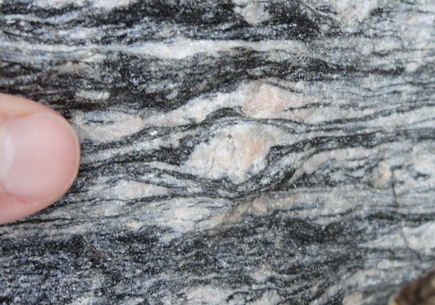
If you zoom in on the central sample (the “mylonite”), you can see a nice “winged” porphyroclast indicating dextral kinematics:
Nine and a half minutes on this intriguing outcrop, and I was back in the car. Take-aways: (a) new photos of shear zone rocks, (b) three hefty samples of shear zone rocks, (c) new perspective on the position of another Blue Ridge basement shear zone, and (d) an overall enlivened Callan, perky and contented behind the wheel.
Take it from me, kids: shear zones are better than caffeine for waking up a structural geologist in the morning.

Nice mylonite progression!
Fascinating site, which got me thinking – Assuming that this outcrop might not be well known (other than to maybe a handful of specific researchers), is there, to your knowledge, a Google-tied site where geologists could enter coordinates for a site and have that be part of an accessible database – with the goal of cataloging unique geologic sites? Perhaps it could be tied to the digital Geologic Map of “X” State that can be accessed as another Google Earth layer. That way an interesting site like this that you’ve found and had a chance to think about could be easily accessible, along with others, for teaching/research/”geo tourism” purposes. I know a big question, but you seem to have as good a grasp on the interface between geology, digital media, and public outreach, as anyone.
Mike,
Thanks for the suggestion! I’ve got a good idea about how to do this, and intend to spend next year working on it in great detail (while on sabbatical).
Stay tuned…
C
Wow! Good luck, Callan!
That’s a terrific idea! I hope it happens.