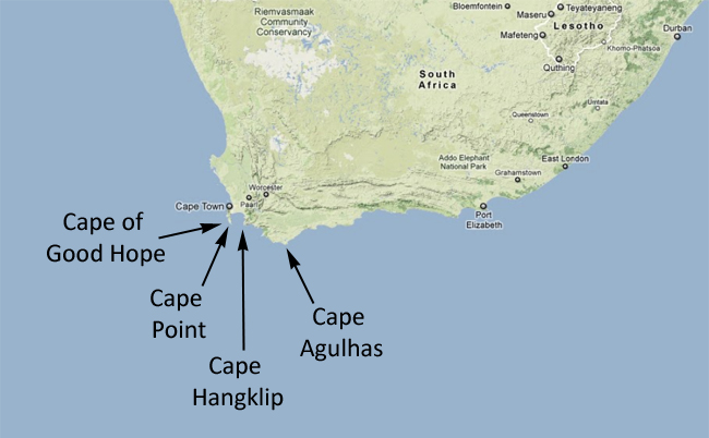
One thing I was very pleased to do on my winter trip to South Africa was to visit the southernmost point of the African continent. There are various protuberances of land in southern South Africa, each of which is a “cape” with its own proper name. The Cape of Good Hope is probably most famous by virtue of its awesome, mythological-sounding name and its proximity to the urban center of Cape Town, but there are others, too. For instance, Cape Point is only a kilometer or two from the Cape of Good Hope. On the other side of False Bay, there is Cape Hangklip, and beyond that a ways lies the object of today’s post, Cape Agulhas:
Lily and I made a day trip there from Hermanus, to check out the scene and earn ‘geographical extremes’ bragging rights:
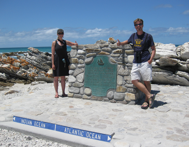

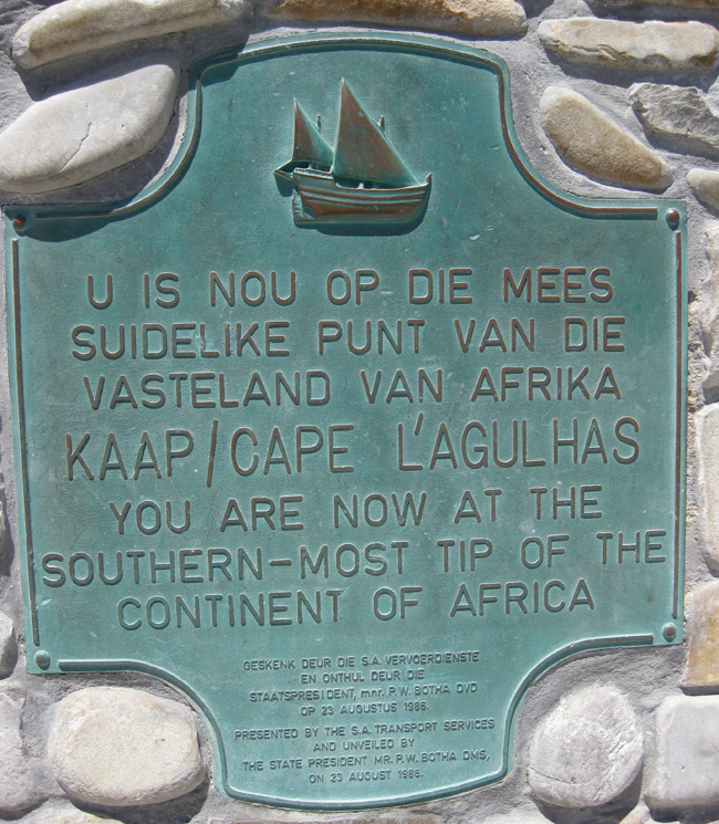
The word “Agulhas” apparently means “needles,” a Portuguese reference to that when it was named in the year 1500, the cape was about where magnetic declination was 0°; in other words, the longitude at which magnetic north and true north were the same. (Since the magnetic pole wanders, however, this appellation is no longer strictly apt.)
It’s a pretty enough place, as you can see in the images below, but not nearly so striking as Cape Point or the Cape of Good Hope. It’s a mildly curving coastline, rocky and wavestruck, but it’s not a crisp peninsula or anything like that…
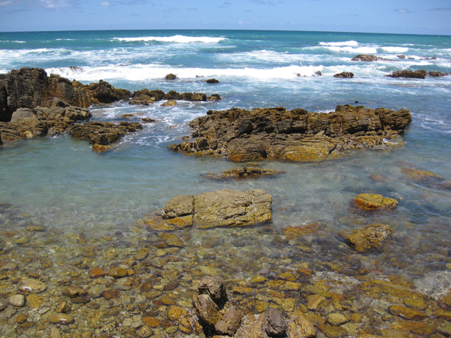
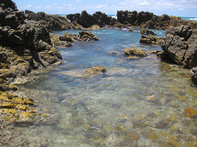
We waded out to one of the small outcrops of quartzite just offshore:
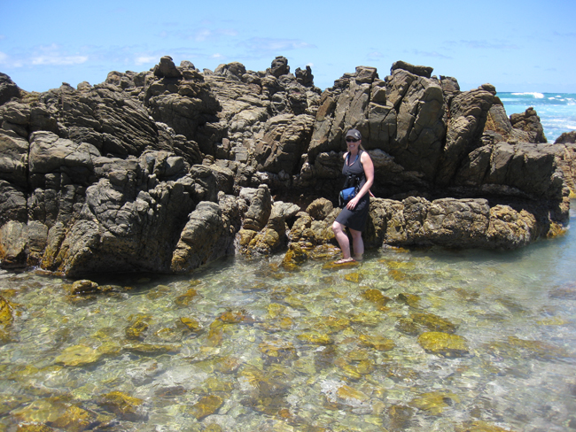
…careful not to slip on the slimy seaweeds growing there:
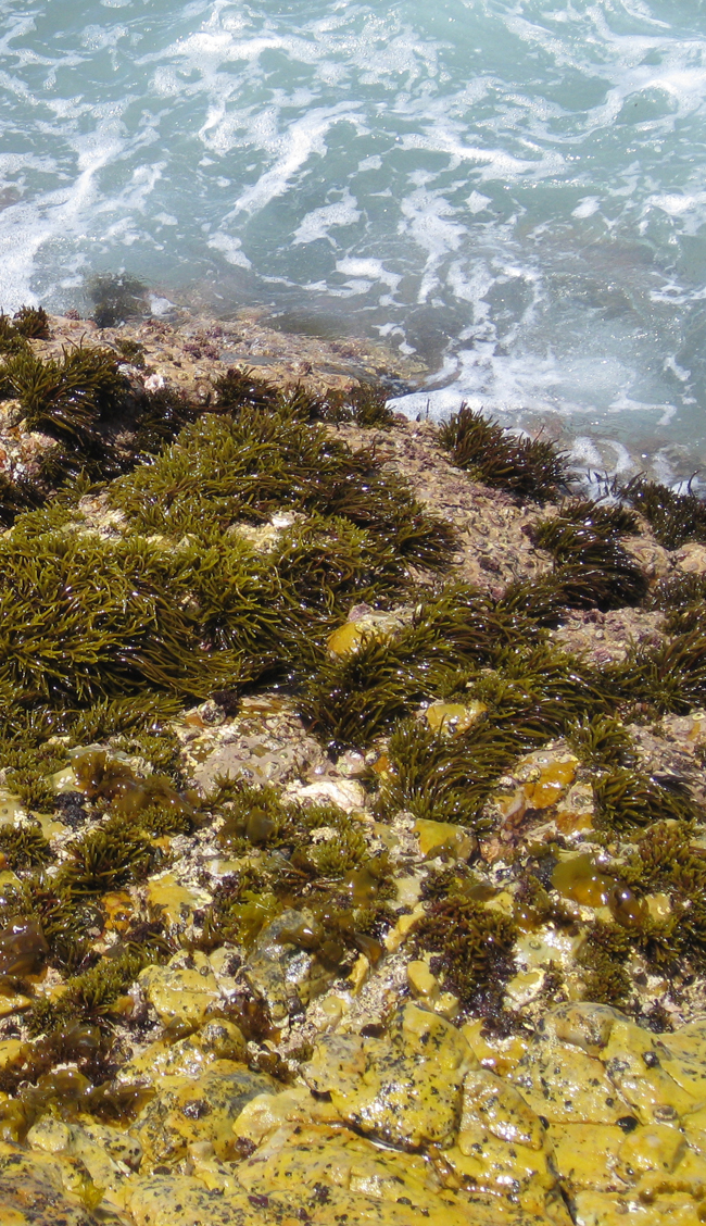
And then I noticed something…
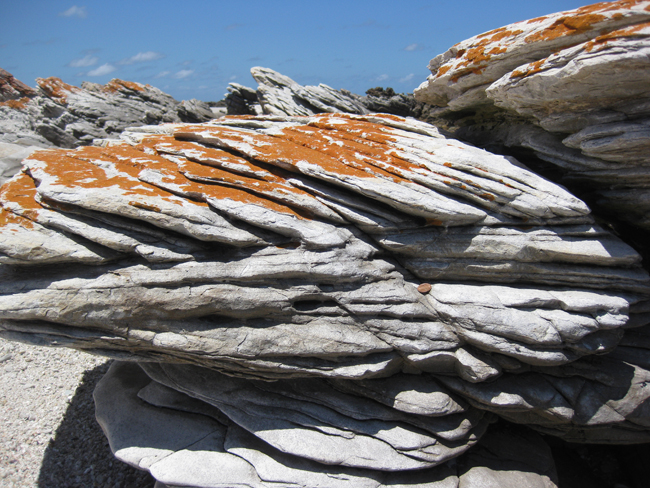
Do you see what I see there?
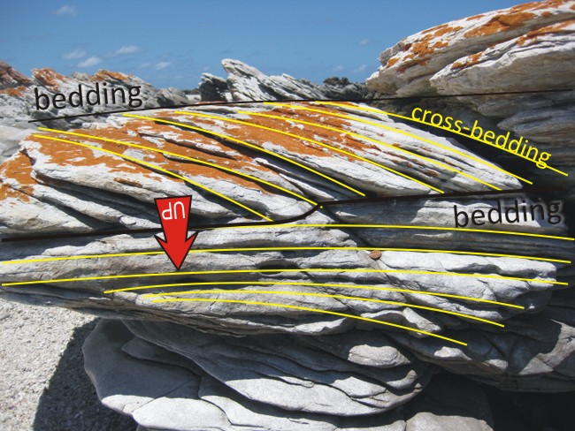
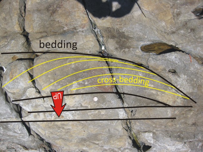
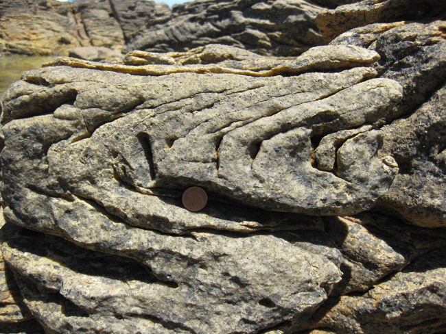
I see cross-bedding, and it’s up-side-down!
Cross-bedding is formed when layers of sediment are deposited on the leeward side of a ripple or dune that is moving grain by grain in a uni-directional current.

Notice how the cross-beds are at an angle to the main beds, and that the cross-beds are concave-up. They are tangential to the main bed at the bottom (meaning they curve gently to be parallel with the main bed) and they are truncated by the main bed at the top (meaning that they stop at an abrupt angle with the bottom of the overlying bed). In other words, cross-beds look different right-side-up than they do up-side-down. They can thus serve as good geopetal indicators: little geologic clues in stratified rocks about “which way was up” when the beds were deposited.
Here’s what a right-side-up set of cross-beds looks like, from a few dozen meters away:
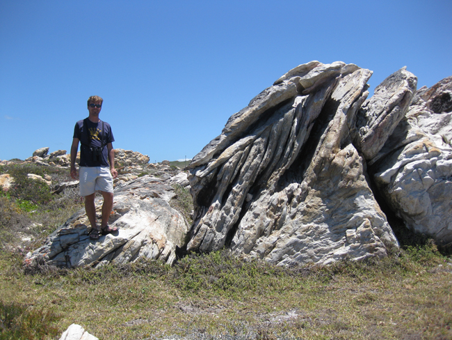
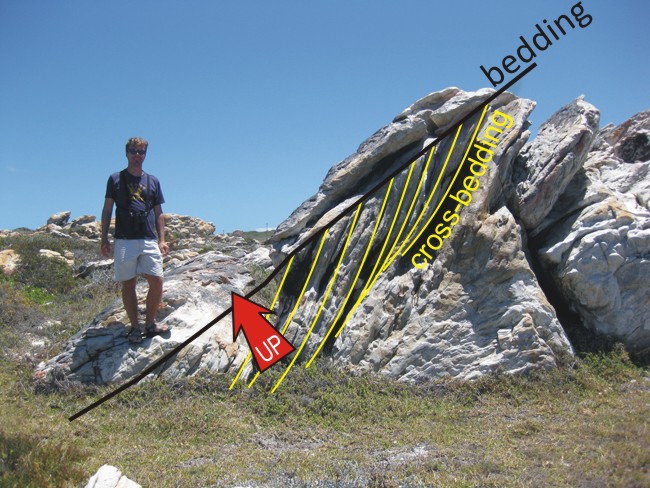
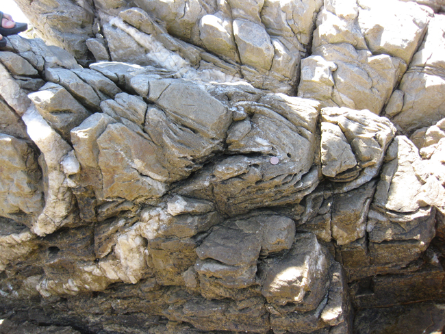
This observation piqued my interest, and I spent a pleasant half hour searching around for cross-bedding in different orientations. I found a bunch of examples. Check ’em out:
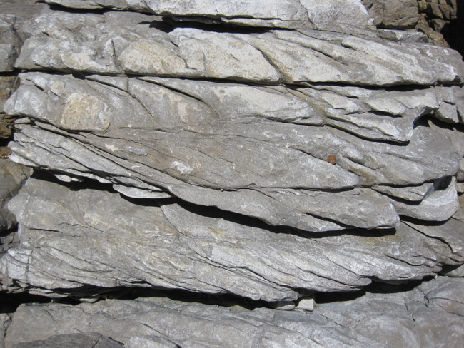
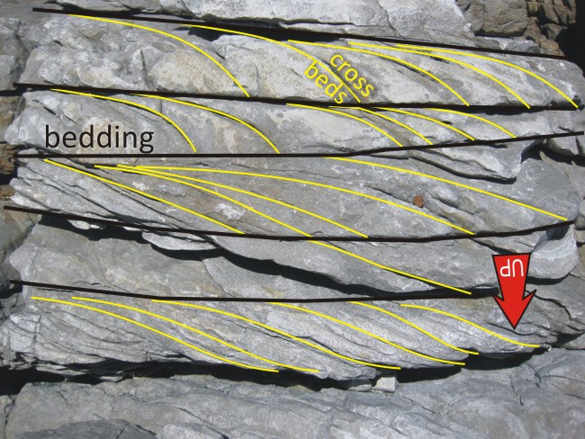
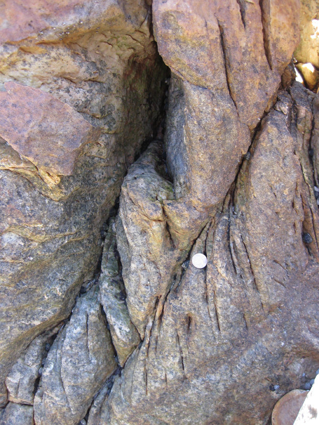
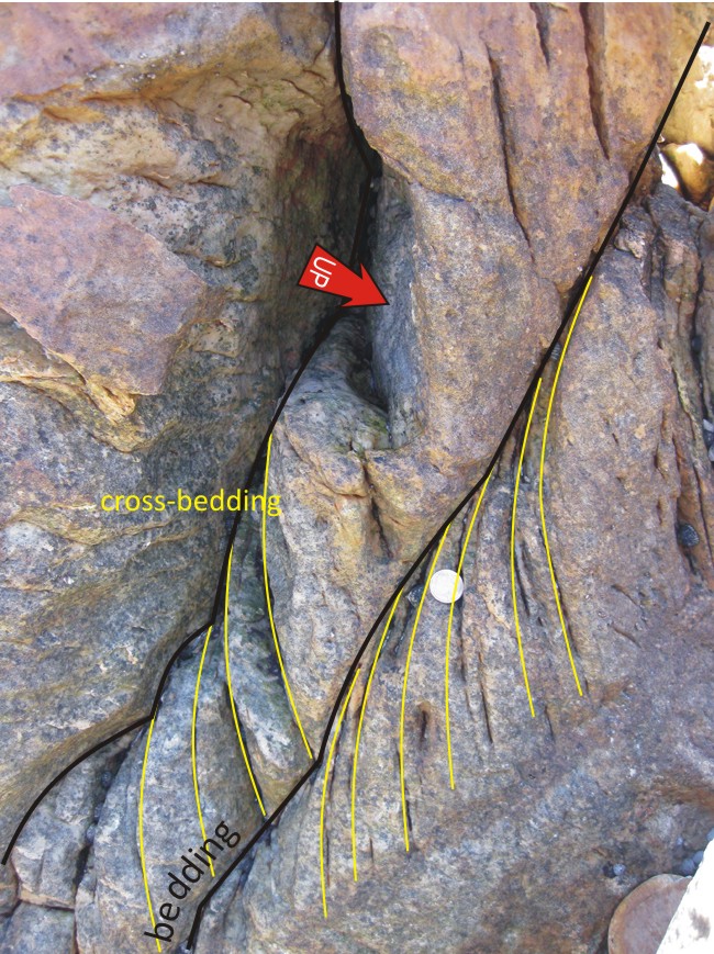
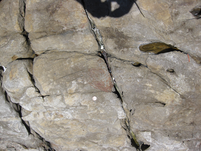
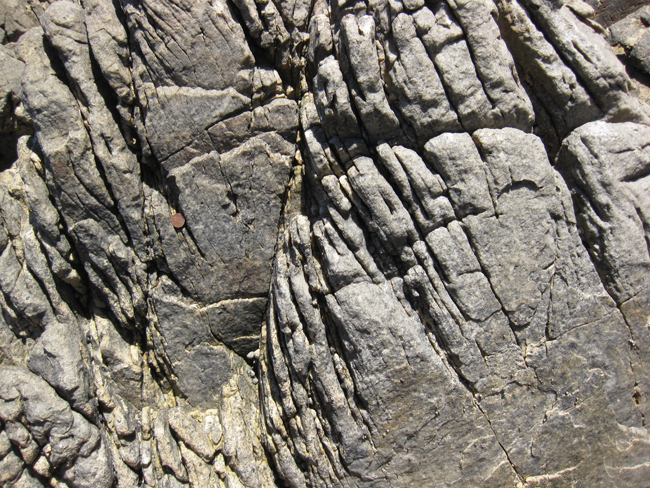
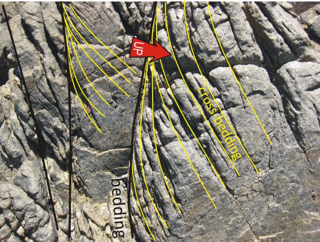
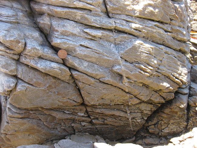
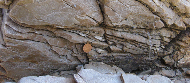
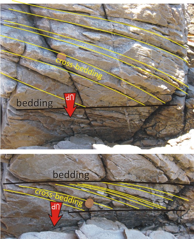
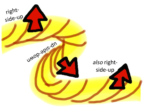
So there are a variety of orientations for the cross-bedding that I observed. How to explain this? The solution that unfolds in my mind is that the beds in which the cross-beds are included are themselves in multiple orientations, and in many places overturned. One way to accomplish this is by folding the beds up rather intensely. Like this (sketch drawn on my iPad’s “Whiteboard” app):
Sure enough, once I spent a little time looking around, testing my “folded” hypothesis, I found some confirming evidence; a few tight small scale folds:
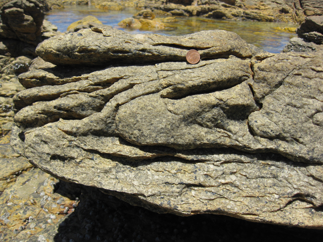
Presumably there were larger-scale folds here too, but they were not readily apparent to the eye. I’m sure a few hours of mapping these outcrops would reveal them, however. These folds (and the flipped-around beds they deform) are part of the Cape Fold Belt, an east-west trending mountain belt that formed along the southern coast of South Africa when South America mashed into it during the amalgamation of the southern supercontinent Gondwana. These quartzite strata are the same geologic unit that holds up the mesa-like form of Table Mountain immediately south of Cape Town, but here they are much more deformed than at Table Mountain.

Very nice field lesson on overturned beds — appreciate the diagrams which definitely help to explain it all. Glad you found the tight folds nearby as they also help explain the big picture.
Thanks – this was a fun experience for me — a little “bonus” for making the trip out to Agulhas, and I liked making the blog post, too!
Awesome pics of the cross-beds! Don’t always get to see those in a funky orientation. Thanks for posting.
Thank you for sharing this information. Please visit again. Will show you around if you want to see a few more interesting things.
Just came across these photos and they are most excellent. I will be showing a couple of them to my historical geology students in lecture as fantastic examples of way-up indicators. Many thanks for sharing these!
Wow, so exciting. Have just done a short course in earth science and love to read what these rocks tell us. I live 5 km from the southernmost tip and drive past by that almost every day. Planning to do a tour guide course in march so hopefully when i am registered i can tell them much more about….. rocky patterns.
These photos and explanations are great.
We were looking at it when taking a hike through the resereve and was wondering about it.
What still puzzles my friends and I is the flat dark grey/black rock surface on top of the hill. It covers a large area and varies from rough surfaces connected to smooth patches. It seems like loose stones may have been covered and affixed by melted fluid soil.
Can anyone please share some information about this?
Gosh, I didn’t notice this. Any photos of it?
I did not take enough good photo’s of the rough patches, but I do have a few – unfortunately they won’t give you the full picture.
I don’t know how to upload them though.
Well, you don’t get to upload them here to my blog, but you can upload them somewhere else, like Flickr or Picasa or SmugMug or Twitter or Facebook or Google Drive, and then link to them from here (just paste the URL into another comment).
CB