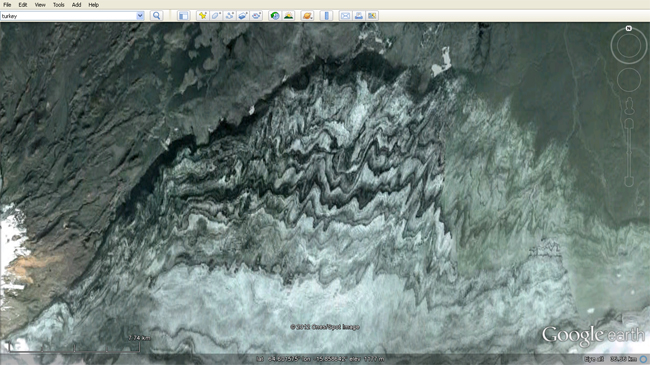
Searching for Peter Luffi’s latest Where On Google Earth? challenge, I found myself touring Iceland last week. While I didn’t find the strange comet-shaped feature he posted, I did find this:
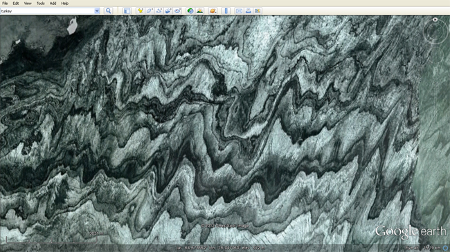
And zooming in a bit, to the high-contrast area in the center:
This appears to be volcanic ash layers distorted by glacial flow and then melting/sublimation/weathering/erosion/ablation of the glacier. I posted something similar as the Friday fold almost a year ago. But this one is more beautiful.
Happy Friday!
(I didn’t find the Where on Google Earth location, by the way. But Ron Schott did, and he has issued a new challenge here.)


Are you sure anything is actually folded? Looks like irregular erosion exposing horizontal layers of ash/sediment. Just like on the rim of the Grand Canyon, the “folds” are illusions when viewed from above.
Terrain view shows nothing much there – could be a lack of topographic relief, could be a lack of data, could be a choice in the presentation of that data by the programmers. But: No, I’m not sure. I’m inferring. Would it be so shocking for it to be folded?
Congratulations, you perfectly recreated my WoGE 274. 😉 It’s indeed a great picture, and without a scale, quite ambiguous.
Brian, who solved it, has some explanation about it in the comments on my blog and in his WoGE 275 entry.
Wild! I had no idea. Thanks for linking to these earlier posts.