Last summer (2011), my wife and I spent some time in the Canadian Rockies, checking out the geology in preparation for a new NOVA field class that I’ll be leading this summer (2012) in July. One thing we did was to ask around for good hikes. The ranger who put us on to Mt. Cory said it was “the toughest hike in the Banff area.” We parked at the Fireside Picnic Area on the south end of the Bow Parkway, about 5 km north of Banff village. The route took us up to Cory Pass (visible in the middle distance where you can see a dark rock nubbin), then down and around the mountain and back via Edith Pass.
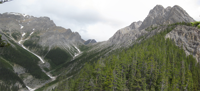
You can see that a substantial portion of this route was above treeline, and the bit just beyond Cory Pass was indescribably epic. Just raw rock, naked and lifeless, as if it was deglaciated a week before we got there. Here’s a composite panorama view looking into the maw of Cory Pass itself:
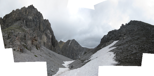
Step across the threshold, and a gorgeous scene awaits…
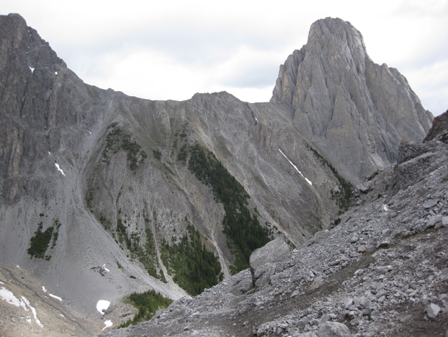
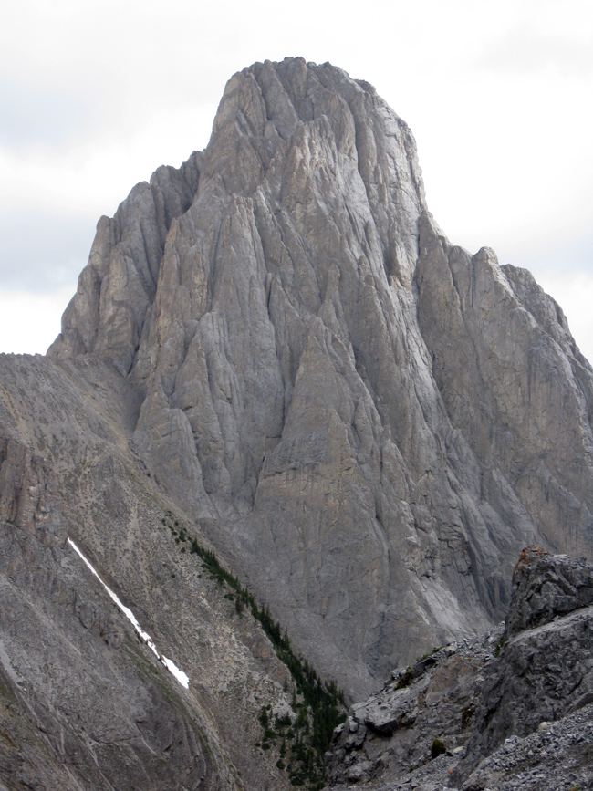
I think this tower is Mt. Louis…(?)
Turning to the right, and looking down the valley… Look at those steep slopes! The phrase that pops into my mind is “sheer declivity“…
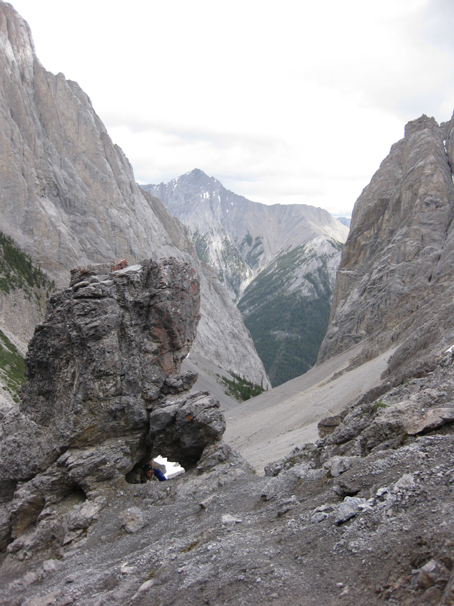
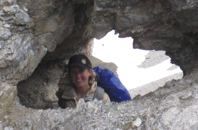
Did you spot the little character hidden in that last image? If not, I’ll zoom in on her:
As we walked down towards the bottom of this new valley (towards lunch with two marmots and a pika), we saw blocks of rock bearing multi-pronged trace fossils, which I reckon must be feeding traces:
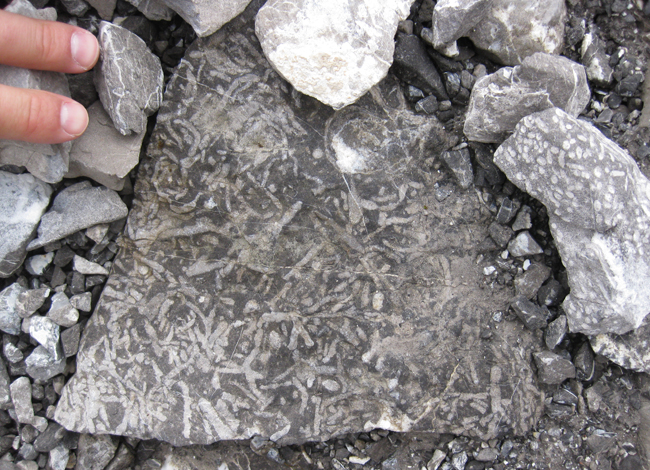
Based on my reading of Ben Gadd’s book Canadian Rockies Geology Road Tours, I think that this is Cairn Formation dolostone – a Devonian deposit. It has a distinctly petroliferous stink to it when freshly broken – a real nostril-opener!
I’m looking forward to leading 18 NOVA students through this same hike this summer…

The Cairn Formation (subsurface equivalent: Leduc Fm) is one of the main hydrocarbon zones in the WCSB. That last picture I don’t think are traces but rather Thamnopora corals (based on the branches). They belong to a major off reef facies and are super common in the Frasnian of Alberta.
Thanks!
Here’s a bigger version if anyone wants a closer look.
Nice photos! Cory Pass is definitely a classic hike in the Banff area–good choice. You got the mountain right–Mt. Louis. There’s a similar but less-spectacular peak to the NW of it, called Mt. Fifi (maybe Fifi was Louis’ poodle??)
I’d agree with Arkose about the fossils, though they’re probably a mixture of Thamnopora (tabulate coral; slightly thicker, with obvious little holes all over it) and Amphipora, a stick-like stromatoporoid; thinner, pretty much featureless in dolomite facies, where the microstructure is usually lost due to recrystallization. These are pretty much iconic guide fossils for Upper Devonian back-reef/lagoon facies. Every petroleum geologist in Alberta knows them by heart.
What tremendous climbing opportunities. Had to check out the climbing routes on Mt. Louis – easiest is 5.7.
This is worth looking at if climbing on rock interests you.
http://www.summitpost.org/mount-louis/150423
What a great mountain.
Nice. I did this hike back in 2002 and can still remember the first view of the valley behind Cory Pass. Very otherworldly. A tough hike up though, and we lost the trail on the scree on the backside, but still made it down. Are you doing this hike with the class? Did you guys do Helen Lake/Cirque Peak when you were up there last year?
Yeah – “otherworldly” is a good way of putting it. Yes, a tough hike up. Yes, planning on doing it with the class (or at least that portion of the class who wants a “tough” hike that day).
No to Helen Lake/Cirque Peak. Should I put it on my list?