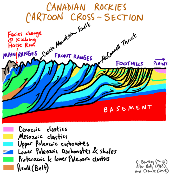
I’m headed off Saturday to the Canadian Rockies for two weeks. My colleague Pete Berquist and I are leading a regional field geology course up there. It’s a new gig for both of us, and I’m sure the trip will be quite a learning experience. As I was preparing for the trip today, I drew this cartoon to clarify in my mind the distinguishing characteristics of the three main physiographic provinces in the Canadian Rockies.

The cross-section is at about the latitude of Banff and Calgary. It would look rather different (dominated by the Belt/Purcell Supergroup) further south in the vicinity of Waterton Lakes. Note that the older portion of the section is exposed in the west, including the Burgess Shale (in the deeper water Cambrian facies), and the strata get younger to the east. The Front Ranges and Main Ranges are held up mainly by tough, erosion-resistant limestones (and also some quartzites), while the foothills are weaker clastic strata from the Mesozoic. East of them, of course, the strata aren’t folded or faulted much at all: those are the layers that underlie the Great Plains.
