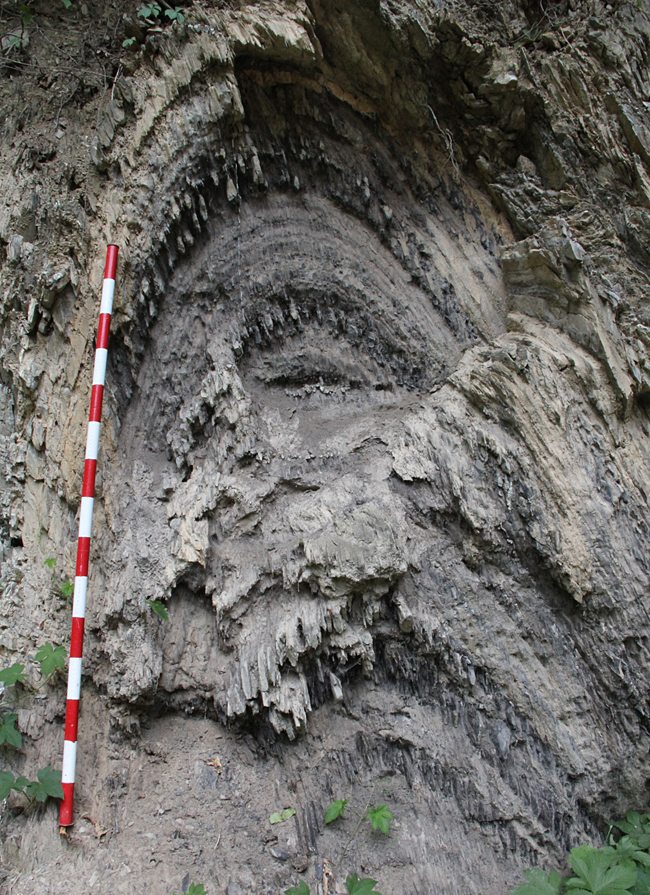
On Monday, my former students (and current M.A.G.I.C. collaborators) Alan Pitts and Chris Johnson and I were in the field. We went to take a peek out over the Shenandoah Valley from Woodstock Tower, and we checked out fossils of crinoids and spiriferid brachiopods in the Mahantango Formation near the Fort Valley Museum, but the highlight of the day was this lovely fold, with a nice display of pressure-solution cleavage:

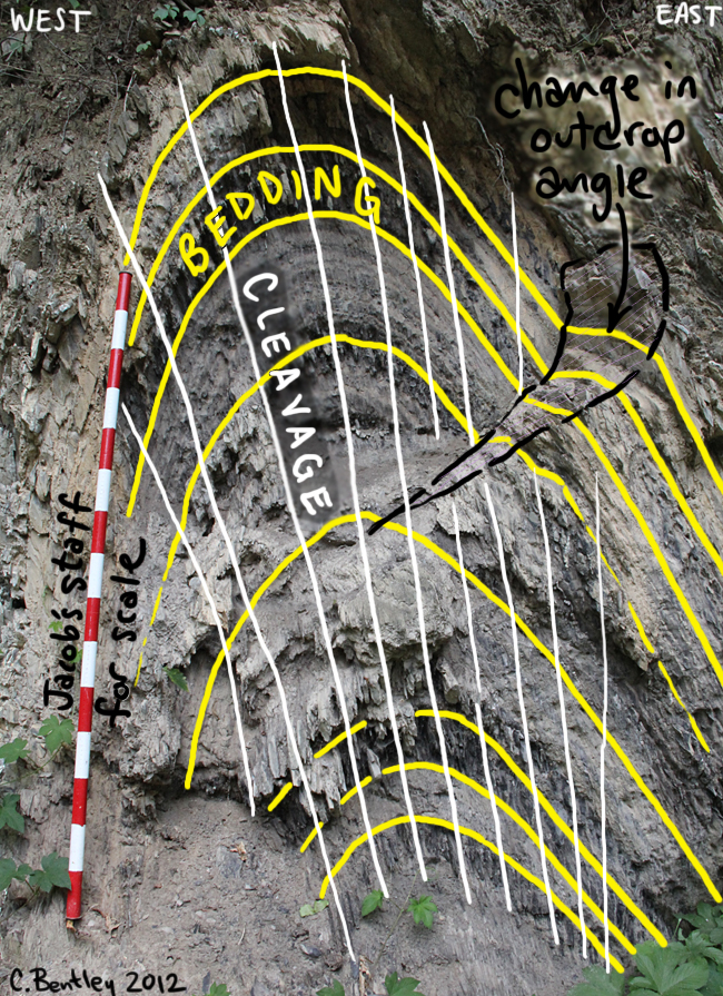
You’re looking north/north-east along the trend of the fold axis. Here’s an annotated version:

The outcrop appears on the South Page Valley Road, near the intersection with Bixler’s Ferry Road in Page County, Virginia. This is classic Valley and Ridge geology: Ordovician limy muds (the rock fizzes) that were generated due to the uplift of land to the east (Taconian Orogeny) during the first phase of Appalachian mountain-building. Later, during the ultimate phase of Appalachian mountain-building (the late Paleozoic Alleghanian Orogeny), these same strata were folded, cleaved, and shoved to the west. You can even see a bit of that westward-verging asymmetry in this image.
Here’s a GigaPan of the outcrop that you can explore on your own:
