In last week’s Friday fold, I featured this image…
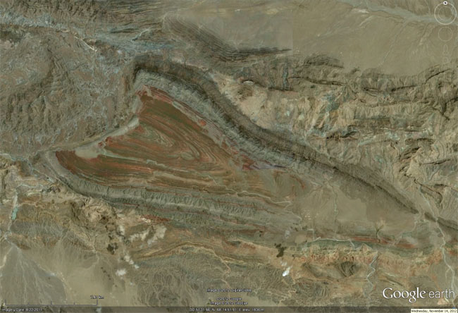
…which prompted commenter Lynn David to ask,
What’s going on to the west side of that red/green rock cored syncline in #2? It looks like some sort of disconformity but then I looked closer (and man, does that rock redden up) and it appears that the synclinal axis suddenly gets smashed up against “something” – possibly a fault of a different trend than the folding? Could be a folded thrust in the mix??
This was a good question. I hadn’t looked too closely at it when I snapshotted it – I had assumed a big round igneous intrusion, if I gave it much thought at all, but Lynn’s comment prompted me to go and take a closer look. And, wow, am I glad I did. You should too: Here’s a link to the spot on Flash Earth.
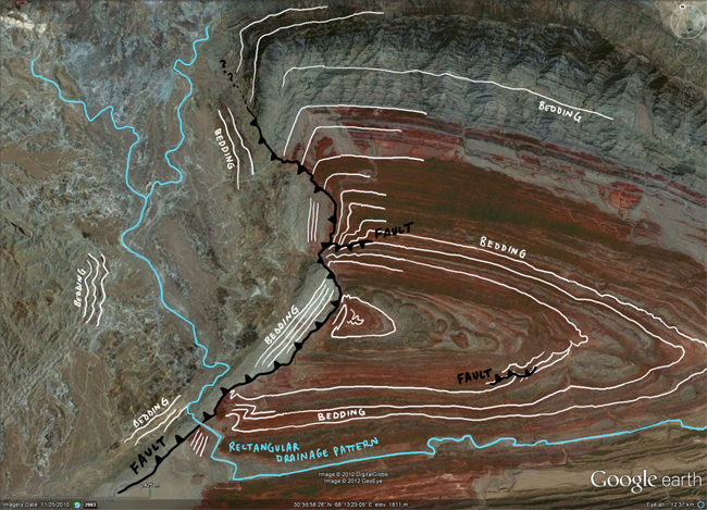
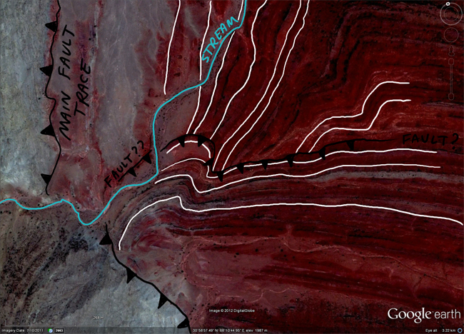
After poking around for ten minutes and looking at some of the details, here’s what I sketched out:
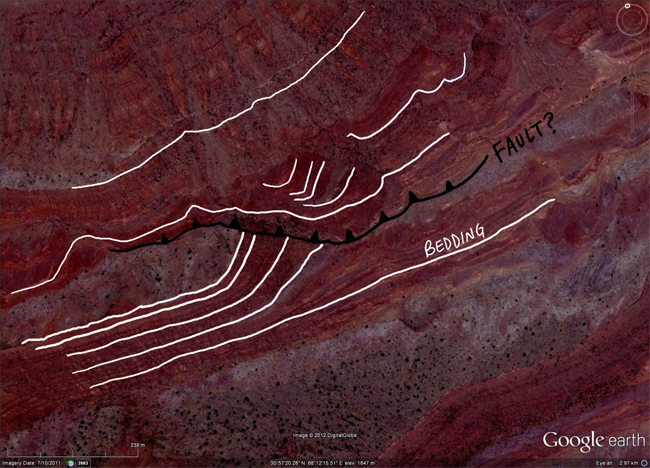
You’ll notice (a) I interpret the contact as a east-verging thrust fault (hanging wall is green colored rocks on the west), and (b) that I’ve drawn into two subsidiary faults at sites where the red bedding gets truncated. Close-ups of these two appear below:
I tried to check my off-the-cuff interpretation with One Geology, but the resolution is nowhere near sufficient, and Pakistan doesn’t have a good map laid out in the geological layer. But I found this great big jpg instead, and sure enough, there are a series of faults there with more or less the pattern I interpreted:
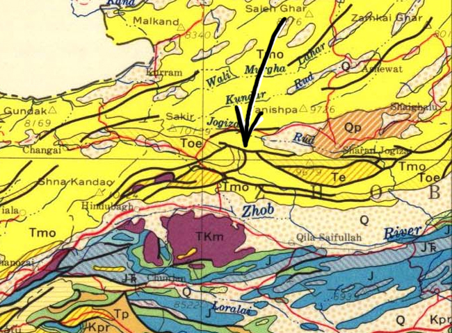
Awesome. That’s gratifying. What a cool area. I’d love the opportunity to do mapping there – with the proper human-safety controls, of course.
Lynn has a map, too, and says,
Ok… looked at my map of Pakistan and the core of that syncline is Miocene-Oligocene (M/O) and there is a fault there on the west that is possibly reverse (thrust?) faulting Oligocene-Eocene (O/E) age rocks over the M/O. But the synform continues west and you get back into the M/O sequence.
And the M/O syncline is bounded by faults to both the north and south. Although the southern fault plays out as you go east. But the northern one has Eocene age rocks up on the M/O to the east. So I’m guessing the thrusting is from north to south, even though there is a east-west trending Jurassic/Triassic cored anticlinorium to the south.
There’s some serious controls going on there trending west-southwest from where that syncline gets truncated by the fault off toward the city of Quetta, the J/Tr anticlinorium get smooshed up against the trend and it includes some intrusions along the way.
Great stuff. Lynn, thanks for the prompt to take a closer look. Happy Friday, all.

You’re most welcome. And that is the map I have of Pakistan. I’ve always been fascinated by that the geology of Asia, but I’m rather an amateur about the area. I have not found a good explanation for the several structural trends in that part of the world; most likely because I have not search hard enough! But it seems to me that in Pakistan there are several competing trends which may be due to changing stress regimes over time.