
Take a look at this…
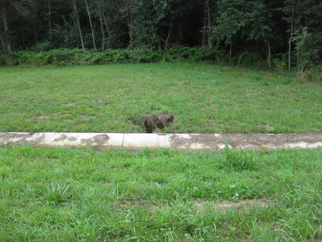
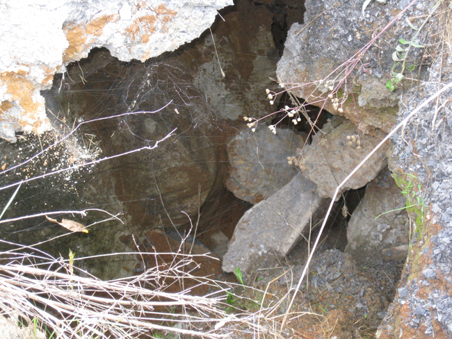
Doesn’t look like much, does it? But it’s actually the surface expression of a vast, long-lived sinkhole. If you walk over to the hole and look in, you can’t see the bottom. It’s semi-supported by limestone boulders, but between the boulders, the soil and gravel filter down, down, down, like the sands in an hourglass.
My friend and neighbor Diane Artz Furlong, who also shared her saddleback caterpillar photos yesterday, alerted me to this feature, on the edge of Virginia route 629, Oranda Road, between Strasburg and Oranda, as seen here:
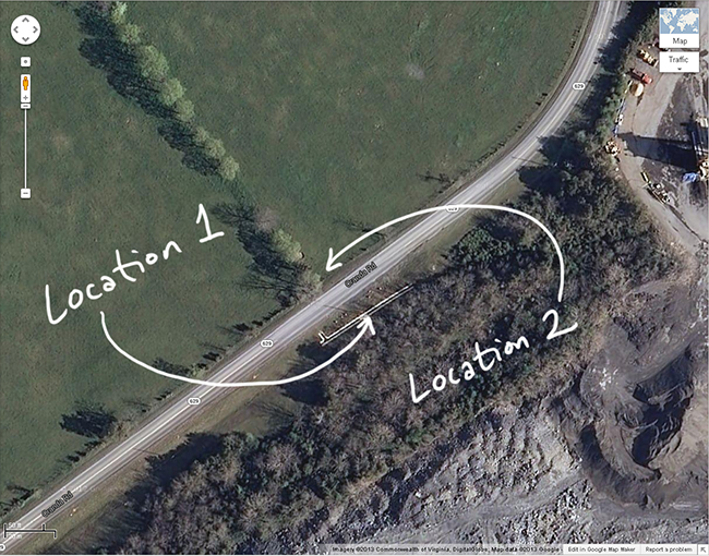
Zooming in, you can see the concrete drainage ditch installed at the site (“Location 1”):
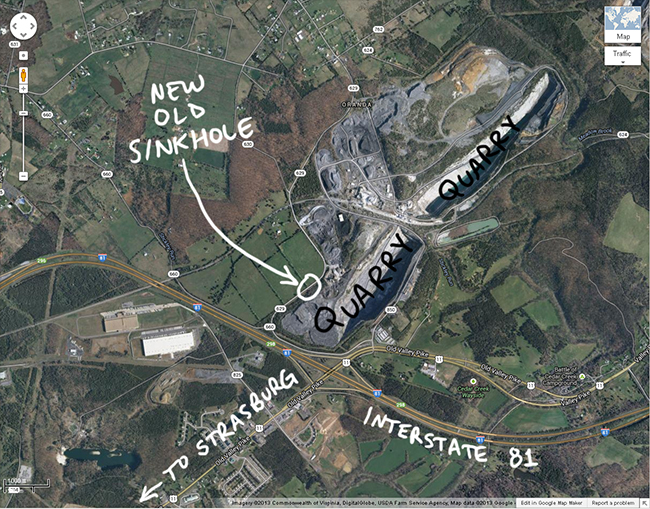
The sinkhole is on the property of the quarry, which has filled it in repeatedly in the past with gravel, according to Diane. Here she is with my wife Lily at the site last week:
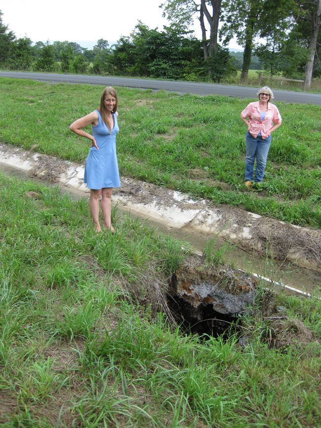
Diane estimates it has opened up and been refilled artificially three or four times in the past several years.
The scary thing to me is that the subsidence is not limited to the southeast side of the road – there is an equivalent hole, much larger in diameter, on the northwest side of the street (“Location 2” on my map above):
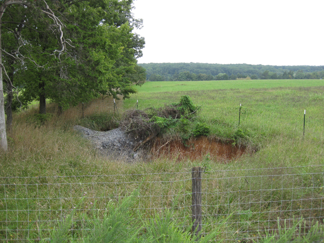
You can see the remnants of the last load of gravel fill trickling in toward the back…
These sinkholes will continue to grow to some size, and if they coalesce, it will swallow a chunk of Oranda Road. However, before that happens, I’m sure the quarry will again attempt to choke it up with a fresh load of gravel. Depending on the volume of the subterranean reservoir, and its rate of downstream evacuation, this hole-filling game will buy some time. And it will renew confidence in the soundness of the road. But so long as gravity works, and the rain falls, and there’s room in the collapsing cave below, this “feeding the meter” at the sinkhole could go on for a long time….
I’ll keep you updated if it grows or gets topped off again…
Is blasting from the quarry accelerating the repeated collapsing?
It’s hard to tell from the photos how much relief there is between the quarry bottom and the road level, but…seeing as how close those “sinkholes” are to the edge of the quarry, is it possible that they could be incipient slump fractures? I wonder if the blocky limestone bedrock is pulling apart and slowly shifting toward the quarry, perhaps aided by heavy truck traffic?
Great observation i must say, very good article and information to share. The sinkholes seems to be very deep and dangerous as it is just next to the road. There are high chances that the road can get affected due to the sink holes as they are next to each other. This should have a proper Inspection and Rehabilitation to avoid any incidents later in the near future.