
Today, we continue with the story of the field trip I took last week out to Corridor H, the new superhighway in West Virginia that is practically unused, and decorated with multistory roadcuts of spectacular Valley and Ridge sedimentary sequences, and their attendant structures.
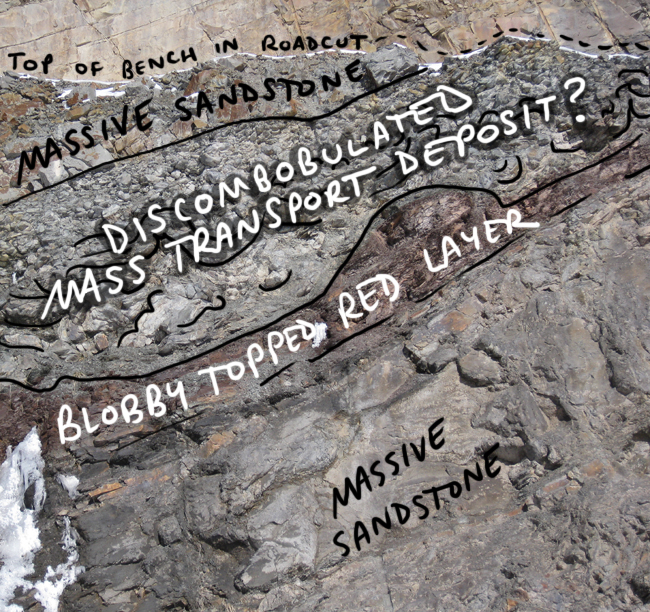
From the putative Hampshire Formation exposures with their uncharacteristic marine incursion strata, we moved downhill (and, down-section) to examine a road-cut of what we inferred to be Foreknobs Formation. The left (uphill/youngest) part of this roadcut had some interesting stuff going on:
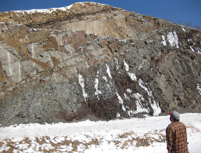
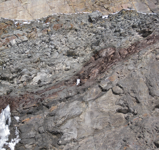
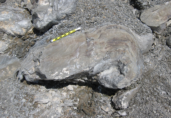
Whereas most of the strata in the Valley & Ridge are relatively coherent, the red blobby layer caught our eye as being odd. That clued us in to the layer overlying it, which we think might be a big shaley mass transport deposit: a weak pile of sand and mud that slumped, pre-lithification.
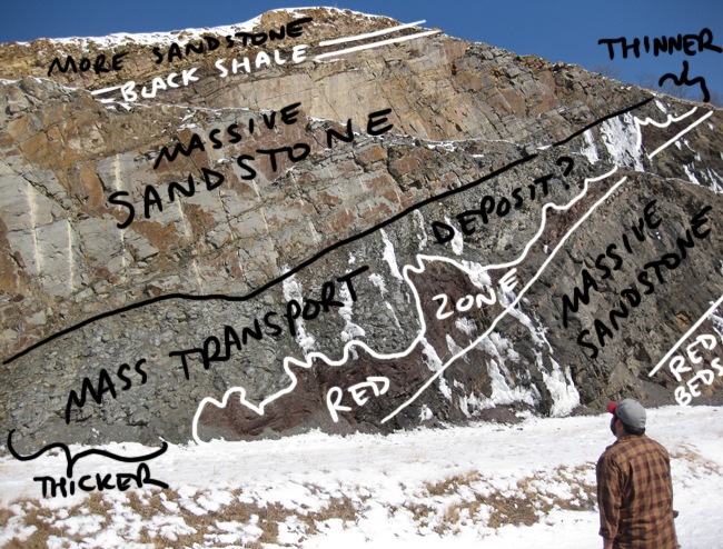
Note how the layer in question varies in thickness from the lower right to the upper left.
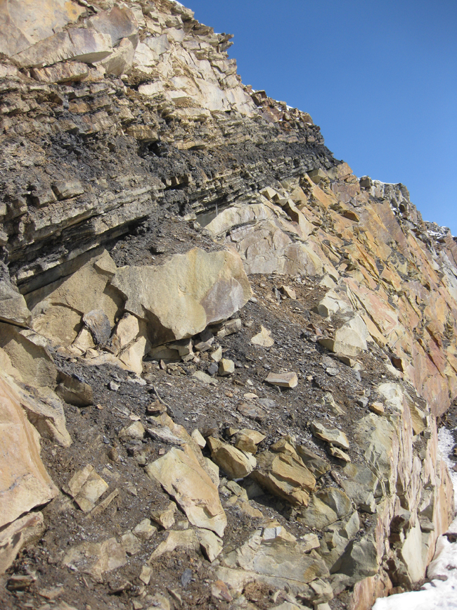
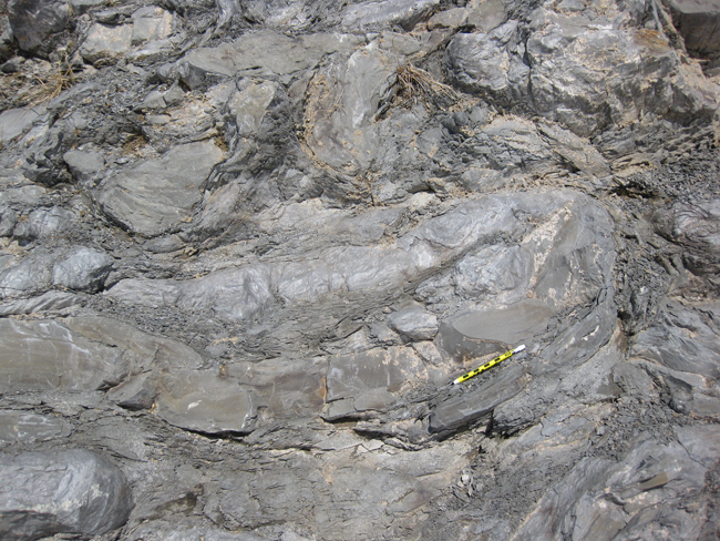
You’ll note there’s a lot of massive quartz sandstone in this outcrop, although there are occasional breaks in that monotony, such as this black shale layer seen at the far left of the outcrop (penultimate stratum in this sequence):
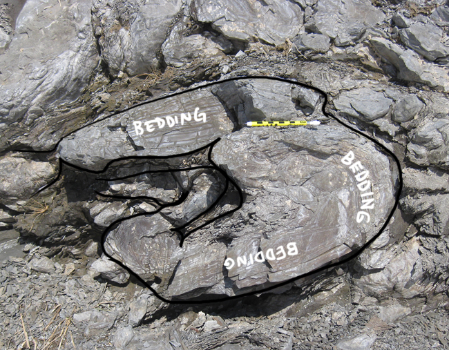
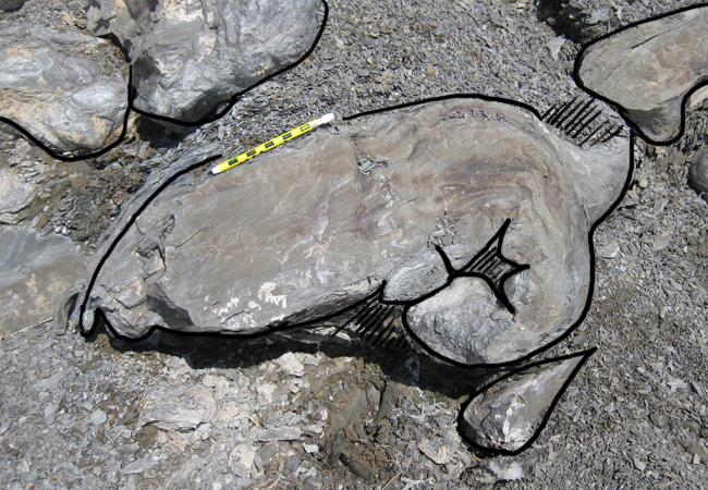
But while shale is all well and good, I’m more interested in the structural story in the gray shale / sandstone layer:
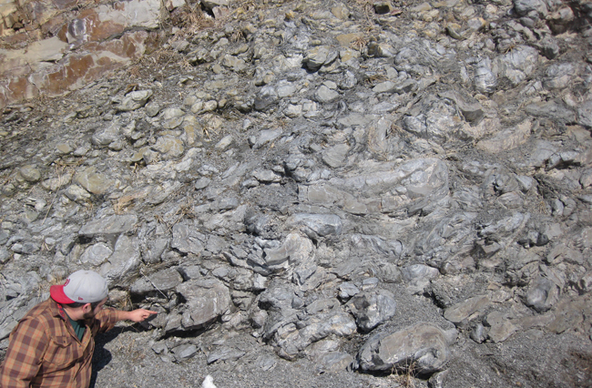
Here’s Alan pointing at some key features in the unit, which appear to be dismembered (boudinaged?), folded competent sandstone layers, surrounded by incompetent shale.
Let’s examine a few of these chunks in more detail… 1, 2, and 3…
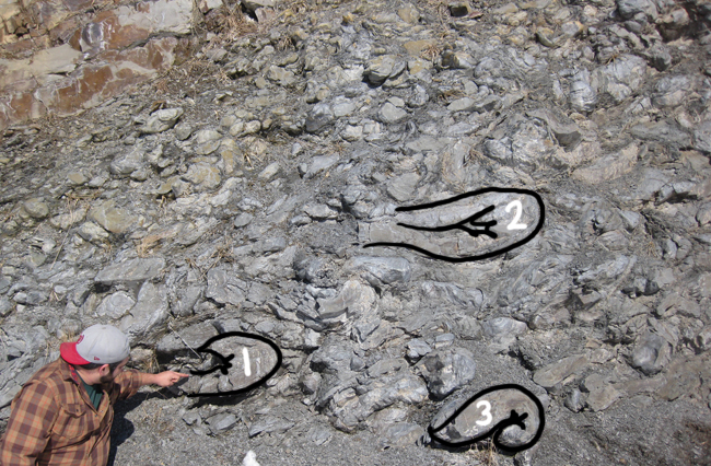
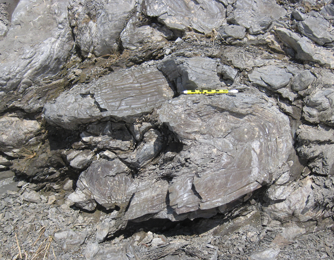
First, let’s look at fold #1, just to the right of Alan’s pointing finger:
Then, there’s fold #2:
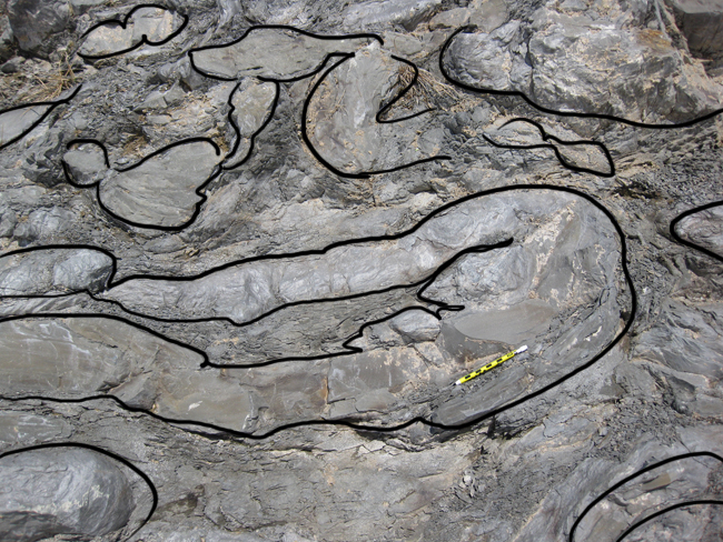
…And fold #3:
What do you think – is this a “broken formation” sort of scenario (i.e., the precursor to a tectonic mélange), where the deformation is tectonic (related, presumably, the Alleghanian thrusting and faulting), or is this a primary sedimentary feature (a submarine slump, a mass transport deposit)? I’m curious to hear your thoughts.
Unless you and Alan see/saw at least some clear evidence to the contrary position, this looks like mass transport in the sedimentary environment, not tectonically generated. Any evidence in the shale or folded sandstones for structural deformation? Slicks? Faulting? Granted, very hard to see such in weathered outcrop of shale, but that’s what’s needed to poke at any kind of tectonic origin, double-especially when it’s neatly sandwiched in between gently folded rocks where the age of folding is significantly later than the deposition age.
Pretty outcrops indeed. Thanks for all the sharing. Nice to have Mountain Beltway in my RSS feed.
I agree with Paul. I was wondering whether the “red zone” shales below the disrupted layer have their uneven upper contact due to erosion, or if that was loading deformation. In the second annotated photo, it looks as if one of the upward extensions has bedding that’s cut off at the contact, suggesting that the mass transport deposit was doing some eroding as it was emplaced. I’d definitely look for red rip-ups in the disrupted layer.
Pretty much what Paul said. Those sandstone “roll-ups” look completely willy-nilly, pointing to penecontemporaneous deformation. Even if one could argue that the chaotic shaly unit suffered tectonic deformation preferentially because it was an incompetent unit among more competent units (which were therefore less liable to deform than the shaly unit), wouldn’t there be a more clearly defined structural fabric to the deformation? It looks like it was all churned up and dumped in a heap. Very cool exposure!
If I saw especially the bottom pic in the Flinders Ranges, South Australia, I’d say they were stromatolites, especially with the heiroglyphic stuff around the lump. I’d scratch my head a bit about the fact that they aren’t aranged in some sort of sensible layer but me not understanding something doesn’t preclude it’s being correct.
Get the prize?
Wow! Fantastic outcrop, must go see.
Looks like MTDs to me.
Callan – I enjoy your posting and photos – particularly of the metagraywacke along the Billy Goat Trail. Where exactly is this particular Foreknobs outcrop?
It’s on Corridor H, on the grade going up to the lip of the Alleghany Plateau. You can’t miss it. East of Mt. Storm, west of Moorefield and Greenland Gap.
Thanks, that portion of Rt 55 has been opened since the last time I was there (year and a half?) – I may check it out in a few weeks when I’m back there. The Foreknobs is much more complicated than what a lot of geologists think – lots of huge surprises if there were large Book Cliff-type exposures in it !!!!
Update: I no longer think this is Foreknobs, but instead uppermost Hampshire Formation (directly above the Spechty Kopf Diamictite) and below the Rockwell Formation / Pocono Group.