While on Corridor H 2 weeks ago with Alan Pitts, we stopped astride the Patterson Creek Mountain Anticline, with extensive road cuts displaying Tonoloway Formation overlying Wills Creek Formation. We love this spot for its lovely folds and halite casts. See what I mean?
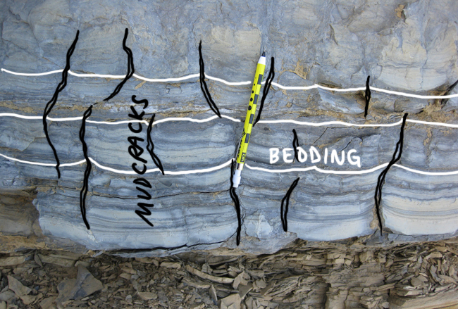
This time, however, my eye was drawn to the prodigious quantities of mudcracks to be seen in side-view (that is, in cross-section). Take a gander:
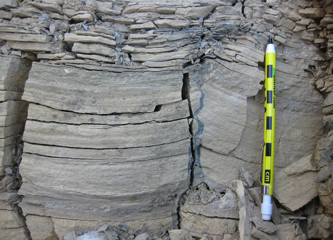
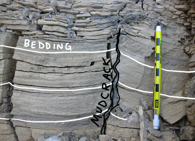
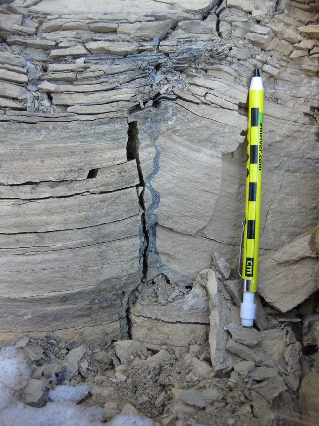
Zooming in on the crack betwixt the concave-up “dishes: of finely laminated carbonate mud:
Here’s another example:
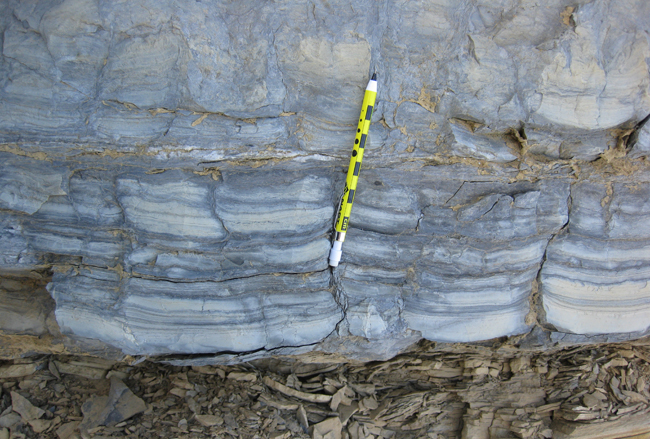
And another:
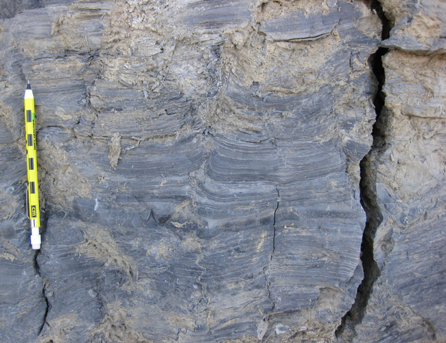
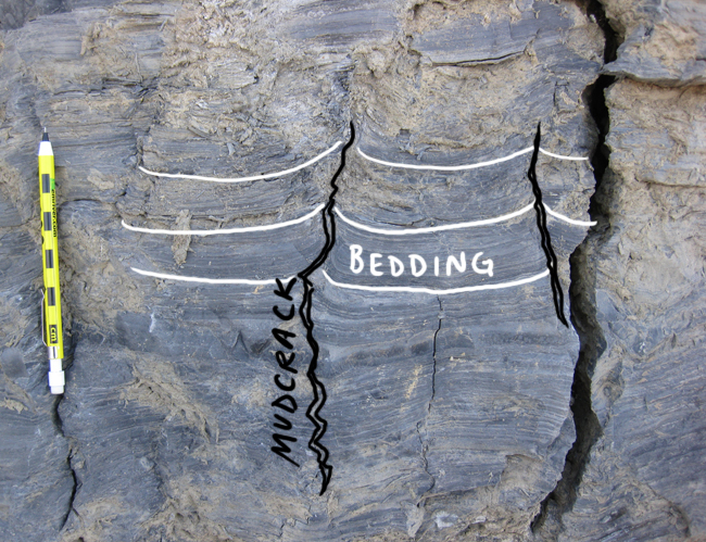
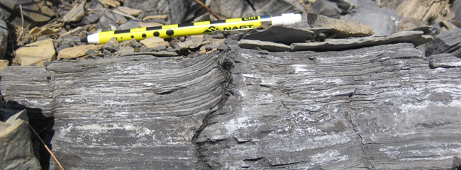
And one more, from the other (sunny) side of the road…
What do these features look like when viewed from “above,” that is, viewed on the bedding plane itself (rather than in cross-section)? We’ve proudly displayed them before:
That last GigaPan is at a quarry on old Route 55, on the west flank of the Hanging Rock Anticline.
Students: What can we infer about conditions in West Virginia during the Silurian period of geologic time, when these rocks were deposited as sediment?

This is a really cool outcrop!
What do you think about the possibility that some (if not all) of these are dewatering structures? Some of these things seem to taper up-section, rather than the other way around, as I would expect for dessication cracks; also, I tend to think of dessication cracks as being relatively superficial (mm to a few cm in scale). Of course, I’m assuming–perhaps wrongly–that you’re thinking “dessication cracks” when you’re using the term “mud cracks”.
I might be interpreting too much from the photos, but the structure in the first three images seems to originate in a darker, muddier bed (level with the eraser-end of the pencil), and seems to be carrying that muddier sediment upward, and tapering significantly in the same direction.
Dewatering structures wouldn’t necessarily be inconsistent with the salt hoppers, either. Thoughts?
Thoughts: I think this is why I blog, to get insights about things that I wouldn’t have thought of. I guess I don’t know enough about dewatering structures to evaluate their plausibilty here. What are the key features to watch for beyond the tapering upward pattern?
(Yes, I meant dessication cracks when I said mud cracks.)
Thanks – as always – for your insights.
Sir, can you please explain to me exactly how mud cracks are formed? And please do mention the difference between the formation processes of mud cracks and syneresis cracks…
It seems to me dewatering structures. Dewatering of liquefied/fluidized sediments can produce dish-pillar structures, sand dykes, sand volcanoes and mud volcanoes as well. Also, in some pictures I see light-colored balls of coarser grains floating inside the dark-colored mud.