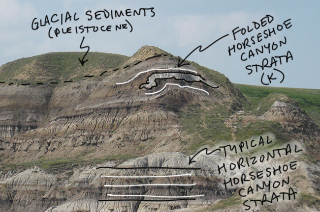
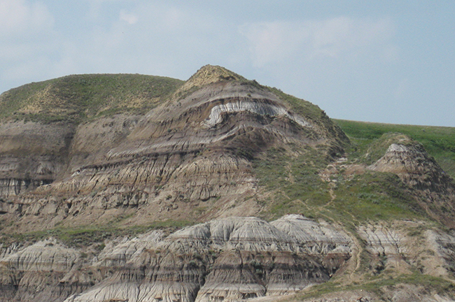
It’s Friday! Time for a fold. Here’s one in the Horseshoe Canyon Formation of eastern Alberta, seen on the bluff east of the Red Deer River near Willow Creek (“The Hoodoos”).

This is anomalous – it’s unusual to see deformed strata out here, so very far from the mountain front to the west. One possibility is this representative of soft sediment deformation in the sediments; slumping, say, shortly after deposition.
Another possibility is more astonishing — the idea that Pleistocene ice sheets may have plowed into these pre-existing strata of Cretaceous age and crumpled them up as they moved along. (Subsequently, the crumpled uppermost Cretaceous rocks were buried in post-glacial sediments (loess and outwash). Such a thing has in fact been documented in the Great Plains north of here, at about the same distance from the Rockies. And previously on this blog, we’ve examined a similar case of glacially-induced deformation just east of Glacier National Park, Montana.
What do you think? Happy Friday!


The Horseshoe Canyon member has been folded and ice-rafted in central Alberta near Edmonton (Wabamun Lake). It would not surprise me if this was also folded from Pleistocene ice sheets!
I’m gonna go with ice-sheet. I visited Block Island (between Long Island and Martha’s Vineyard), which is all glacial and there were many examples of this type of deformation. I really didn’t appreciate it before then!
I remember (it was 1976) a similar case being pointed out on a geologic field trip on the southeast side of Glacier National Park in Montana.