
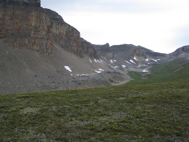
This is Helen Lake.
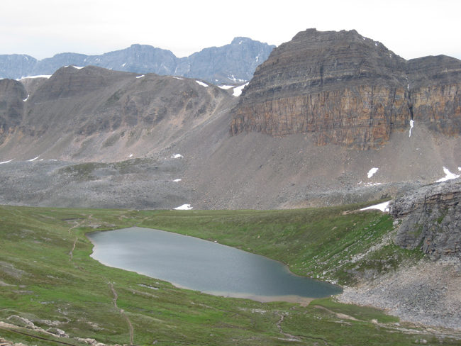
It’s a lovely little tarn. I hiked there last summer with Aaron Barth, to do some GigaPanning of stromatolites. But we’ll save those images for another day. Right now, I want to focus on the geomorphology of this valley.
A wider view of Helen Lake’s setting can be seen in this GigaPan:
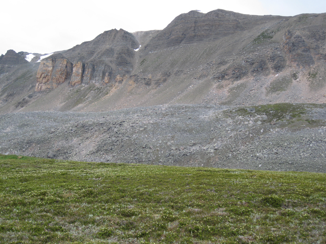
One thing that I hope will catch your eye in that GigaPan is the big pink googly eye on the cliffs at left (south) in the background. This is a rock fall deposit:
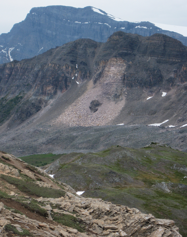
Here’s a GigaPan of the rock fall:
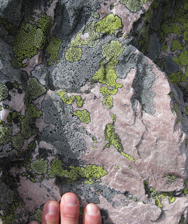
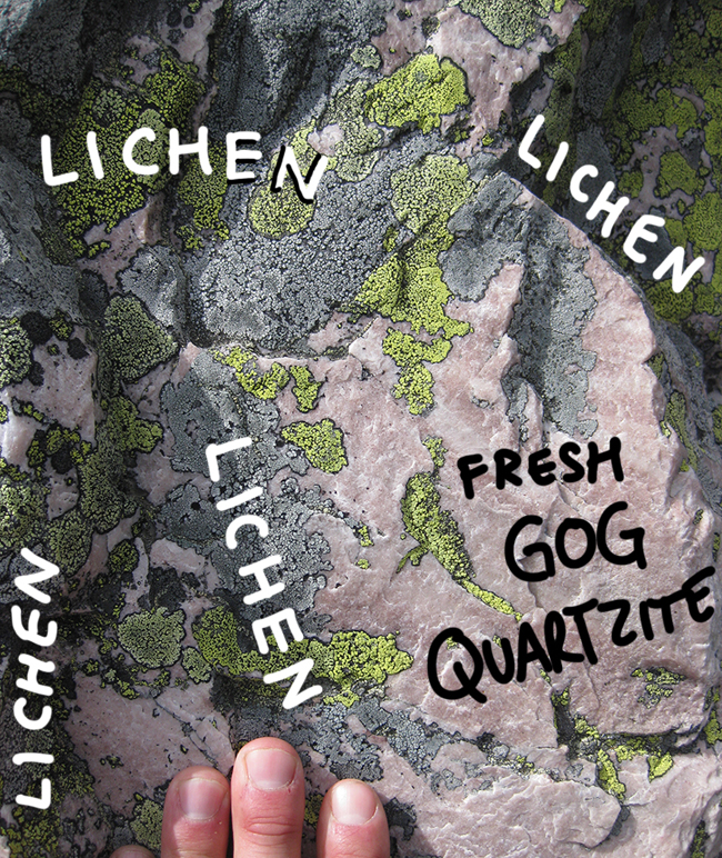
The rockfall shows up so well because fresh Gog quartzite is very light in color: white or pink. But when it’s been exposed for a while, it tends to host lichens, and they come in green and gray varieties, as seen here:
Super; So that’s straightforward and understandable. We can see the source area of the slide on the cliffs above. We can see a little nubbin of the darker underlying sedimentary rock poking through in the middle. Case closed. But what’s this thing in the middle distance??

Wait, Callan. What “thing” are you talking about?
This one:
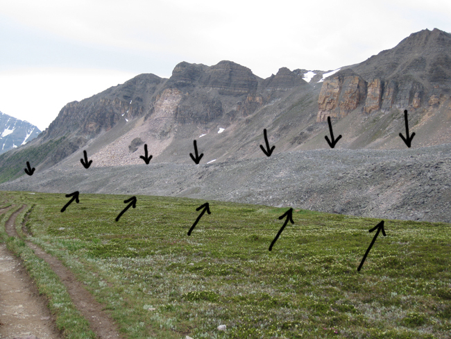
At first glance, you might be tempted to classify this as a lateral moraine, since it’s a linear feature along the side of the valley, made out of bouldery sediment. However, compare it to this example of a lateral moraine, from the Athabasca Glacier:
You can see that till, the poorly sorted sediment that makes up a true lateral moraine, is dominated by lots of finer-grained stuff in addition to the big boulders. The big guys “float” in a finer-grained matrix. With the Helen Lake example, however, it all seems to be big stuff – the character of the sediment looks distinct from the till I would expect a moraine to be constructed from. It looks more like a talus slope, made of bouldery colluvium, except that it’s clearly offset from the base of the cliffs. Maddenigly, like a lateral moraine, it follows the valley upslope…
I’m tempted to call this a protalus rampart. If I understand the term correctly, it implies partial glacier melt-back, followed by an extended period of time when snow and ice remain in the deepest “corner” of the valley. Spalling of rock from the cliffs above triggers rock fall, but the resultant boulders land on the snowy slope, sliding like blocky sleds downhill to pile up at the toe of the snow slope. Later, the snow and ice melt away, removing the “ramp,” and isolating the line of talus from the source cliffs. What do you think? Have I got that right?
…Or is something else going on here?
I might be tempted to call it a rock glacier; perhaps it’s an incipient (if not “actual”) rock glacier, which is probably on an evolutionary spectrum with the “protalus rampart,”a term I’ve never heard, but seems like a reasonable interpretation of this feature. Rock glaciers occur in many places in the northern Rockies, including the southern Kananaskis, around Highwood Pass. They are essentially heaps of scree/talus that have enough interstitial ice “cement” to allow them to flow at some point, like a regular ice glacier.
Interesting about the rock fall: I have an old Kodachrome slide taken from near the spot your second gigapan was taken, and the rock fall wasn’t there–therefore the fall must have occurred more recently than 1982.
Rock glacier, as above, or it could be the geomophic expression of a lateral moraine that is covered with scree. But then I am wondering what geomorphically the grassy area that you are standing on would be. Just a low spur of a hill?
Ok… went back to the beginning to learn what the grassy area is.
I am never bored and often amazed