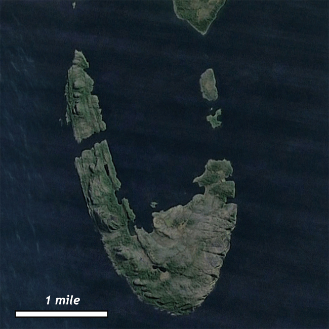
I’m very nearly delinquent on posting the Friday fold… Here you go – a Google Earth view of a differentially-weathered fold partly above and partly below sea level in Chilean Patagonia, south of Puerto Natales:

They call it Isla Escarpada. Awesome.
Here’s a Google Maps link if you want to explore it yourself.
Happy Friday!

Entirely too cool!
The Belcher Islands in Hudson Bay have a similar look.
http://en.wikipedia.org/wiki/Belcher_Islands
Been there, Friday folded that:
https://blogs.agu.org/mountainbeltway/2010/11/19/friday-fold-belcher-islands/
Do you think it would fair to guess this was an anticline since the center appears to have have weathered out first?
Hi Michael,
What evidence are you noticing that suggests the center ‘appears to have weathered out first’?