
My colleague Dan Doctor (USGS) just shared some new LiDAR imagery of my neighborhood. Check it out:
There are some amazing things to be seen in this image.
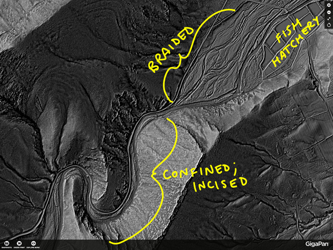
For instance, check out the change in the course of Passage Creek where it exits the Fort Valley – it goes from a deeply incised morphology to a broad, braided plain:
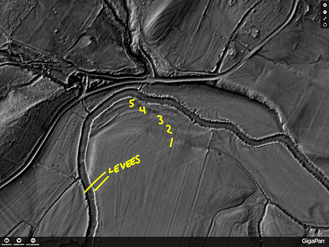
Speaking of the creek, I can make out both natural levees and old river terraces in this area of the image:
It’s really striking how sedimentary strata can be traced out through the forested mountainsides due to slight differential weathering:
And the same differential erosion of the strata of the Massanutten Sandstone exposed at Mudhole Gap reveal the structure of Green Mountain to be an anticline:
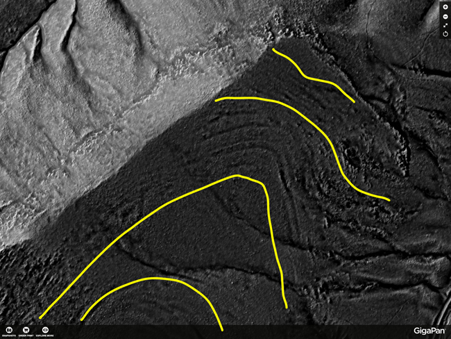
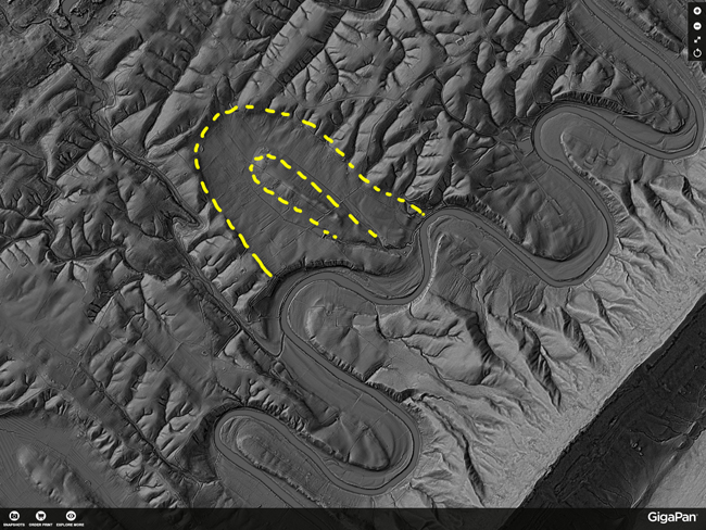
Outside the Fort Valley, the parallelism between ridge-perpendicular fractures and the long “arms” of the meanders of the North Fork of the Shenandoah River show up nicely, and this abandoned meander is exquisitely preserved:
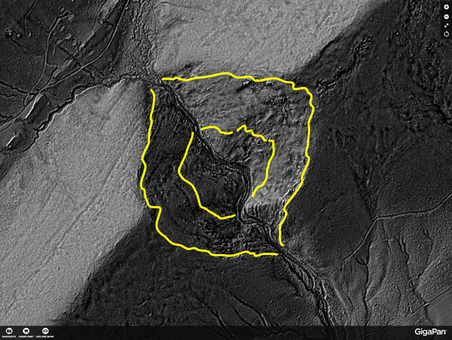
Perhaps most intriguingly, I found an odd set of perfectly flat little circles on the northwest side of the ridge of Massanutten Mountain:
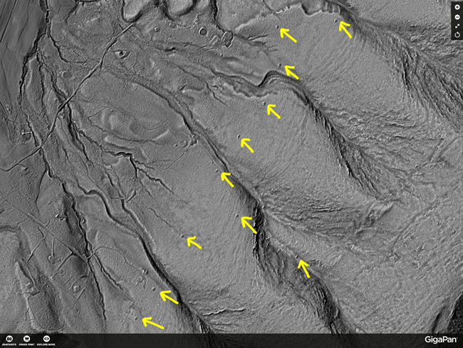
What are these things? They are almost the perfect size for campsites, but they are out in the middle of nowhere in the George Washington National Forest. I’ve visited one of these in person, and am deeply curious at why there are so many, including so many on the same contour. Any ideas?
It’s great fun to explore this image – there’s a wealth to be learned, and probably a lot to be discovered by poking around in it. Let me know if you find anything particularly neat!
I found your post here while visiting the Massanutten Resort last week. I love the information!
As for the circular dots on the last image, I suspect these are charcoal mounds. Perhaps located along fence or property lines? The linear nature is odd, though you can see several others not on that line. Katharine Johnson, a doctoral candidate of William Ouimet at UConn, has been working with LiDAR to classify the charcoal hearths and stone fences in New England. I’ve seen her presentations at several recent conferences, and she has a paper out now, http://www.sciencedirect.com/science/article/pii/S0305440313004342
And a summary of her work in NGS, http://news.nationalgeographic.com/news/2014/01/140103-new-england-archaeology-lidar-science/
Thanks!