
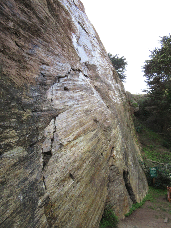
On my final day at the AGU Fall meeting, I made a pilgrimage to a place I’d long wanted to visit: Corona Heights, where there is a subvertical exposure of a fault, bedecked with both fault breccia and the most amazing set of slickensides I’ve ever seen. I was able to find it easily thanks to the awesome map that Christie Rowe made for AGU visitors to get a taste of local geology.
From the plunging orientation of these lines, raking across the subplanar fault surface, we can deduce the kinematics (motion) of the fault. In this case, it’s an extraordinary example of an oblique slip fault, cutting cherts of the Franciscan complex.
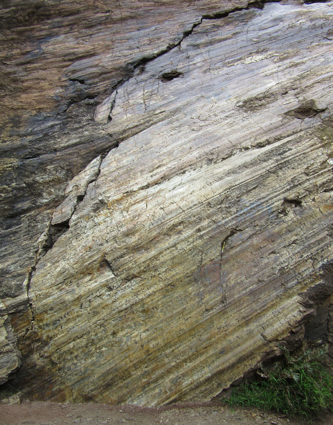
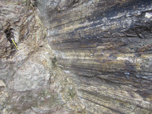
“Slickensides” is a general term for linear features on a fault surface. The lines may be grooves that result from gouging, in which case we can call them slickenlines, or they may be mineral crystals that grow in small extensional spaces along the fault surface, in which case we might refer to crystal fiber lineations. At Corona Heights, it’s slickenlines, and they are profoundly well developed, well exposed, and well preserved.
They are also coated in many places with a silica gel, making the fault mirror-like in its reflectivity when viewed from certain angles. Here is the perspective looking up the cliff at the same spot as the previous photo, showing the reflectivity of the fault surface:
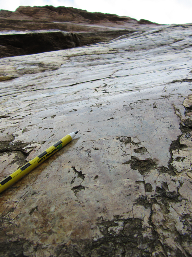
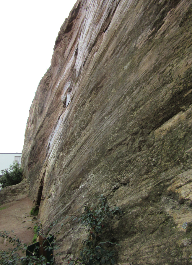
The exposure is steep (note the rowhouse roof line in the background as a horizontal reference):
Swiveling our perspective to the right, here is an animated GIF to show the shiny surface of the fault:
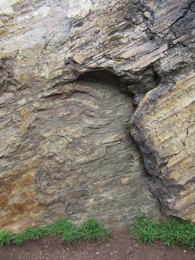
At one place, the fault surface (and its slickensides) have broken off, revealing a look deeper into the footwall. There, you can see a fold in the chert layers:
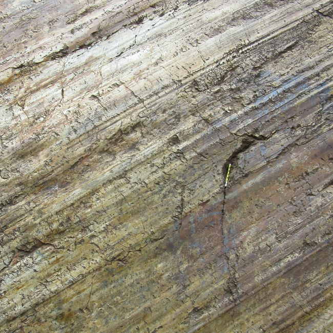
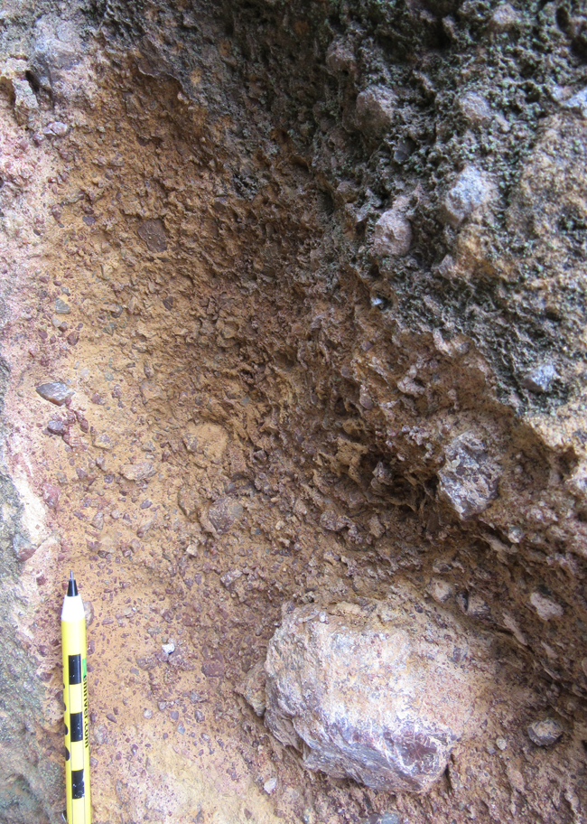
Here, the slicks plunge into the ground, neighbored by a zone of fault breccia, upon which the pencil lies:
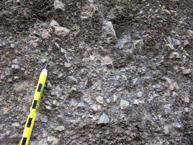
Close-ups of the breccia:
I brought the GigaPan:
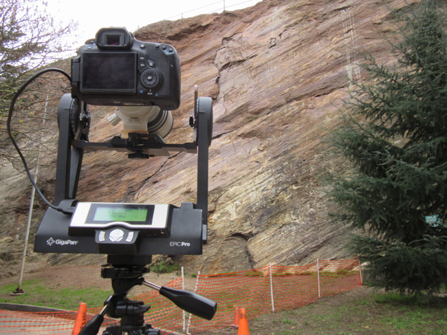
Here are the resulting explorable GigaPan images, the result of about two hours spend on-site. Can you find the scale pencil? Can you find exposures of breccia? Enjoy exploring them for fun details.
Link Image by Callan Bentley
Link Image by Callan Bentley
Link Image by Callan Bentley
This is a world-class site. If you have any interest in faults, it should be your top stop when next in San Francisco.
I think the term “slickensides” means the “polished fault surface,” which may or may not feature striations, fibers, and other structures resulting from slip. In any case, nice photos! I’ve never visited what is now a classic locality. Definitely on my next visit to SF.
Nice description. What’s the genesis?
Update:
Here’s a macro GigaPan of the breccia (4 samples of 2 colors):
http://gigapan.com/gigapans/185868
Hi Callan,
I was fortunate enough to visit the site last week, and it is the best example of fault slickensides I have seen. Apparently the missing half was cut away to exploit the some chert for rough bricks, so I guess the exposure is not 100% ‘natural’.
As you say, assuming there has been no post fault rotation, this is clearly an oblique slip fault, and its azimuth is somewhere WNW ESE.
Was the fault already there before the famous dextral San Andreas strike slip system commenced? Or is it a transpressive San Andreas riedel feature?
I see that a chap called Jamie Kirkpatrick has taken Lidar image data and is studying the fault – are you familiar with his work?.
I also saw some slickensides on some fallen block at the top of Corona Heights.
Best regards,
Jonathan Brown (Geoscientist).