
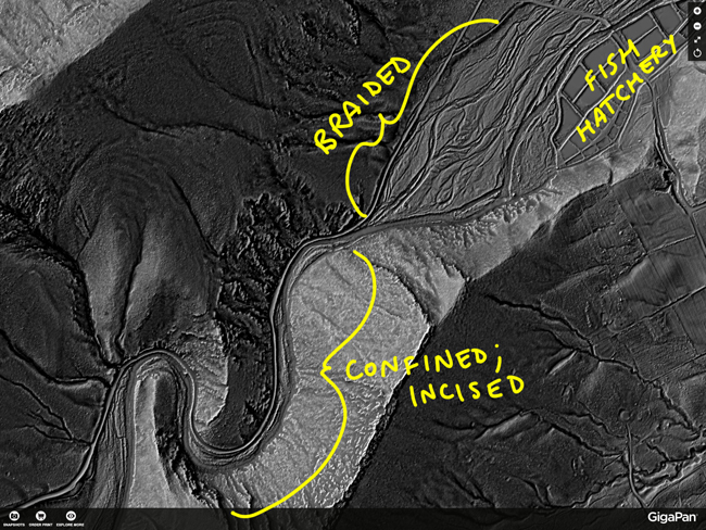
A couple of weeks ago, before a series of snowfalsl altered my daily work routine in a destabilizing way, I took a walk through the braided floodplain / gravel fan of Passage Creek, where it exits the Massanutten Mountain system near the state fish hatchery. There, no longer restrained by the steep walls of quartzite, the creek’s water can expand during flood times over a broad forested plain of channel bars. The change is geomorphology is astonishing when viewed through the lens of LiDAR:
Here’s a sight I saw as I traversed this braided area from the road to the main channel of the creek:
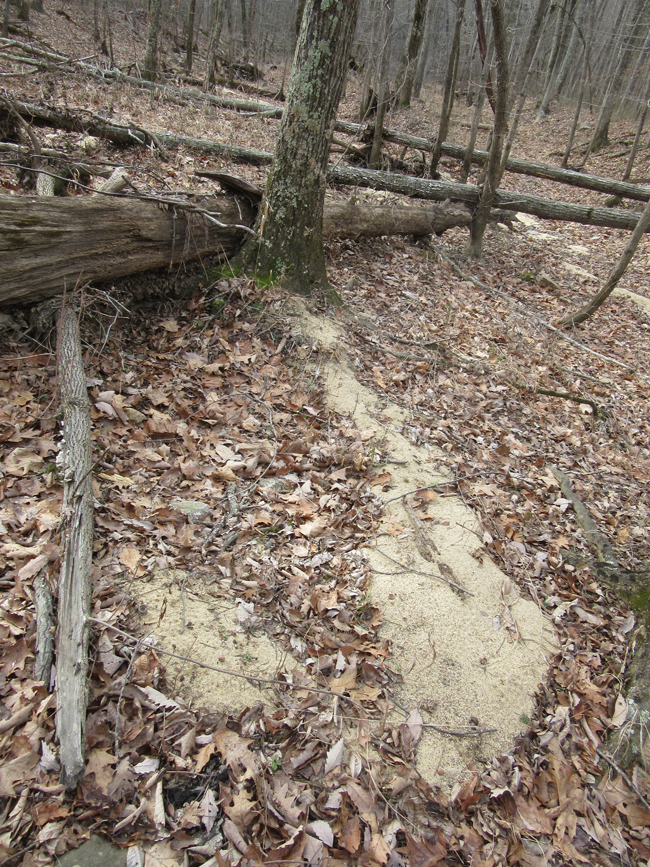
Emerging from the base of that tree, and pointing downstream, there is a fresh deposit of sand atop the dead leaves. During the last big flood, this area was underwater, and that water was moving. The moving water transported sand, doubtless as saltating bedload. The tree trunk acted as an obstacle to that flow, and an eddy formed downstream, where the current strength would have been diminished. Sand grains entering this small ‘doldrum’ found that they couldn’t escape again. The water energy was too low in that zone to keep the sand grains moving, so they piled up, marking the zone where the current strength dropped below that critical threshold. If I stood upstream of the tree with a flashlight, I could make a shadow in roughly the same shape as this sand deposit.
It’s a sand shadow!
I remember that lidar image, I spent a lot of time looking at it. It was full of amazing details.
I have wonder about the explanation for the sand deposit though. Notice we don’t see similar bars downstream of other trees. Why just there? What is unique about that spot?
My guess is that the fallen tree just upstream behind the tree and the fallen sapling parallel to the bar are the keys. I think that created a back-eddy zone of swirling water with a scour area directly in front of the fallen tree. The exit channel was directly between the bars, and the bars formed in a low flow zone on either side of the exit path.
BTW, thank you for the original lidar image. I had a good time examining that in detail.
I did see a few others, but this was the most exemplary. You can see another in the distance.
Thanks for your input – yeah; the fallen tree just upstream is likely part of the story, for sure.