On Friday, I participated in a field review for a new geologic map of the Timberville quadrangle in western Virginia’s Valley & Ridge province. The field trip leaders were the two lead mappers, Matt Heller (Virginia Department of Geology and Mineral Resources) and Randy Orndorff (United States Geological Survey). I brought along my new Ricoh Theta 360° camera, and made these images of three scenes during the day’s geologizing. Each image can (and should!) be explored through turning left or right, up or down, zooming in or out. Enjoy!
Randy Orndorff (USGS) explains his multi-horse model for the North Mountain Fault (juxtaposing 2 synclinoria):
Randy Orndorff (USGS) explains his multi-horse model for the North Mountain Fault (juxtaposing 2 synclinoria) – Spherical Image – RICOH THETA
Fault surface, differentially weathered to appear scarp-like, placing Cambrian carbonate over Ordovician shales:
Fault scarp (Cambrian limestones over Ordovician shales, probably), Timberville quad, VA. – Spherical Image – RICOH THETA
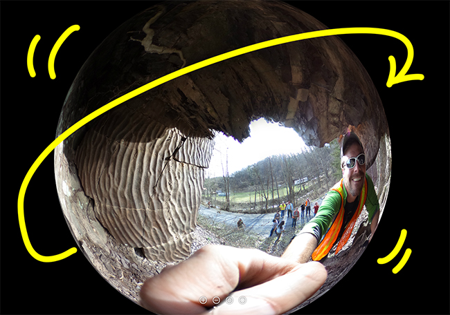
Ripple marks preserved on vertical strata of the Devonian Foreknobs or Hampshire Formation (gradational contact; not sure which it is):
Ripple marks preserved on vertical strata of the Devonian Foreknobs or Hampshire Formation, Timberville quadrangle, Virginia. – Spherical Image – RICOH THETA

