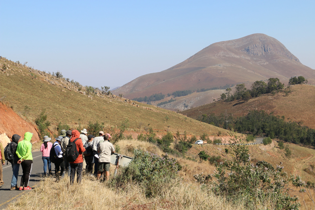
Here’s a scene from the pre-IGC field trip I participated in, a week-long examination of the Barberton Greenstone Belt:

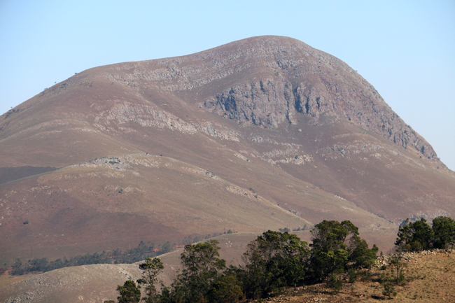
Look at the mountain over to the right. It’s “looking” back at you!

This is Sibubule, 1765m in elevation, as viewed from the R40 in Barberton Mountain Land, not far from the border with Swaziland.
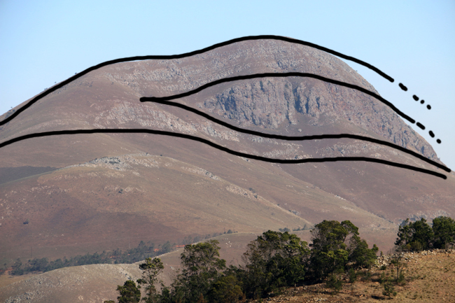
It shows a more or less recumbent fold, like a taco lying on its side. The perspective of the photo is looking ~south at the ~eastern face of the mountain.
Here it is in Google Maps view:
Our field trip leader, Christoph Heubeck, furnished me with this information:
The mountain is incompletely mapped (that is, we only walked up to the base of the northern cliff and lateral equivalents) but there is a hinge at 25°57’9.10″S 31° 5’46.14″E well visible on Google Earth (best when viewed towards the south), and we have been there. I think the other hinge of the “eye” is at 25°57’35.84″S 31° 5’23.85″E but we have never climbed up there, either. Mapping the mountain would be beautiful and not difficult – alas, so little time…
The fold axial plane is moderately south-dipping. The big south-dipping slope of Sibubule appears [to be] a dip slope in overturned cherts of the uppermost Onverwacht (Mendon Formation).
These cherts bound a thick package of banded iron formation (BIF) of the Mapepe Formation (lower Fig Tree Group) in the middle. As a result, Chrisoph says,
“It’s a blood-shot eye!”

