Link GigaPan by Callan Bentley
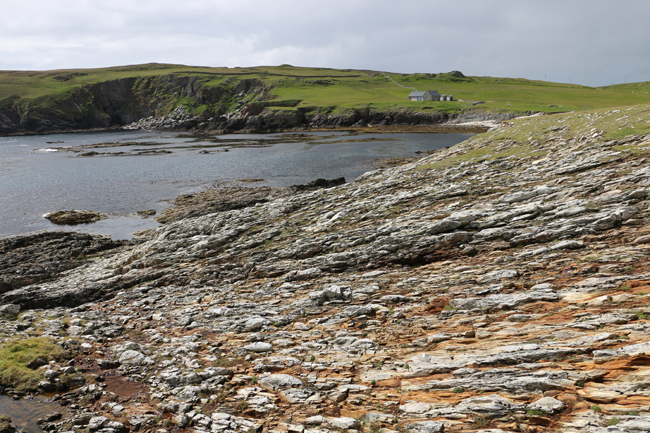
… That’s the Bay of Funzie on the east side of the island of Fetlar, in northern Shetland. You may be struck by the beautiful scene, but what catches my eye are the rocks in the foreground. That is a stretched-pebble metaconglomerate. Originally a conglomerate, its pebbles and cobbles were smeared out by ductile deformation, changing their shape. This bay is the first place that the Flinn diagram was ever used.
I made a structural geology pilgrimage there in July. Driving in with my guide, Allen Fraser of Shetland GeoTours, we passed this informational rock wall showing an artistic rendering of the island’s geology:
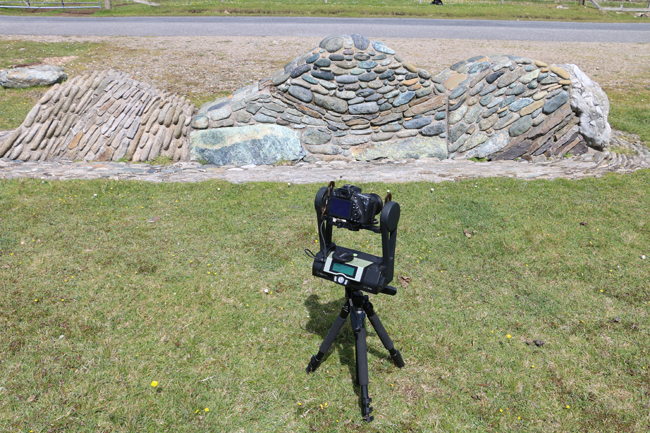
Here it is in GigaPan form. The light colored blob on the right is the Funzie metaconglomerate.
Link GigaPan by Callan Bentley
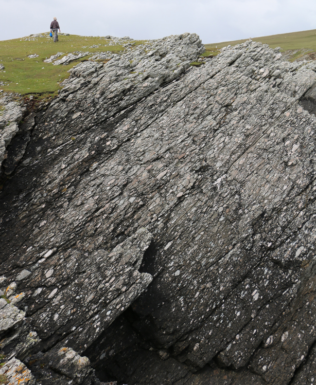
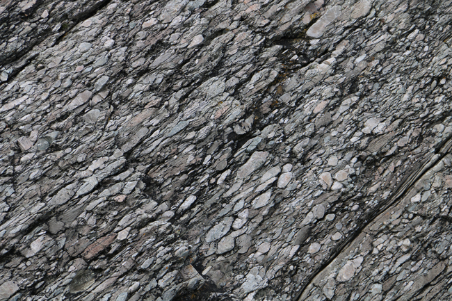
The conglomerate itself looks like this:
Link GigaPan by Callan Bentley
How best to quantitatively describe the “fabric” of this body of rock?
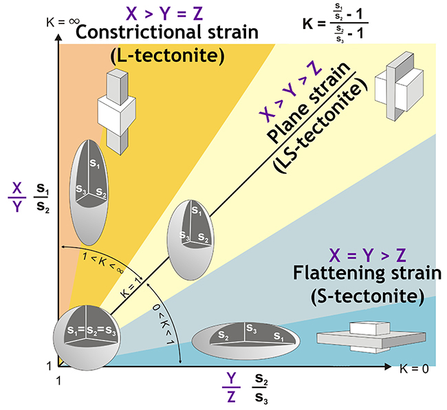
This was the problem Derek Flinn (University of Liverpool) faced when he was figuring out the geology of Shetland. In 1962, he published the first rendition of an elegant diagram that allowed a quantitatively-based visual display of the shape of the strain ellipsoid. Here’s a version of it:
That image was modified (by me) from an original (in Hungarian) on this page by Konrád Gyula of the University of Pécs in Hungary.
The key thing to note is that the shape of a deformed object of known (or assumed) original dimensions can be quantified in terms of the lengths of three mutually-perpendicular axes, X (the longest), Y (intermediate), and Z (the shortest). The hemi-axes in these orientations are respectively designated S1, S2, and S3. (So S1 = ½X, etc.)
If X and Y are about equal to one another, but are larger than Z, then you have a shape like a pancake, an example of ‘flattening strain.’ Rocks with a fabric defined by lots of these “oblate” strain ellipsoids are called S-tectonites. Think of a messy pile of papers lying more or less parallel to one another on a desk top.
If X is far and away much longer than Y and Z, which are more or less equal to each other, then you have a shape like a cigar, an example of ‘constrictional strain.’ Rocks with a fabric defined by lots of these “prolate” strain ellipsoids are called L-tectonites. Think of a handful of pencils clutched in fist.
Assuming all the values of X, Y, and Z start off as “1,” the situation where X is greater than Y, which shows no strain, which is greater than Z, is ‘plane strain.’ All the strain has taken place within a single plane. As Z is shortened, X grows, but Y doesn’t change. That’s the situation along the 45° line running up the middle of the Flinn diagram. Think of a school of fish swimming in the same direction.
The Flinn diagram is well-nigh ubiquitous as a clean, easy way of stating the strain state of a body of rock with good strain markers. I used it in my thesis, for instance, on deformed ignimbrites in the Sierra Nevada Shear Zone system. But Funzie (prounced “Finney”) Bay is where it was first developed. Feast your eyes on its rocks:
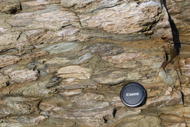
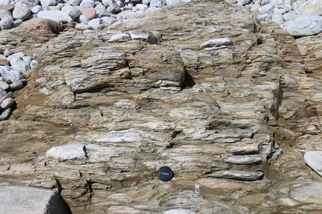
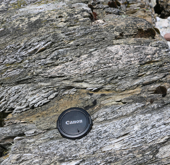
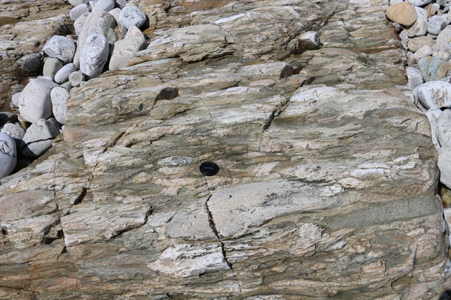
It was a treat to go to a place like this, see these inspirational rocks. For me, it was like a scholar of American history might feel on walking into Independence Hall in Philadelphia for the first time.
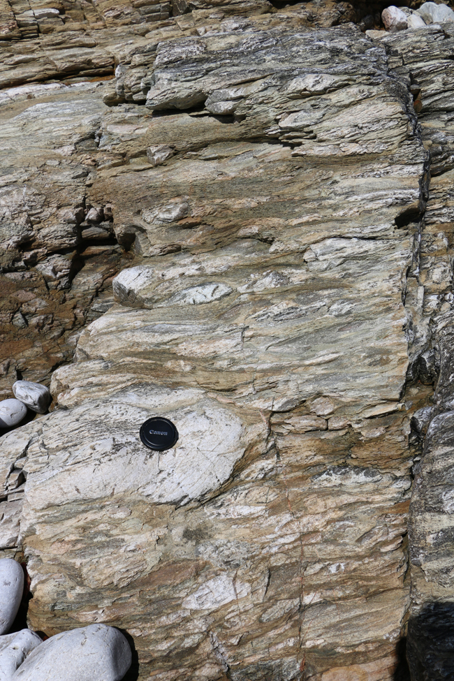
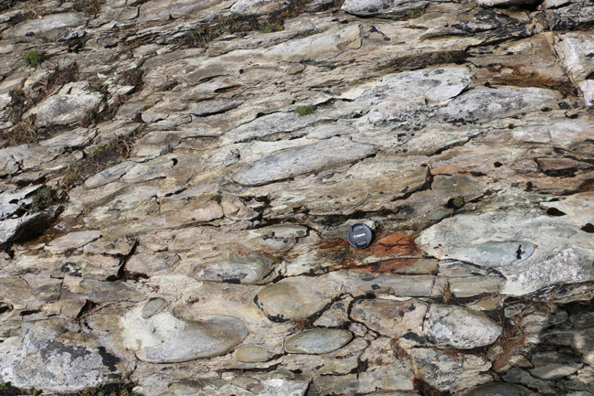
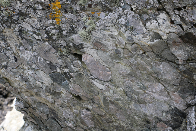
Link GigaPan by Callan Bentley
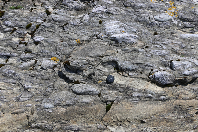
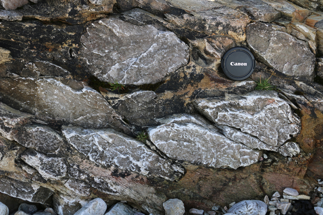
Certain outcrops really showed the role of pressure solution in attaining this shape:
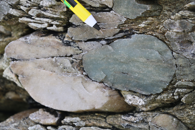
(See how the grain boundary of the greenish clast totally gets into the personal space of the larger white clast?)
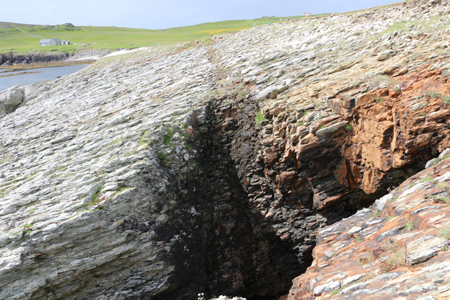
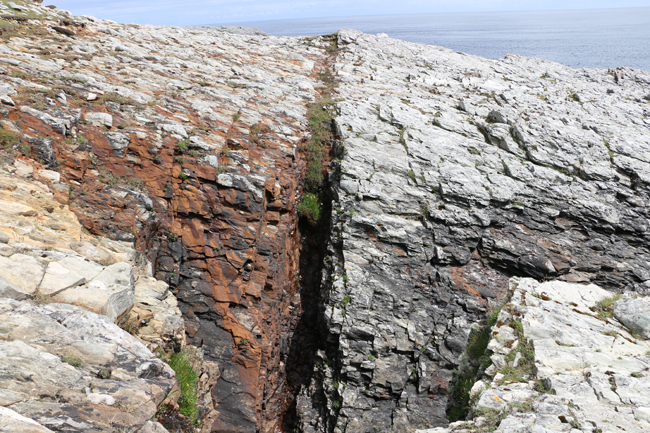
Bonus: a small fault, looking alogn strike to the east and then to the west:
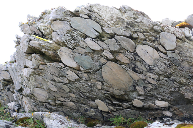
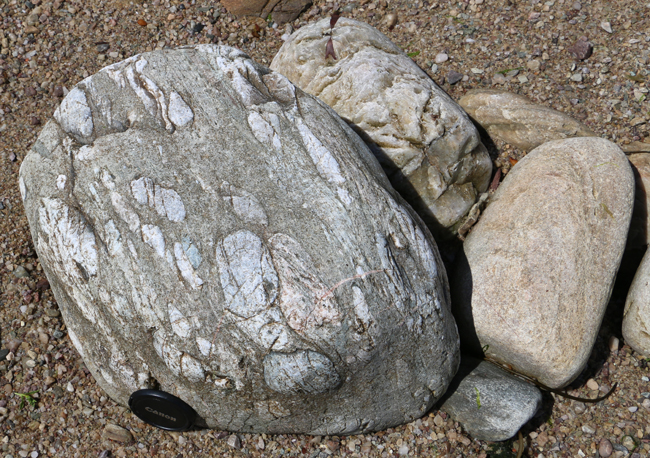
I call this next one, “Cobble of cobbles, with cobbles” :
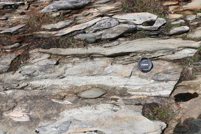
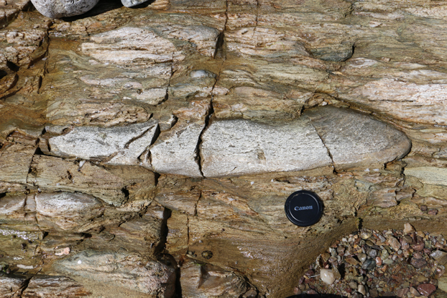
Long ones:
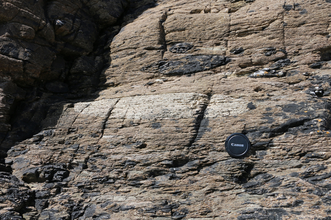
Now for a trio of GigaPans of the same outcrop imaging three mutually-perpendicular perspectives on the rock fabric: the XZ plane, the XY plane, and the YZ plane:
XZ:
LinkGigaPan by Callan Bentley
XY:
Link GigaPan by Callan Bentley
YZ:
Link GigaPan by Callan Bentley
This beautiful metaconglomerate spurred the development of the Flinn diagram. I’m glad I got to visit it in person.

Hi there! Can I ask what is the unit scale of the measuring pole you used to scale the outcrop showing pressure solution?
It’s a pencil with cm markings on the side.