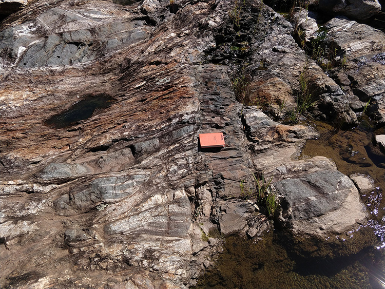
Scott White (@SeafloorScott) of the University of South Carolina pitched in with today’s Friday fold:
 Click to enlarge
This shows a section of high grade gneiss in the spillway of the Saluda Dam in Columbia, South Carolina.
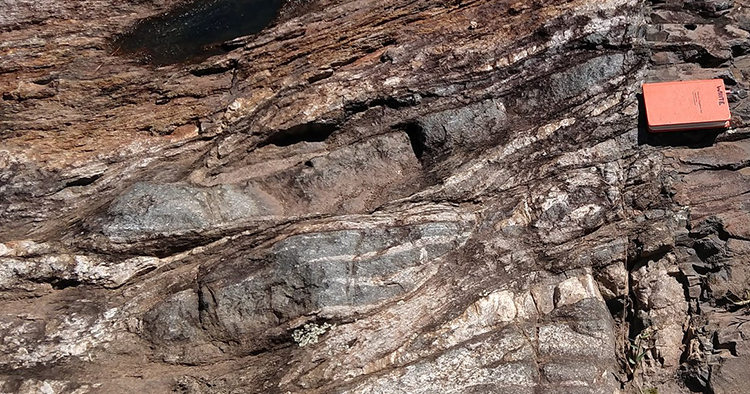
Zooming in there, you can see a nice fold hinge on the left edge:

Although I don’t know the precise location of this outcrop, I did a bit of internet sleuthing… According to the interactive geologic map of South Carolina, these rocks appear to be gneisses in the Modoc fault zone: “A distinctive suite of mostly mylonitic rock with numerous mesoscopic to map-scale orthogneiss sheets oriented approximately parallel to the boundaries of the zone, upper amphibolite facies rocks.”
Thanks for sharing, Scott!
I hope everyone has a safe and rejuvenative weekend ahead. My thoughts this weekend are with all those geoscientists furloughed by the federal government over the budget impasse and are going on a month without work. They deserve better.

Hear, hear. I’m constantly amazed at the amount of high-quality, useful, accessible information that’s in the public domain thanks to the hard-working folks at NWS/NOAA, USGS, NASA, the Census Bureau, etc.