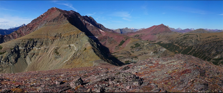
Working on a virtual field experience for Glacier National Park this weekend, I came across this amazing GigaPan of a portion of central Glacier by Joe Giersch of the USGS:
What really struck me about it is that big arc of white rock (quartzite, no doubt) within the lower green argillites of the Appekunny Formation… Just left of center. Zoom in and see if you can find it!
I saw that and thought, “Ooh! A fold!” But then I thought that perhaps it was just a trick of the outcrop: i.e. a curved landscape intersection a planar bed, as in the false syncline I noted in Titus Canyon. To corroborate, I looked to adjoining ridges. And…sure enough, it can also be seen in the next ridge over to the right, highlighted by vegetation.
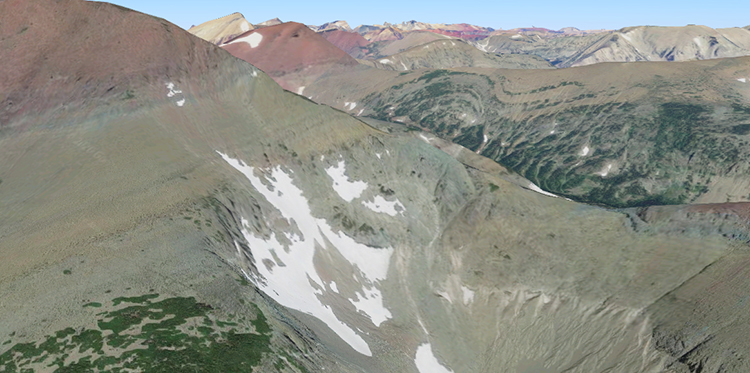
I found the place in Google Maps, and shifted the perspective so I was looking along strike of the anticline’s axis:

Because the fold trends north-northwest, and the valleys run east-west, you can see it appearing in cross section on at least three ridges there! Here’s a link on Google Maps to get this same view, should you care to poke around there yourself.
Sure enough, on the Whipple (1992) geologic map of the park, there’s an anticline mapped at that location:
A little virtual geological discovery for me… What an amazing place; I miss it pangfully.


‘Whipple, J.W., 1992’,is he a descendant of geographer Whipple that mapped parts of Arizona in 1850-60’s, and for whom the Whipple detachment fault in southwest Arizona is named, (between Lake Havasu City and Parker, AZ)?
I couldn’t tell you!