I have moved from the Fort Valley to Charlottesville, Virginia, where next month I’ll take up a new position teaching geology at Piedmont Virginia Community College. I’m excited to be in a more progressive community with excellent food and music, and a wealth of new outdoor recreational opportunities – not to mention higher-performing public schools for my son.
But what about the rocks? I don’t know the rocks around here yet!
This is the first post of what I hope will be many, as I explore my new home region and learn about its diverse geology. Charlottesville sits at the interface between the Blue Ridge and Piedmont geologic provinces, with Triassic rift basins located a short distance along strike to both the northeast and southwest. Surely there will be lots to see and learn! Where to begin, though….?
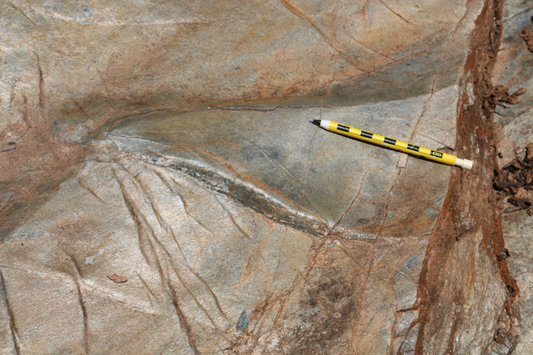
I’m fortunate to have several friends in town, and this past week, one of them showed me a cool outcrop of phyllite. At the spillway for a dammed reservoir on Totier Creek, north of the James River near Scottsville, the outcrop is much cleaner and less vegetated than many central Virginia sites. It pleases me to find clean rocks outside!
Here’s the site in Google Maps.
Because of being periodically scoured by overflow from the reservoir, the outcrop here is pretty clean, with sparkling silver outcrop where the water is rushing over it…
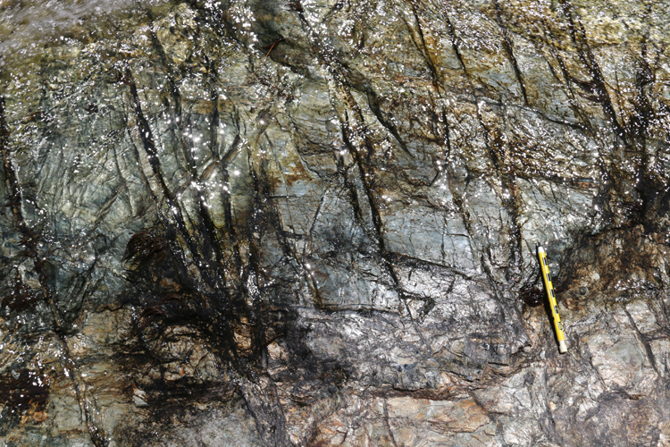
…and nearby dry locations shining with a muscovite gleam:
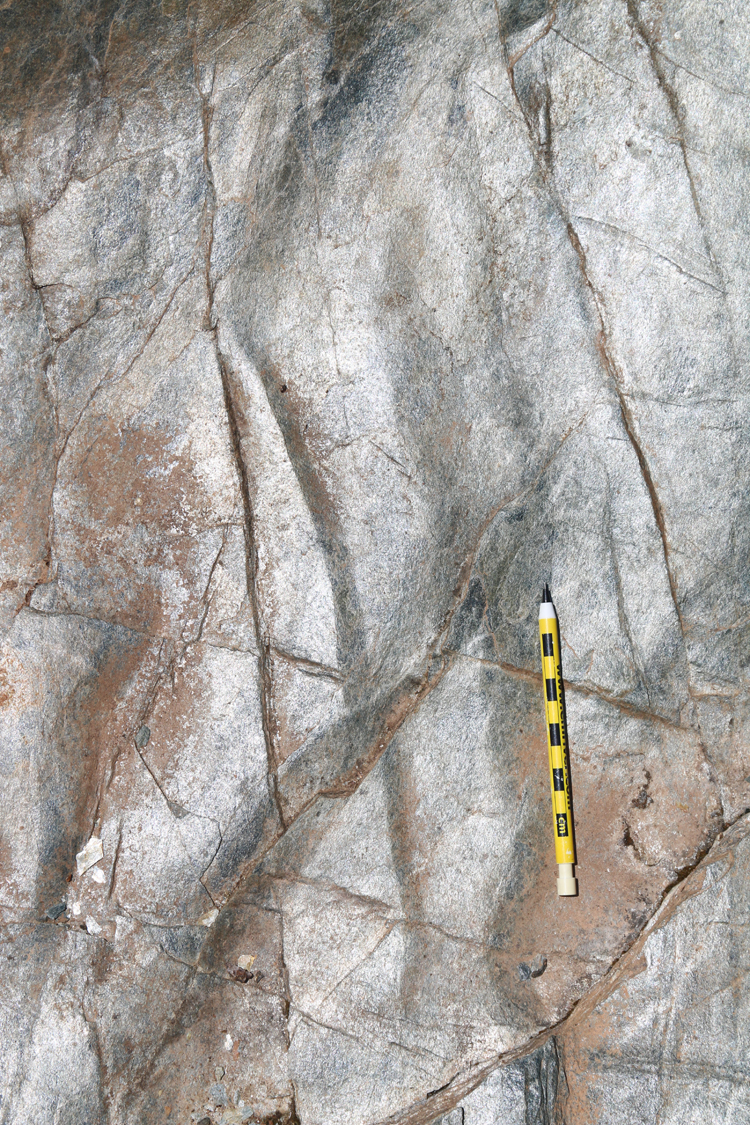
…but the same rocks show a rusty patina at less frequently scoured locations…
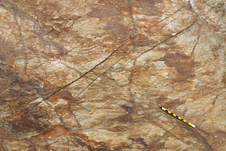
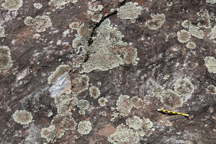
… and lichen encrustation at the most infrequently-scrubbed sites:
And the foliation is folded in a bunch of different styles – open, undulating folds, tight kinks, and combinations thereupon:
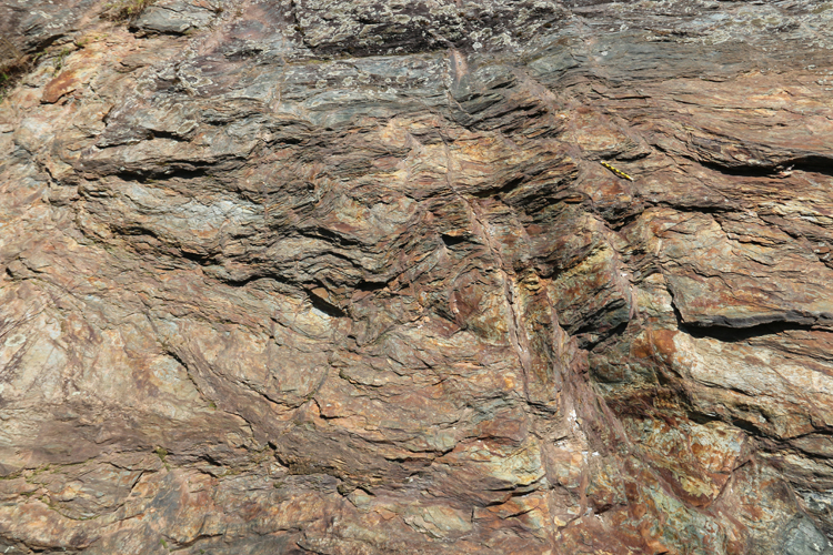
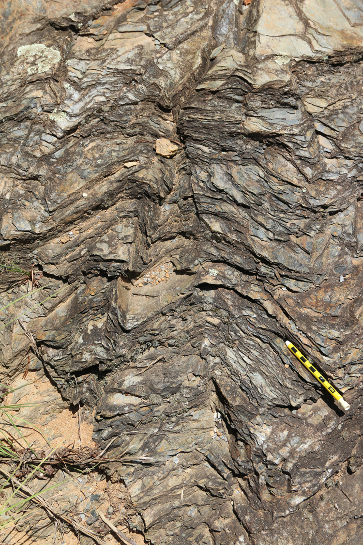
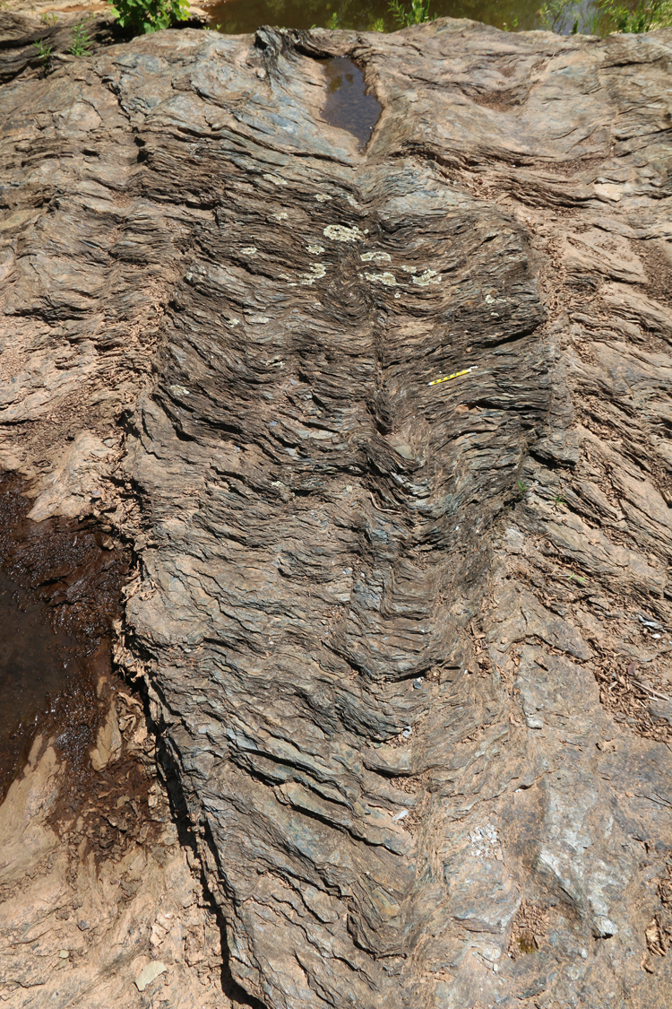
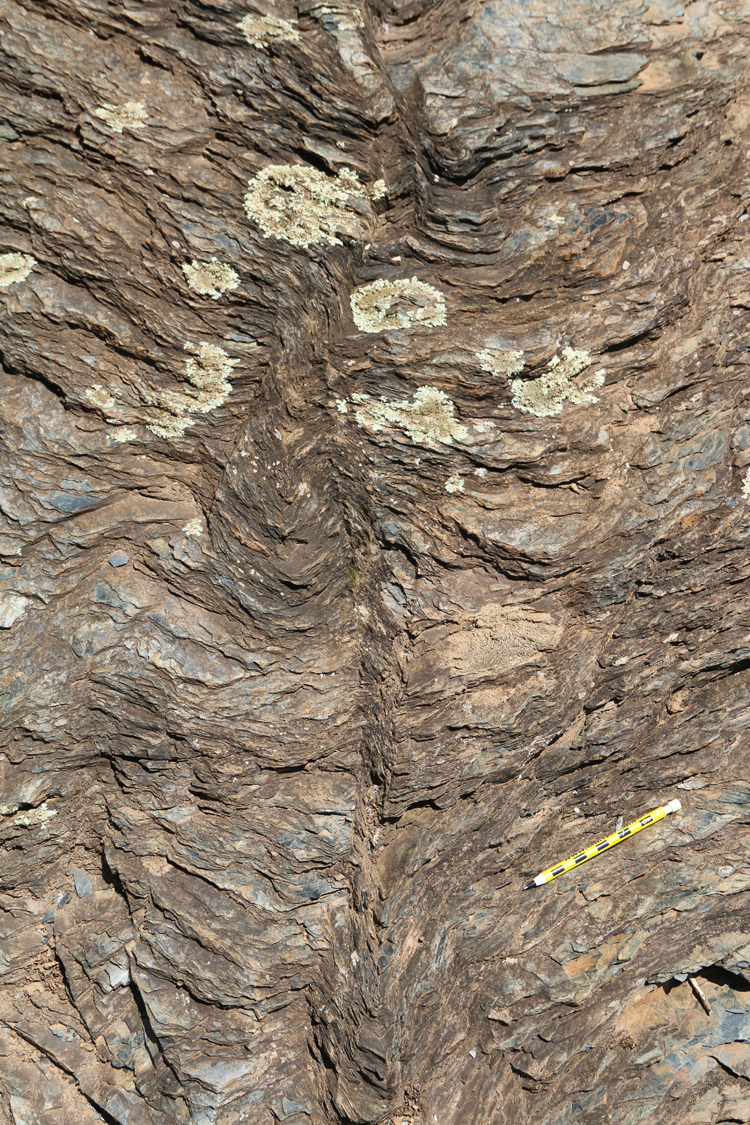
Depending on the map you consult and how willing you are to extrapolate along strike, this site is mapped as “ꞒZpm- metagraywacke, quartzose schist and melange,” “ꞒZmg – metagraywacke,” or Pzc – Candler Formation – muscovite-chlorite-quartz-paragonite phyllite and schist, metagraywacke.” I found my visit there to be intellectually stimulating, despite oppressively brutal heat. But these were new rocks, and visiting the Totier Creek spillway was the first step toward a new appreciation of a new regional geology.
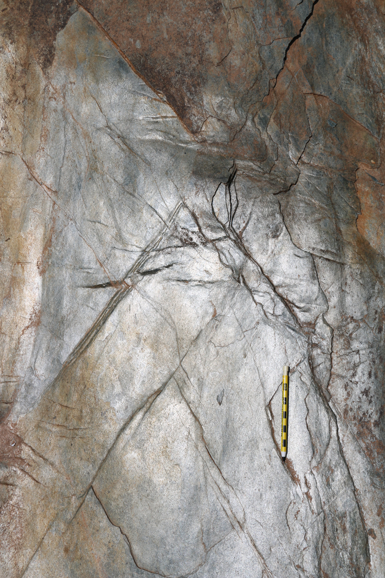
All told, there was a good amount to see, and I can envision some fun student projects to be conducted at the site: for instance, “Does the orientation of the maximum principal stress implied by the veins match that implied by the kink fold axes? If not, which one came first?” Or using the weathering levels to map out scouring histories of different parts of the outcrop; perhaps augmented by some lichenometry?
It’s exciting to think about the possibilities… hopefully our nation will be able to get this pandemic situation under control so that someday I can actually plan for field trips with students again.

Welcome to Charlottesville! I hope you enjoy it here. If you haven’t been, you should pay a visit to the office of the Division of Mineral Resources in the Fontaine Research Park. Outside their office they have an outdoor educational rock and mineral garden featuring 50 cool Virginia rocks.
Thanks! Yes, I’m well aware of their lovely rock garden. Great collection, and very well displayed!
Good luck on your new position and thanks for posting photos and narrative, a fellow geologist – Chuck
Thank you.
Of course I’ve read “damned reservoir” and had no idea why it was damned. 😀
Good luck!
“Damn you, Totier Creek! Damn you straight to the bedrock!”
PVCC has a nice small rock garden of greenstone out front along with an informational sign. My young girls like to visit it. It would be lovely if the sign was restored and the garden expanded.