I’ve been helping a student of mine work on a mapping project these past few weeks, documenting the geology in Pleasant Grove Park in Fluvanna County. That’s in Virginia’s Piedmont geologic province, a land of rolling hills where we find the remains of the Iapetus Ocean basin, thence squashed and cooked at the roots of the young Appalachian Mountains. Pleasant Grove Park is an interesting place with lots of trails which supposedly hosts a contact between Laurentian-affinity and peri-Gondwanan terranes. Exposure isn’t all we could hope for, but there are some neat outcrops for sure.
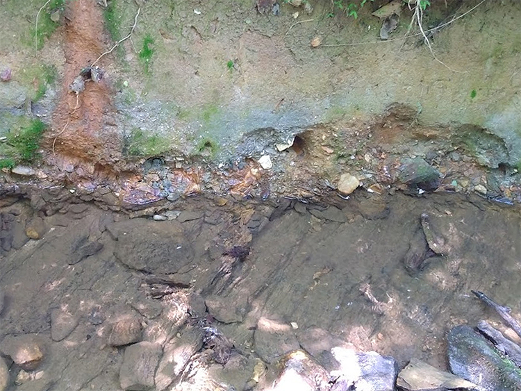
Here’s one outcrop that I thought to be fairly impressive when I first walked up to it several weeks ago:

To my eye as a geologist of some vintage and experience, it was plain that I was looking at an unconformity surface exposed in this creek’s cut bank. But I soon realized that not everyone could make that out so plainly. I took the photo above and then posted it to the PVCC Geology Club’s Discord server, where I post daily challenges for my students. My expectation was that someone would be very quick to key into the difference between the exposures in the stream floor and those of the cut bank above, marked by a layer of gravel along the contact.
But that didn’t happen. There was an excruciating series of guesses and frustration as I said “nope” over and over. The students got the cut bank part, but they didn’t get that it was an unconformity until I drew in some lines annotating the photo.
I realized that I hadn’t set them up for success, because I took a pretty crummy photo of the outcrop.
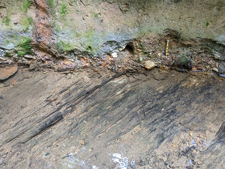
Yesterday, back in the park, I resolved to do better. This time, before I took the photograph, I (a) positioned a sense of scale, (b) cleaned the bedload cobbles off the stream floor and swished away much of the sand and mud covering the trace of the metamorphic foliation, (c) removed stray vines and other vegetation from the outcrop, and (d) waited for diffuse light, eliminating the inconsistent exposure that comes from the dappled sunlight making its way through holes in the forest canopy. I also (e) changed the angle of capture to more fully capture the “pavement” exposure in the creek bed, with its prominent “diagonal” pattern of the trace of foliation.
This is the result:

A side-by-side comparison:


I think the key relationship is much plainer in the new image.
So much for my little discourse on outcrop portraiture!
