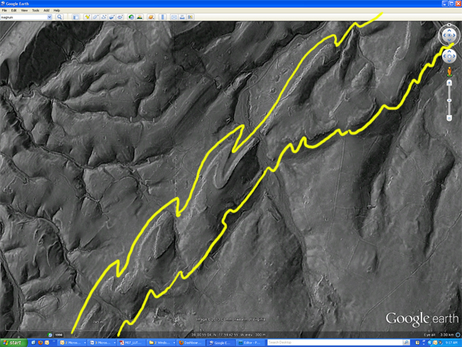
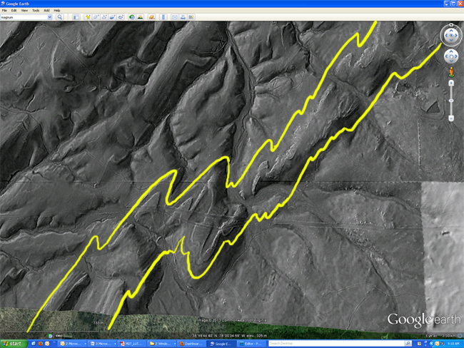
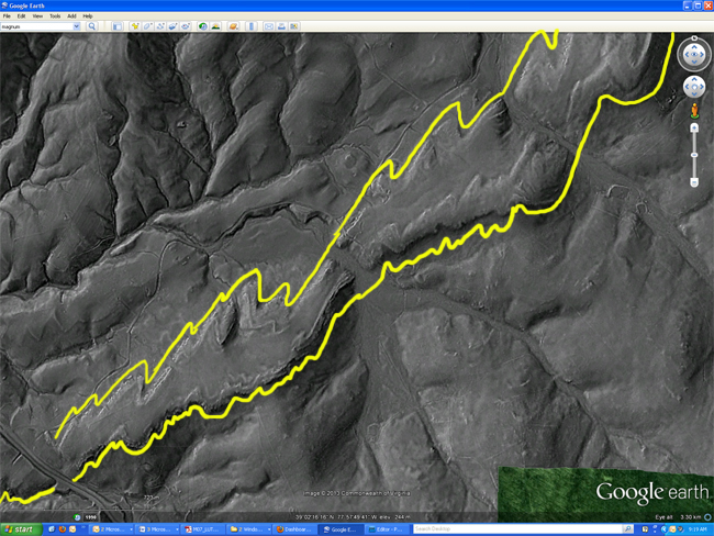
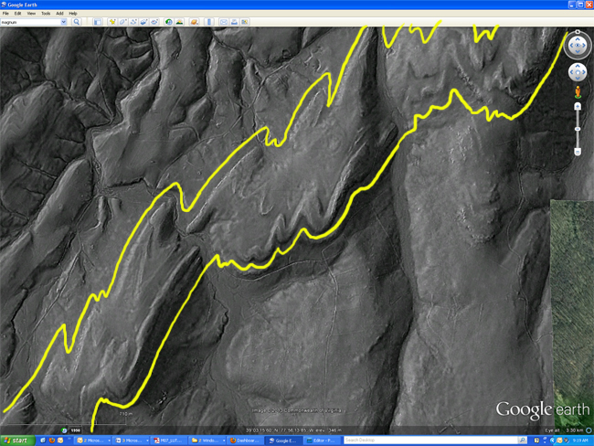
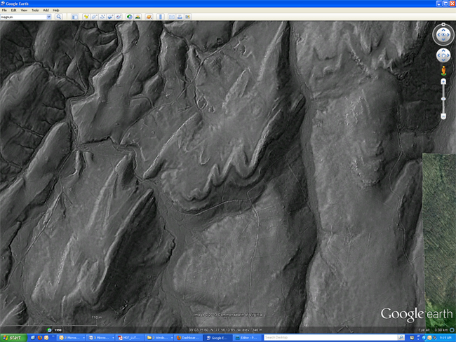
Dan Doctor of the US Geological Survey contributed this week’s Friday fold. It’s a lovely view of the asymmetric folds in the Cambrian-aged Weverton Formation (part of the Chilhowee Group, a Sauk-Sea passive margin transgressive sequence), exposed on the western flank of the western limb of the Blue Ridge Anticlinorium.
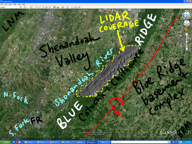
It’s a LIDAR image, and it’s best viewed when draped over the scenery in a Google Earth view. Here’s a KMZ file so you can experience it for yourself. On my annotated view above, FR = Front Royal (the town at the confluence of the North Fork and South Fork of the Shenandoah River), BRM = Bull Run Mountains (far southeast), and LNM = Little North Mountain (far northwest).
If you’re not familiar with LIDAR, it’s pretty incredible. A super high resolution digital elevation model (DEM) results with obscuring effects like trees removed. All the rage because of the much smaller scale features it allows us to resolve. And it’s gathered with lasers on airplanes – sheer awesomeness!
Here’s a GigaPan version, so you can explore it right here in the context of this blog post. Go ahead and zoom in, and then scroll along strike. Amazing!
And another version, with the 1974 Geologic Map of the Ashby Gap quadrangle (Gathright & Nystrom) overlaid on the central portion of the LIDAR:
I’ve taken a few screenshots (of the LIDAR DEM alone, sans geologic map overlay), and you can look at them here if for some reason you can’t open Google Earth right now, and/or you’re viewing this on a non-Flash compatible device:
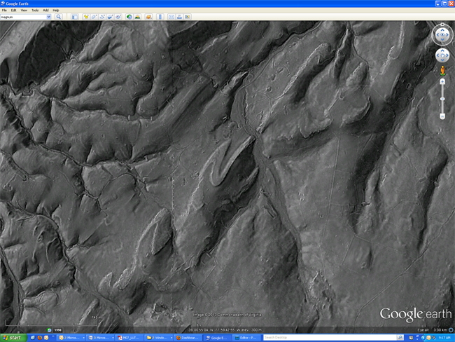
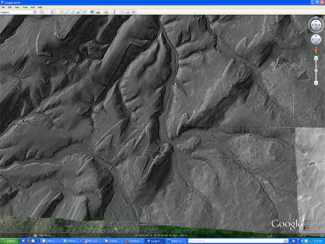
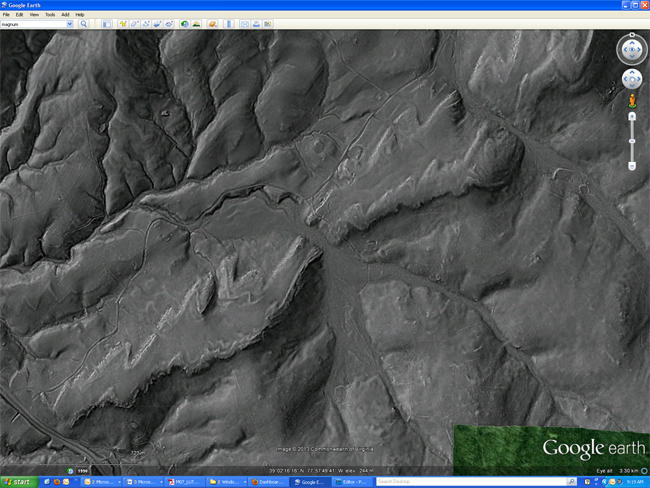
Bedding traces highlighted in yellow in the next 4 versions:
Happy Friday!

lots of fun lidar data to be had here: http://www.opentopography.org/
Wow. Nice blogpost, especially the interactive LiDAR generated hillshade maps. It’s amazing how human and geological/geomorphological features can be differentiated so easily in these maps.