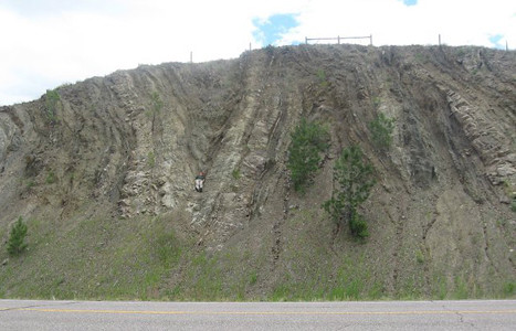
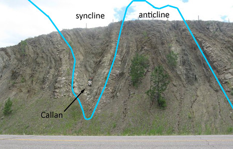
This fold is located on Highway 287, north of Wolf Creek, Montana.
As with last week’s Friday Fold, this fold owes its existence to (a) deposition of sandstone and shale in the Western Interior Seaway, and (b) deformation under a giant thrust sheet during the thin-skinned compressional tectonics of the Sevier Orogeny.
In this case, we’re south of the Lewis Thrust, and the local equivalent is called the Dorado Thrust. It’s basically the same exact thing you find up north in Glacier National Park: Mesoproterozoic Belt Supergroup metasedimentary rocks thrust as a relatively coherent sheet over weaker, younger Mesozoic sedimentary strata.
The fold is moderately plunging towards the road, which is how I was able to nestle in, tucked into the trough of the syncline, the length of my body parallel to the axis of the fold.
Happy Friday, everyone!


