Yesterday, I put a photo up here on the blog, and asked you to figure out where the formational contact was in that image. Here’s the image I showed you:
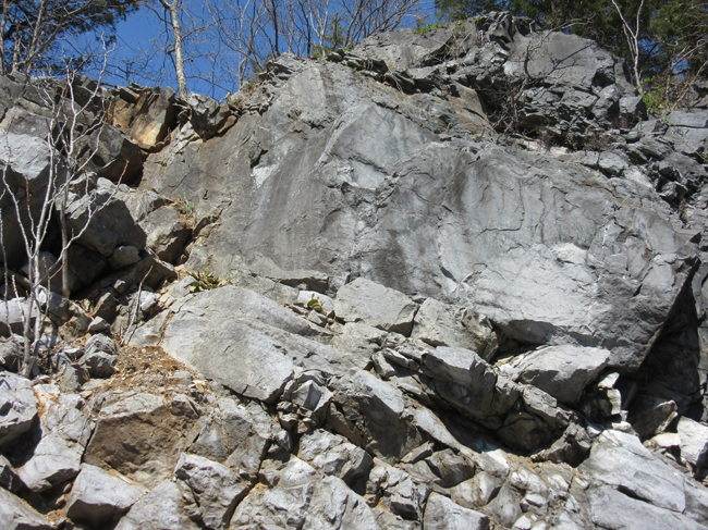
It turns out that my plan to have readers upload their copies of the image didn’t work as well as I had planned – apparently you all don’t have as complete a suite of control options as I do. Shocker! Oh well, the persistent folks got their guesses to me regardless:
Here are some guesses:
…from Bob Goodday via Twitter:
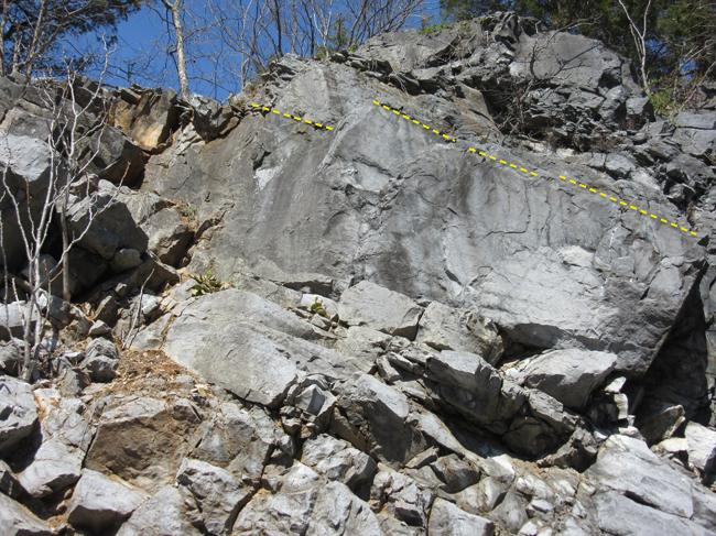
…from Mark Shore via e-mail — the same horizon! —
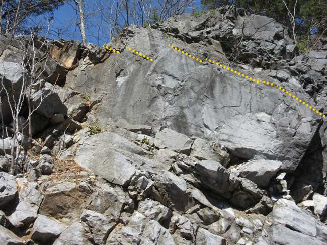
One other guess came in from Nick Rossi on Facebook:
I want to say it is just up section from that really thick block.
That seems to agree with what Bob and Mark have indicated…
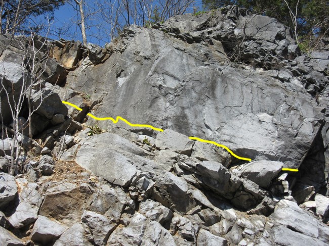
The odd man out is Howard Allen, who sent this image via email:
…Okay, guys, thanks for playing. Now brace yourselves…
Here’s the actual contact, between the lower (older) New Market Formation and the overlying (younger) Lincolnshire Formation:
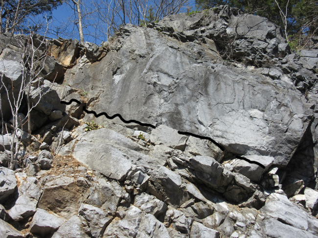
Ta-da!!! Howard Allen wins the grand prize. Congratulations, Howard!
Zooming in:
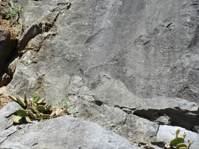
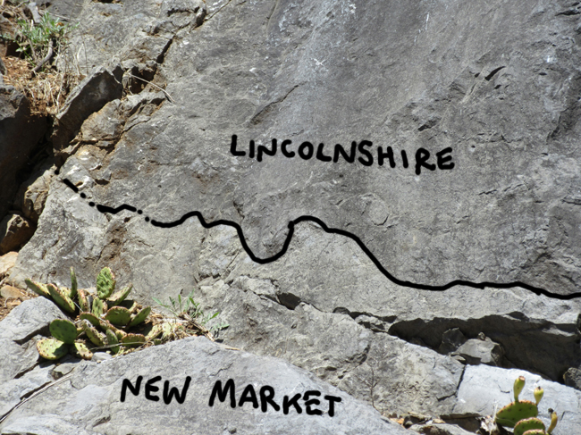
I had been placing this contact in the wrong place for years, and I’m grateful to have had my wrong impressions corrected. This alone was worth the “price of admission” for Rick Diecchio’s sedimentology field trip for GMU last spring. I climbed up on the outcrop to get a better look…
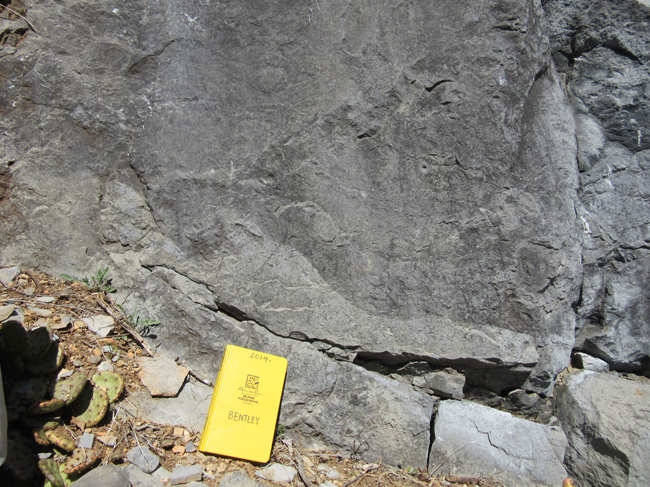
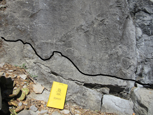
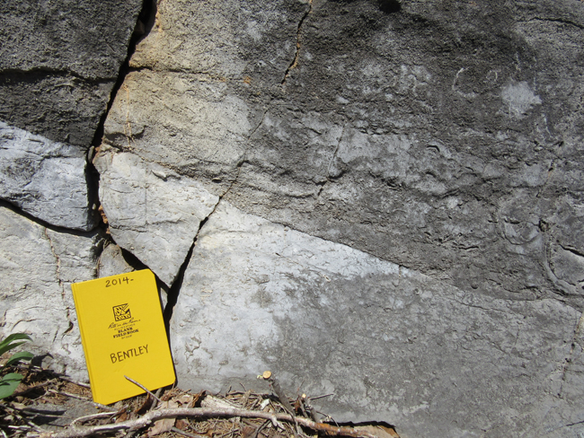
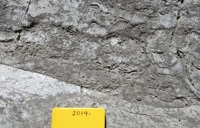

It’s an erosional contact (some portion of the upper New Market was abraded away prior to deposition of the oldest Lincolnshire), and because the layers above and below are more or less parallel, that implies it’s a disconformity of some unknown magnitude. Some amount of time went by between the deposition of the last-surviving New Market and the deposition of the oldest Lincolnshire… but not too much. They are both Ordovician in age.
For years, I had misplaced this contact to exactly where Mark, Bob, and Nick guessed it should be – at the switch between massive bedding and thinner, more easily weathered bedding at the top of the massive block. It wasn’t until this spring’s GMU sedimentology field trip that Rick Diecchio was able to set me straight. Now here’s the thing about the GigaPan: I made that image more than four years ago, and the real contact is plainly obvious in it, but I had completely overlooked it (a) while shooting the image and (b) every time I looked at the image on the computer.
So the take-home lessons are two:
- It’s so, so, so useful to go into the field with people who know what they are talking about. Field time with colleagues is irreplaceable and of infinite value. I look at these strata differently now as a result of going there with Rick.
- GigaPan images contain data of which the photographers themselves are ignorant. The imagery offers an opportunity for authentic research experiences – chances for students to discover things their professors don’t know about.
Thanks to everyone who submitted a guess (or tried to!).

Looks extremely similar to a ubiquitous, locally unconformable contact here in central Kentucky between the Lexington Limestone (dark gray fossiliferous calcarenite) and the underlying Tyrone Fm. (light gray to white calcilutite/micrite). Both are Ordovician (~450 Ma). Image here: http://www.uky.edu/OtherOrgs/KPS/images/tyronelex.jpg
Cool – our bentonites show up at the TOP of the Lincolnshire, defining the base of the overlying Edinburg Fm.
Ha! Interesting that Bob also picked the same dashed yellow line as I did.
In hindsight the disconformity is clear… I guess I put too much weight on the finely-bedded/thickly-bedded general description. But well-spotted by Harold.
Thanks for the intro to GigaPan. Speaking of which, wasn’t there originally a link to a long introduction to the local geology and to a GigaPan image that could be maximized to fill the page?