Two weeks ago, I went on an awesome, informal field trip to eastern Washington State to visit the Channeled Scablands for the first time. My collegue Bill Richards of North Idaho College picked me up in Spokane and drove me halfway across Washington and back to Moscow, Idaho, over the course of a day. This is a region of the country where a glacier-dammed valley filled up with water (Glacial Lake Missoula), then floated its icy obstruction out of the way, draining out to the west in a series of catastrophic floods. The scale of the floodwaters boggles the imagination. They swept away the fertile loess that makes the Palouse so agriculturally productive, and incised downward into the underlying Columbia River flood basalts, etching out a series of deep channels called coulees. Where cataracts formed, escarpments rapidly retreated, deep plungepools were scoured, and giant potholes were drilled. All this eroded material tumbled downstream, formed enormous gravel bars topped with giant current ripples (gravel dunes).
Erosional buttes of Columbia River basalt (left) and giant gravel bars (right) in Crab Creek Coulee, near Wilson Creek, Washington:
Link
The guts of these enormous features are made of poorly sorted, rounded gravels (cobbles and boulders):
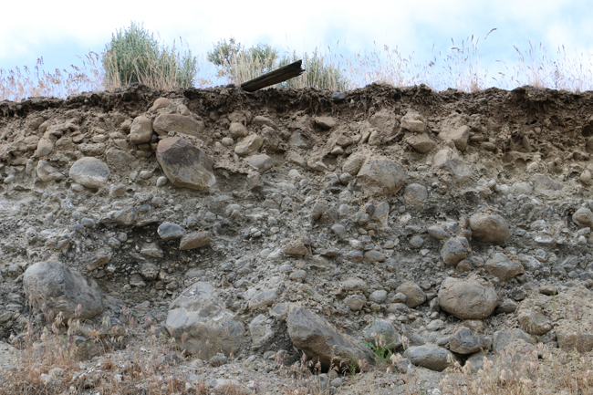
You can explore a cross section of one Wilson Creek gravel bar in this GigaPan:
Link
We took a detour to drive through the Crab Creek Coulee north of Pinto Ridge, and saw both erosional and depositional landforms there:
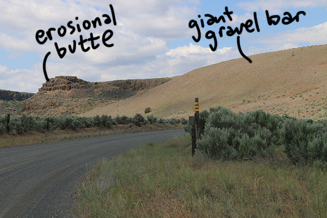
Pinto Ridge Road erosional butte and 2 giant gravel bars:
Link
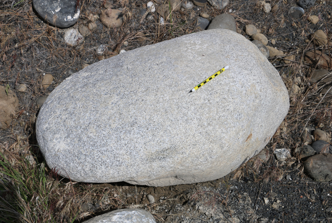
South of Soap Lake, where the Grand Coulee opens up into wider terrane, there’s a giant subaqueous expansion bar called the Ephrata fan. It’s mostly made of cobbles of Columbia River basalt, but there are also examples of basement granites, like this boulder:
Here is an enormous boulder of columnar-jointed basalt, with me for scale. This thing was transported by the floods!!
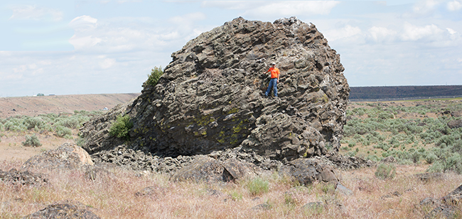 Click to enlarge to an ~8000 pixel wide version
Actually, it used to be even bigger, as it’s weathering in place and sloughing off columns left and right. There’s a nice raven’s nest on it too – just to the left of where I’m standing. Click to make it bigger.
Nearby, we saw a primary sedimentary signature of the prograding “fan”:
Foreset gravel beds, Ephrata Fan:
Link
Last, Bill and I journeyed to Crescent Bar, on the Columbia River, where we took many photos of the outstanding giant current ripple complex there:
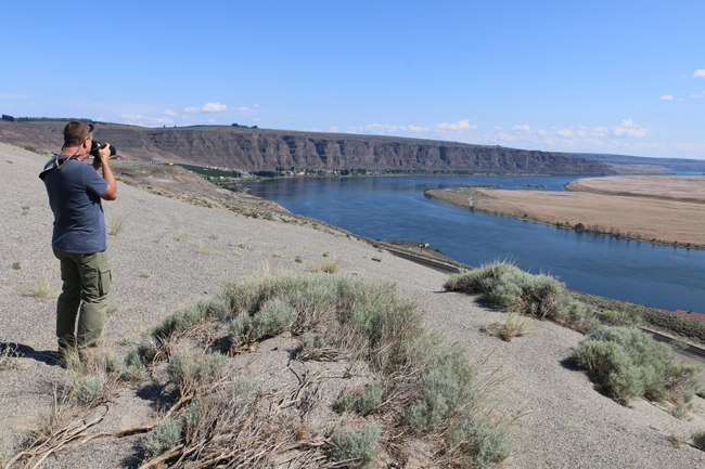
We shot multiple handheld GigaPans here:
Crescent Bar from two different perspective points. Note the erosional cliffs of basalt on the left and the enormous point bar covered in giant current ripples that are probably 30 meters tall:
Link
Close-up on the giant current ripples covering Crescent Bar:
Link
This field trip really opened my eyes (or my mind) to the scale of the Missoula floods. It is astonishing. I was highly motivated to participate in a session at the Rocky Mountain GSA meeting that followed, focusing on various scientific aspects of giant flood events, both in the Channeled Scablands and elsewhere. I will certainly be going back someday to visit some of the other sites that record this enormous event.

