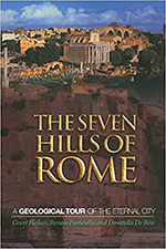
 I’m preparing for some time in Italy this summer, and picked up a couple of books to bring me up to speed geologically. The first is a geological guide for Rome. It’s structured around the archetypal “seven hills” of Rome, but the story is simpler in many regards than some other seven-hilled European capitals I could name. Rome’s geology appears to consist of four major units: older sedimentary rocks (which are Pliocene and Pleistocene, so still quite young in the grand scheme of things), deposits from the ancestral form of the Tiber River which incised and back-filled in alternation, depending on where sea level was, then volcanic deposits (mainly tuff) from nearby volcanic fields, and finally an Anthropocene layer of human debris. This last is unique in my experience – it’s actually a stratum of substantial thickness in some parts of the city, such that some older buildings are now in a “hole” as the city has been slowly built up (literally UP) around them. One hill is composed of almost nothing but olive oil amphorae! Imagine that: making a landscape feature from old bottles! Other interesting tidbits: much of the quarrying of tuff for building stone took place underground, as surface real estate was too valuable for other purposes. This however has resulted in occasional cave-ins of the old emptied-out mine workings below Rome’s surface. Also: the asymmetric damage to the Colosseum that gives it such a unique “look” results from it being built astride a geologic contact between Pleistocene sedimentary rocks and unconsolidated alluvial channel fill. When shaken by an earthquake, the loose sediment amplified the shaking, and thus the damage to the overlying structure: but only the half on top of the old river deposits. Additional portions of the text address travertine, marble, historical flooding on the Tiber River, volcanic and earthquake risk, and the aqueduct system that supplies the city with fresh water. A series of field trip itineraries are described in detail at the end of the book.

