“GoSF” = Geology of San Francisco
Want to trade your snow for some sand? Over the past couple of weeks, Mountain Beltway is reviewing three field trips I took in early December examining the geology of San Francisco and neighboring areas. The master plan is to cover:
Fractures and the chemistry along them
Pleistocene dunes (today)
The San Andreas Fault and Mussel Rock
The San Francisco Peninsula is mostly covered in Pleistocene dune deposits of sand.
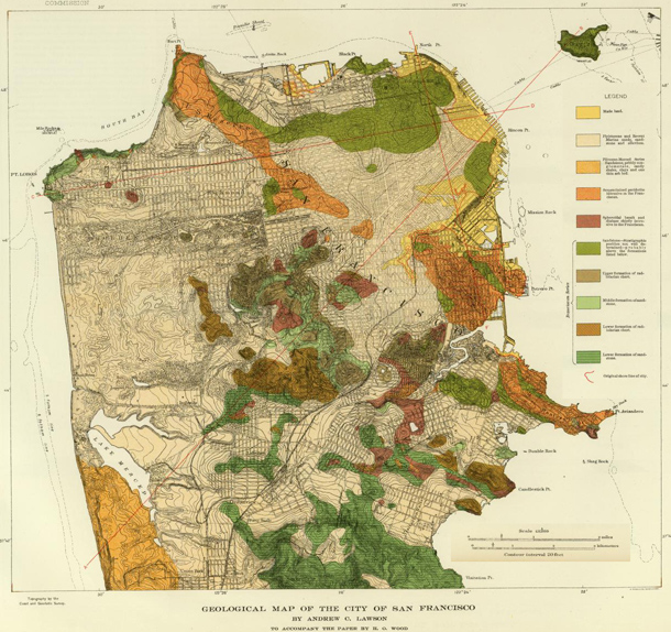
Check out this 1908 geological map of San Francisco (modified from here) to see what I mean:

The orange, the green, the amber, and the red are all bedrock of the different terranes we’ve been seeing on our “GoSF” journey. The tan stuff that covers most of the peninsula’s area is sand. That’s what we’re after today.
During the Pleistocene Ice Ages, glaciation in the Sierra Nevada was generating a huge amount of sediment. As this sediment was dumped in massive, unsorted piles called moraines, the wind went to work on it. Winnowing the sand and silt from the rest of the glacial till, the wind carried fine-grained sediment away, and deposited some along the coast. More was carried out to see, eventually to rain down to the abyssal deep and make the pelagic shales of the future.
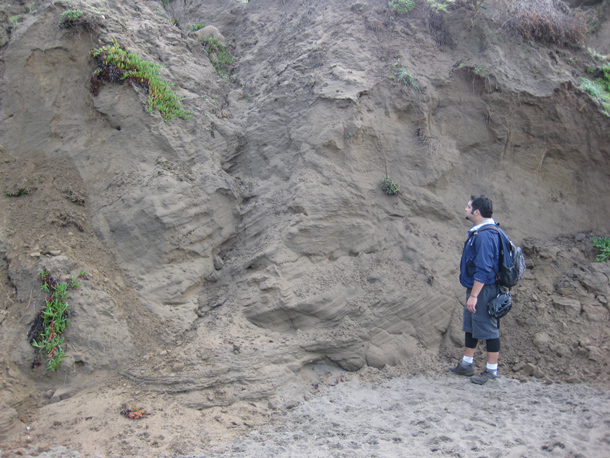
Alan and I saw some of these coastal dune deposits along Baker’s Beach, on our way to the graywacke outcrops. Here’s Alan standing next to one of these immobilized Pleistocene sand dune deposits:

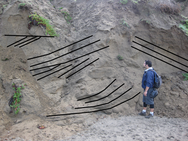
Here’s that same photo again, annotated to highlight positions & orientations of large-scale cross-beds which say “dunes!” to geologists:

The only two things in San Francisco’s long geologic history that have been active more recently than these shifting sands are the San Andreas Fault and landslides associated with oversteepened cliffs. To see those, we will journey south to Pacifica… in our next and final post in this series.

Lots more dunes along Ocean Beach, worth a separate trip.