
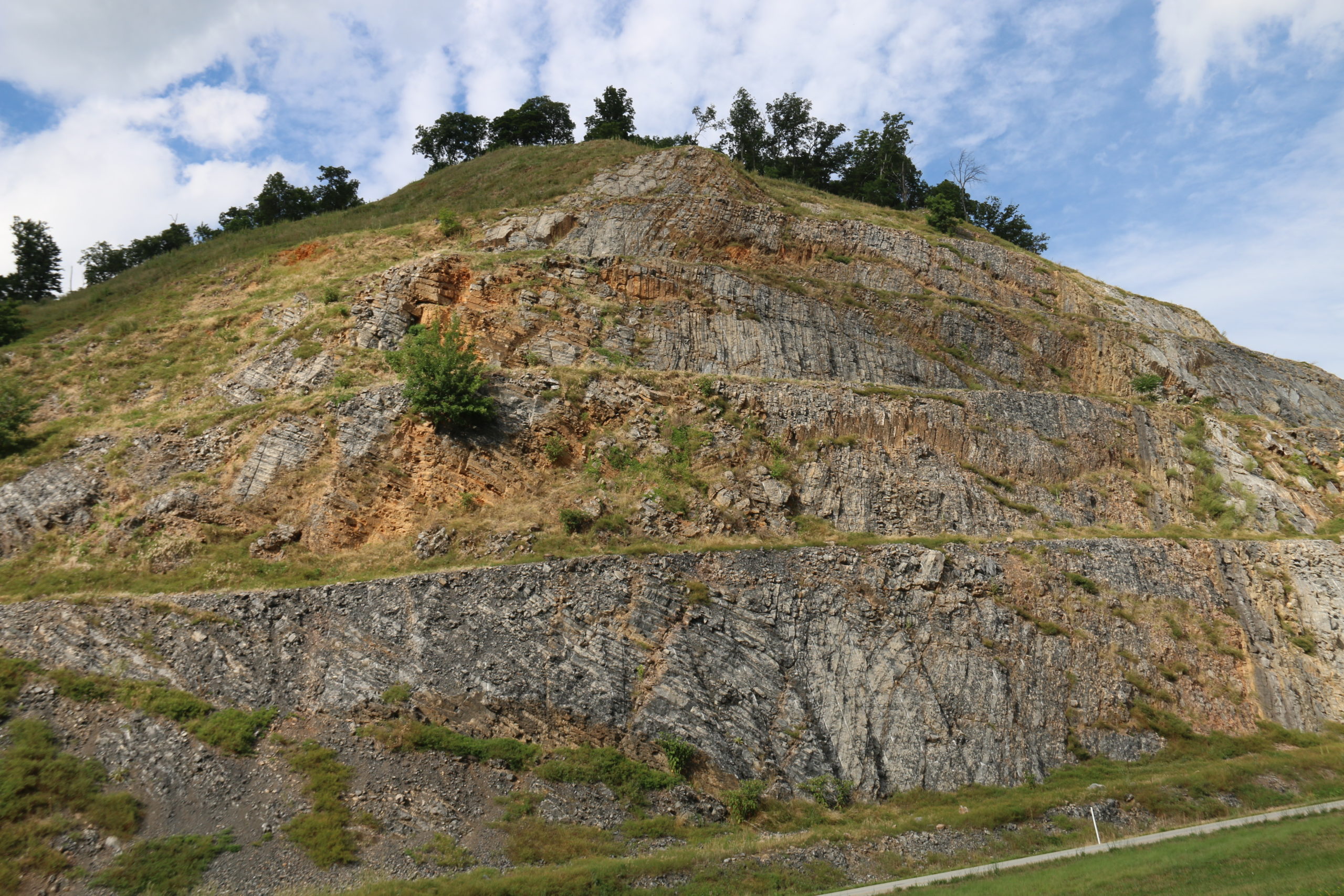
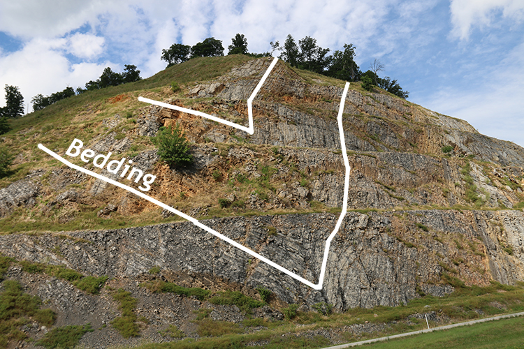
I went on a day of field work last week to Corridor H, West Virginia, to help make drone-based photogrammetric 3D models of the huge outcrops there. One site we stopped at is this beautiful V-shaped syncline in Devonian-aged Helderberg Group limestones.

Click to enlarge
Here are two layers traced out:
Here is a GigaPan that Alan Pitts shot of this outcrop several years ago, when it was a bit fresher, and in a different season, to boot. You’ll note some significant differences in comparing the two views!
Happy Friday to you. Today marks one week of residence at my new house in the hills north of Charlottesville; we’re finally starting to feel settled in. I hope you are well.
Hi Callan, I think of you when traveling on Corridor H and admiring the roadcuts along the way. Once in a awhile I’ll see a gathering of rockhounders on the side of the road wondering if that is you leading a field trip. I have stopped in several places on my way to Moorefield, WV. My favorite spot is mile marker 117 where I found large slabs of wavy rock on a steep incline. (similar to the ocean beach). Off of Pinnacle Drive is a shale pit with trilobites. Thank you for diagramming the roadcut on your post. Can you tell me where this site is? Mile marker?
Enjoy your new digs!