

Okay, a final post (for now, anyhow) sharing some images from last Friday’s field trip to the Billy Goat Trail, in Potomac, Maryland.
Yesterday we looked at lamprophyre dikes, but there are other dikes on the Billy Goat Trail, too. Like this granite pegmatite:
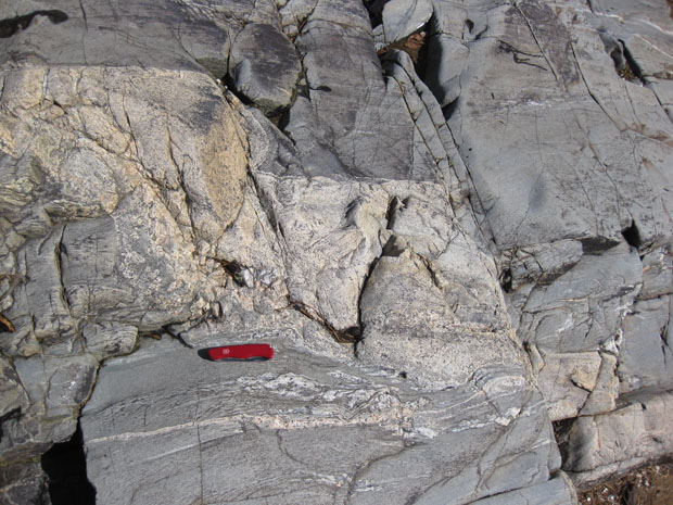
What’s interesting to me about this is that the joint set seems to have contradictory cross-cutting relations with the dike. Did the joints come first? Or the crystallization of the magma? If the latter, are the joints not really joints, but small faults? Blerg.
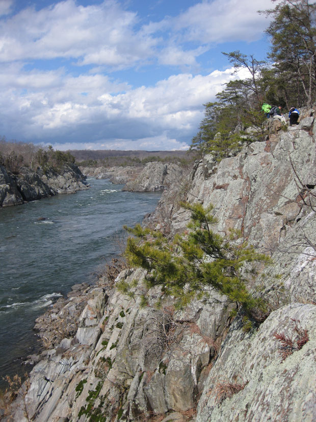
A look upstream at Mather Gorge, with the Rocky Islands in the distance. Students working at upper right:
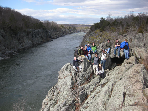
A class portrait adjacent to Mather Gorge, looking upstream, from the “Pothole Alley” stretch of trail:
Okay, what are these?
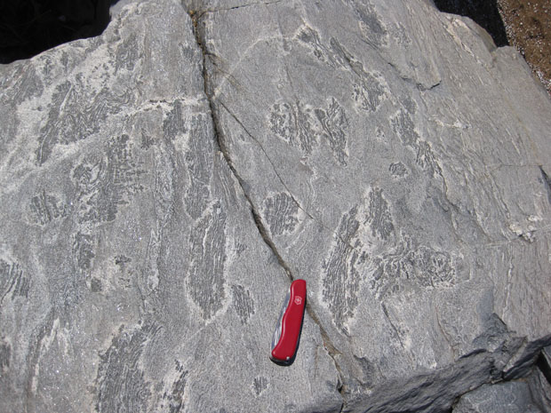
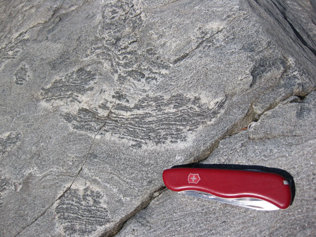
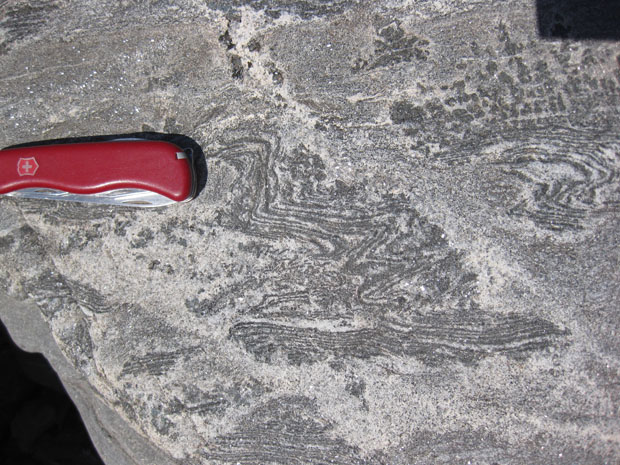
I have some ideas, but before I pollute your mind with them, let’s hear what you have to say…
Gneiss inclusions in andesite? (Or are my many years since I studied this showing?)
Hi Gillian,
The “host” rock here is a metamorphosed graywacke (turbidite assemblage), as evidenced by the graded beds it displays — some of those graded bed images were taken a few feet away from these odd fellows. So: no andesite locally.
You’re right, however, to notice the banding in the “inclusions” — some of it is even folded! Hmmm…
C
That was my first thought some sort of metamorphic inclusion… but figured callan wouldn’t do anything too easy
Well, I’m not out to dupe anyone here… But if they were just gneiss clasts that somehow ended up in the graywacke protolith and were then metamorphosed along with the graywacke, then it would be quite a coincidence to have so many in such a small area that all are roughly (within the same order of magnitude) the same size, and all so very similar in appearance…
I’ve never really seen an example of migmatite, but that’s how I’ve always kinda pictured it.
There are some excellent migmatites on the trail, and these in fact may be migmatitic (mafic restite surrounded by felsic goo), but that wasn’t what I was fishing for.
* ah! but the host is a sed rock?
Brandon: It **was** a sedimentary rock (graywacke), but then that was metamorphosed (recrystallized) during the Taconian Orogeny, ~460 Ma.
Metamorphosed rip-up clasts? Or maybe just clasts?
Yes. That’s what I am thinking. I’ll put up some other images of similar looking outcrops further south on the trail — I think these are “schist chips” that represent dismembered chunks of formerly clay-rich beds, either dismembered during deposition (rip-up clasts) or during orogenic reorganization (boudins) that were subsequently metamorphosed, allowing them to take on this distinctive texture.
Dear Mr. Bentley,
As a person who has had an interest in geology going back to my days as a Boy Scout – fossil/mineral collecting, etc. – I’ve been following your various blogs for some time. First, I want to express my thanks to you for sharing so much valuable information about the local area. My family and I have over the years visited many of the places in Virginia and West Virginia you’ve discussed. Just last weekend we spent all day Saturday searching for fossils at Massanutten Mountain and returned home with some wonderful samples, including three trilobites.
I’m wondering if you have ever conducted a field trip, or if you have any information to share, on the geologic history of the Smoke Hole Canyon in the Monongahela National Forest in West Virginia. I’m fascinated by this area and would appreciate any expertise you could provide.
Also, I’m very curious about the geologic history of the road cuts that exist just east and west of Goose Creek in Loudoun County that can be seen driving along the Dulles Greenway. I’ve read your comments about the Leesburg Conclomerate along Route 15 norther of Leesburg, which is incredibly fascinating, but would like to know more about the road cut along the Dulles Greenway. I haven’t been able to find any online information about this.
Again, thanks for sharing all your adventures through this blog.