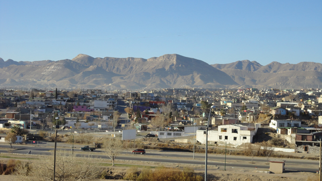
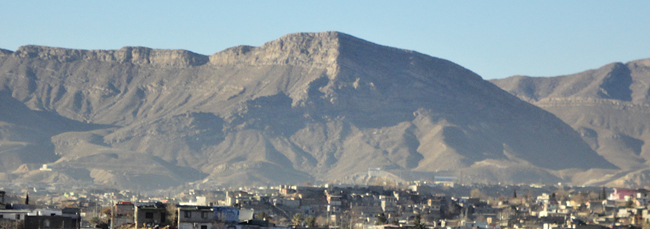
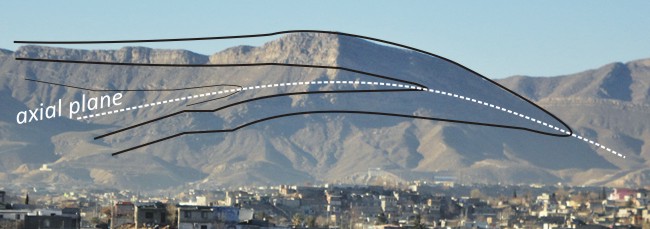
Looking southwest across the border, from El Paso, Texas, into Juarez, Mexico. The mountains on the skyline are the Sierra de Juarez, and smack dab in the middle (partially obscured by shadow) is a lovely recumbent fold.

A recumbent fold is one where the axial plane of the fold is horizontal, or close to horizontal.


This enormous structure formed due to early Cenozoic compression from the southwest: folding and thrusting due to subduction of the Farallon slab. Because this thing opens to the east, I would guess that it’s a recumbent synform, rather than an antiform. (If an antiform formed due to southwesterly-sourced thrusting, and then it tipped over to become recumbent, then it would be facing the other way.) Of course, it would be great to go and check this interpretation in person (perhaps by searching for up-side-down geopetal structures on the upper limb of the fold), but there’s a horrific drug war raging in Juarez these days, and it wouldn’t be safe at all to venture over there for geological reasons.


I live in Juarez Mexico, next time you have a chance to come to El Paso, feel free to get in touch with me: juarezmexico@aol.com Its very safe, I was born here, the violence is between gang members from a couple of cartels. Nothing to do with visitors or local citizens, not related to their business. I would like to take you to the Juarez Mountains and learn from you. There is also a fault that runs from New Mexico, across El Paso Franklin Mountains in to Juarez, (East Franklin Fault) https://www.ktsm.com/news/local-news/largest-earthquake-fault-line-in-el-paso-city-limits/