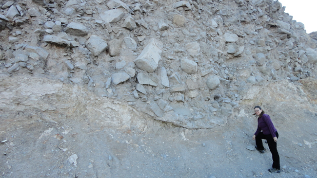
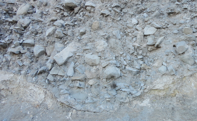
After seeing the contact of the Campus Andesite with Western Interior Seaway sedimentary rocks (Cretaceous in age), we moved a bit on down the line, and saw this disconformable contact between the Cretaceous shales below, and a bouldery sedimentary breccia above. Note the concave-up shape of the contact to the left of Elizabeth Nagy-Shadman (of Pasadena City College, California): that’s probably an old river channel scoured into the shale bedrock, then filled with what appears to be colluvium…

Another perspective on the same outcrop:


Landslide/rockslide debris on a weather surface? Note some apparent erosion of discolored rock with incision of the “channel”. If it was a stream erosion channel, I would expect deeper weathering and a fracture zone at it’s locus because water channels tend to follow the path of least resistance. Rock slides, however, tend to just erode whatever is in their way.
Wow–that’s a pretty impressive exposure! Did you notice chunks of the shale bedrock entrained in the “colluvium”? That would be pretty convincing evidence (but not proof) that the channel was created by the landslide/debris flow rather than secondarily occupied by it. I would also think that if you found stream-rounded cobbles/pebbles entrained in there (especially if they were concentrated near the base), it might be evidence that the channel had been previously occupied by stream deposits that were subsequently scoured out by the “colluvium” flow.
Yes, there were chunks of laminated sedimentary rock (presumably the Cretaceous unit) in the overlying unit, though it was dominated by andesite clasts. No stream rounded cobbles anywhere to be seen, at least not in my 45 seconds of visiting the outcrop…