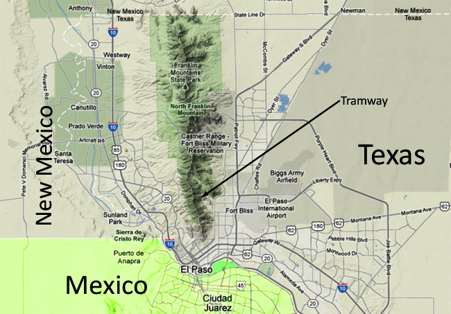
One of the last things I got to do on my recent visit to the Lone Star State was to ride the tramway up the east side of the Franklin Mountains, a north-south-trending fault-block mountain range north of El Paso. I’ll be exploring other aspects of the Franklins’ history in subsequent posts, but if you can’t wait, here’s an overview from the good folks at UTEP.

Here’s a map to get you situated:
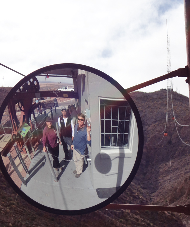
Here is a fisheye portrait of our team (Elizabeth Nagy-Shadman of Pasadena City College, our host Josh Villalobos of El Paso Community College, and me, of Northern Virginia Community College) waiting to ride the tramway up the mountainside. On the right, you can see the orange tramcars coming and going:
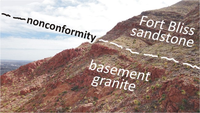
Once we had boarded, the first item of geological interest that we saw was the contact between the Mesoproterozoic basement granite, and the overlying Fort Bliss Sandstone, a Cambrian-Ordovician unit. This view is looking towards the south:
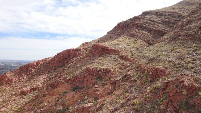
This is a nonconformity: We’re missing about half a billion years of geologic history right at this contact.
Now let’s swivel around and look north. You can see the lower tramway station, and Fort Bliss Sandstone in the foreground. In the middle distance is a limestone quarry — El Paso Group limestones of Ordovician age.
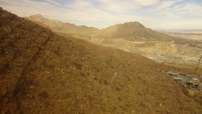
These limestones overlie the Fort Bliss Sandstone, so given the obvious westward dip to the strata, you might be wondering how on Earth those younger limestones got way down “below” the older sandstones… Hold that thought.
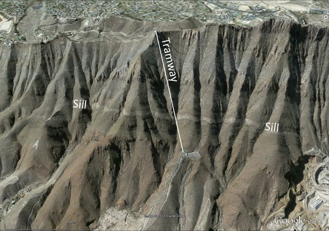
Further up the hill, you can see a sill of granitoid igneous rock (termed a “felsite”) that has intruded parallel to the bedding in the Fort Bliss Sandstone. View remains to the north, so these strata continue to dip to the west:
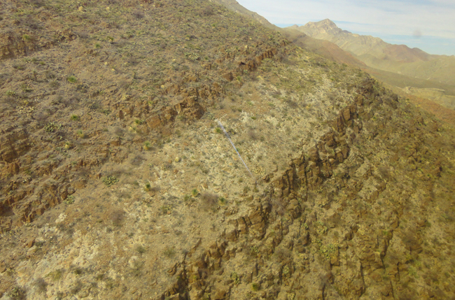
This sill is likely to be of Eocene age, same as the Campus Andesite and the Cristo Rey laccolith beyond that. When it was dated, using the K/Ar method, it yielded a date of only 28 Ma (Oligocene), but that’s probably too “young” due to argon loss. Someone should retry it with the Ar/Ar method!
Here’s a Google Earth screenshot (view to the west/southwest) that shows the sill prominently, and also the course of the tramway up the Franklins:
Above that, we can see the transition to the limestones of the El Paso Group. View remains to the north, so these strata continue to dip to the west:
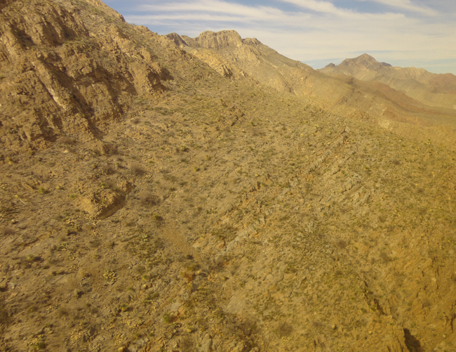
So how can the same limestone strata be both above the Fort Bliss (and its basal nonconformity) and also below it? If you’re thinking “fault,” you’re on the right track. The limestone to the east (in the quarry) is part of a big block that slid down the east face of the Franklins during an extensional episode called the Rio Grande Rift. Here’s a diagram that Josh drew (note his choice of ‘whiteboard’!) to show the regional structure:
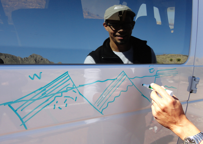
The Rio Grande rift is a big, widely-distributed structure, with many subsidiary faults. These faults bound grabens and half-grabens, which have accumulated a thick stack of sediments. There’s something like 11,000 feet of sediment beneath Ciudad Juarez, for instance, with the same bedrock beneath that as we see at the top of the Wyler Aerial Tramway in the Franklin Mountains. There is a lot of offset along these “bookshelfed” fault-block mountains due to that rifting episode.
The fault-bound blocks occur on multiple scales: at the scale of mountain ranges, we get the Palomas Range, the Franklins, and the Waco Range, but on either side of the Franklins there are medium-scale fault blocks that have slid down and out under gravity’s influence. And within those blocks, there are human-sized offsets to be observed, too.
The view from the top was lovely, but we had to turn around immediately and head back down so that I could catch my flight back to DC. Amazingly, from the top of the mountain to the ticket counters at the airport only took about 15 minutes. I was astonished how quickly we managed it. I caught my flight with 15 minutes to spare!

