Today, we take a look at an outcrop of young, basically unlithified sediments east of Bishop, California, on the way out Poleta Road, toward the White Mountain Research Station’s Owens Valley Lab, where you can get a nice view of the Coyote Warp Relay Ramp. These photos were taken just west of the bridge over the Owens River.
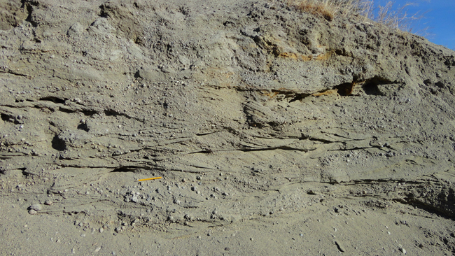
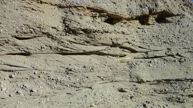
The rapidly-eroding outcrop there is on a small bluff a few meters above the Owens River. It shows medium to coarse clastic sediment with prominent cross-bedding:

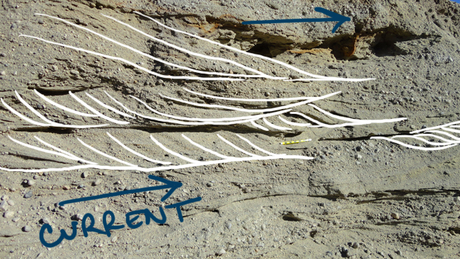
These are “textbook” cross-beds. Absolutely classic and lovely.

In general, you can use top-to-bottom-asymmetric structures (“geopetal structures”) like these to determine if your strata have been tectonically flipped upside-down, and also to determine current flow direction at the time of deposition. It would be a shock if sediments this young had been upended, but it’s not impossible.

That blue “current flow direction” arrow is orthogonal (perpendicular) to the river’s modern flow direction a few meters to the east, but that’s not unexpected, since the Owens River meanders all over the place once it escapes the confines of the gorge it has cut into the Volcanic Tableland to the north.
If the Owens River indeed deposited these sediments in the not-too-distant past, why is the river several meters lower in elevation today? One possibility is a change in the river’s sediment budget. Perhaps during the height of Pleistocene glaciation, more sediment was carried out of the Sierra Nevada (to the west) and dumped into the Owens’ drainage. Since the LGM, both the water budget and sediment budgets would have dropped, but perhaps the sediment dropped more, and so the river began to incise into its recent deposits…

