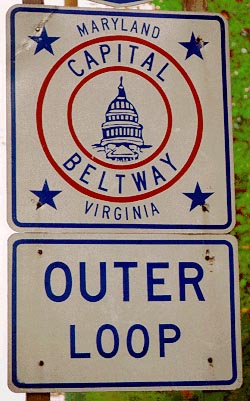
 In Washington, D.C., “the Beltway” is shorthand for Interstate 495, which encircles the city through suburban Maryland and Virginia. There is an inner loop which moves clockwise, and an outer loop which flows counter-clockwise. Because D.C. is a political place, the phrase “inside the Beltway” refers to the wonky machinations of government movers and shakers, as well as the lobbyists who influence them. “Outside the Beltway” refers to the rest of the U.S., also known as “reality.”
In geology, a mountain belt is a linear zone of rock which exhibits characteristics suggesting it was involved in a collisional tectonic setting. Modern mountain belts are, of course, characterized by mountains. However, mountains don’t last forever: gravitational collapse joins forces with erosion to tear them down. Given enough time, mountains will be ground down to their roots. The good news for geologists is that the mountain roots (now at the surface) present just as much information about the former presence of mountains as the peaks themselves. Whether they are ancient or modern, mountain belts are characterized by metamorphic rock, deformed rock (folded and thrust-faulted), and the intrusion of felsic plutonic rocks like granite.
 It turns out that a mountain belt runs right under the Beltway! The Appalachian mountain belt includes the modern-day Appalachian mountains, but also includes the hilly terrain immediately east of the mountains: the Piedmont physiographic province. Beneath these gentle hills are metamorphic rocks, granites, and a wealth of deformational structures that speak of a time when the Appalachians were young. These mountains were formed in the Paleozoic era of geologic time in a series of tectonic pulses called “orogenies.” The mountain-building culminated about 300 million years ago, when eastern North America collided with northwestern Africa. The story of how the Appalachian mountain belt got put together is a primary interest of the author of this blog.
The blog’s banner image shows the Paine Massif in Chilean Patagonia, a more obvious mountain belt, accompanied by some D.C. icons: the Capitol Building and traffic on the Beltway. This combination is intended to visually express the notion that as geologists look at the rocks of D.C., they can imagine the mountains that used to be here.
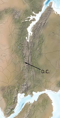
The map at right is modified from a larger paleogeographic map produced by Ron Blakey of Northern Arizona University. It is used with permission. Dr. Blakey has many more amazing maps of North America over time. You should go check them out.